Trail Mountain bike Metzeral - Tour du Gaschney par le Sattel - Photo

Tour du Gaschney par le Sattel

 tfg
tfg

User

© OpenStreetMap contributors
Length
Length
25 km
Max alt
Max alt
997 m
Uphill gradient
Uphill gradient
913 m
Km-Effort
Km-Effort  
37 km
Min alt
Min alt
482 m
Downhill gradient
Downhill gradient
915 m
Boucle
Boucle
Yes
Creation date :
2024-08-18 15:21:51.817
Updated on :
2024-08-20 10:53:26.655

(1 Reviews)

Mountain bike
Mountain bike
2h32
Difficulty : Difficult

Scan this QR Code to open this trail in the SityTrail application

FREE GPS app for hiking

Logo SityTrail SityTrail

IGN / Geographical institutes

Download SityTrail from the App Store Download SityTrail from Google Play

Logo SityTrail SityTrail World

The world is yours!

Download SityTrail from the App Store Download SityTrail from Google Play Download SityTrail on Huawei AppGallery

About

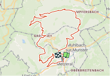
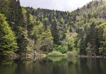
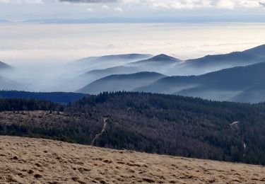
Trail Mountain bike of 25 km to be discovered at Grand Est, Haut-Rhin, Metzeral. This trail is proposed by tfg.

Description

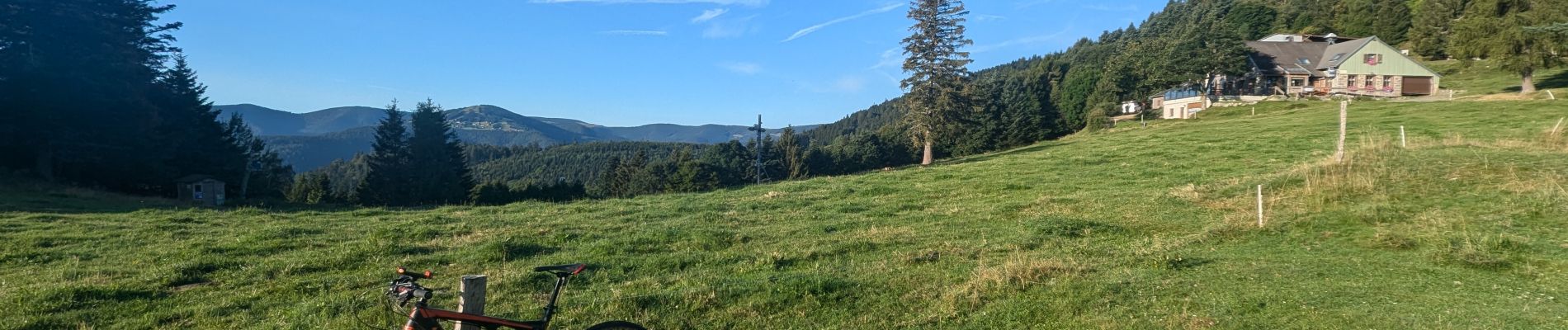
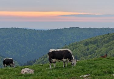
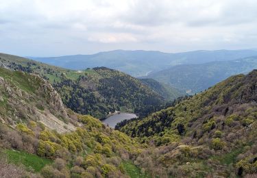
Une très belle randonnée VTT, à faire tôt le matin pour profiter du lever du soleil dans la montée vers le Gaschney (roulante et régulière). La descente vers Rosselwasen se fait par un magnifique single, à la fois roulant et technique par endroit, puis remontée vers le Col du Sattel par une petite route agréable. Dernier effort pour remonter sur quelques centaines de mètres vers le Braunkopf, puis descente par single technique sur la fin.

Elevation profile

Photos

Positioning

Country:
France
Region :
Grand Est
Department/Province :
Haut-Rhin
Municipality :
Metzeral
Location:
Unknown
Start:(UTM)
355948 ; 5319729 (32U) N.

Comments

Please log in to post a review or rate the element


Trails nearby

Trail Walking Munster - De Munster aux 3 Fours (Aller) - Munster - Photo
Walking
tracegps

Walking

Difficult
(1)
Munster, Grand Est, Haut-Rhin, France
14.8 km | 27 km-effort
5h 0min
No
Trail Walking La Bresse - Du Hohneck au Kastelberg par les Spietzkoepfe et le Sentier des Névées - Photo
Walking
tracegps

Walking

Very difficult
(3)
La Bresse, Grand Est, Vosges, France
7.6 km | 13.7 km-effort
3h 30min
Yes
Trail Snowshoes Le Valtin - raquettes  - Photo
Snowshoes
vathi54

Snowshoes

Very easy
(1)
Le Valtin, Grand Est, Vosges, France
6.6 km | 9.4 km-effort
3h 8min
No
Trail Mountain bike Metzeral - Sentier des Névés - Photo
Mountain bike
tracegps

Mountain bike

Very difficult
(1)
Metzeral, Grand Est, Haut-Rhin, France
33 km | 52 km-effort
6h 0min
Yes
Trail Walking Mittlach - 2023-09-24 Marche Mittlach 5 Lacs - Photo
Walking
GUIDE
holtzv

Walking

Medium
Mittlach, Grand Est, Haut-Rhin, France
25 km | 41 km-effort
9h 19min
Yes
Trail Walking Sondernach - 2023-05-19 WE Marche Bivouac Massif du Hohneck - Photo
Walking
GUIDE
holtzv

Walking

Medium
Sondernach, Grand Est, Haut-Rhin, France
46 km | 73 km-effort
16h 41min
Yes
Trail Walking Metzeral - 2023-05-20 Marche Lac Fischboedle vers Firstmiss - Photo
Walking
GUIDE
holtzv

Walking

Medium
Metzeral, Grand Est, Haut-Rhin, France
21 km | 37 km-effort
8h 20min
No
Trail Walking Sondernach - 2023-05-19 Marche Schnepfenried vers Lac du Fischboedle - Photo
Walking
GUIDE
holtzv

Walking

Easy
Sondernach, Grand Est, Haut-Rhin, France
9.1 km | 14.1 km-effort
3h 12min
No
Trail Walking Sondernach - 2020-01-02 Marche Landersen Petit Ballon - Photo
Walking
GUIDE
holtzv

Walking

Difficult
Sondernach, Grand Est, Haut-Rhin, France
17.6 km | 28 km-effort
3h 4min
Yes


Close
My subscriptions