


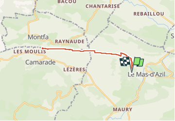

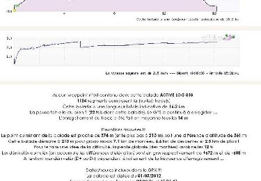
16.2 km | 23 km-effort


User


FREE GPS app for hiking
 SityTrail
IGN / Geographical institutes
SityTrail World
The world is yours!
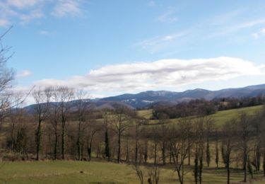
Trail Walking of 13.3 km to be discovered at Occitania, Ariège, Le Mas-d'Azil. This trail is proposed by loic09.
Aller/Retour depuis le parking du dilmen de Cap Del Puech
Walking

Walking

Walking
Walking
Walking
Mountain bike
Walking

Mountain bike

Equestrian