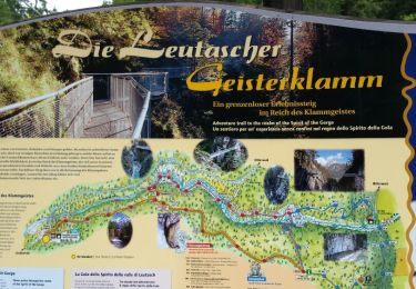
9.4 km | 14.1 km-effort
Seefeld_2024-08-12
Phil.PES
User
Length
12.8 km
Max alt
1260 m
Uphill gradient
435 m
Km-Effort
18.6 km
Min alt
974 m
Downhill gradient
435 m
Boucle
Yes
Creation date :
2024-08-12 08:41:45.288
Updated on :
2024-08-12 12:31:25.024
3h48
Difficulty : Difficult
FREE GPS app for hiking
About
Trail Walking of 12.8 km to be discovered at Tyrol, Bezirk Innsbruck-Land, Gemeinde Scharnitz. This trail is proposed by Phil.PES.
Positioning
Country:
Austria
Region :
Tyrol
Department/Province :
Bezirk Innsbruck-Land
Municipality :
Gemeinde Scharnitz
Location:
Unknown
Start:(Dec)
Start:(UTM)
671542 ; 5250337 (32T) N.
Comments
Trails nearby
Les hauteurs de Seefeld
Walking
Medium
(1)
Gemeinde Seefeld in Tirol,
Tyrol,
Bezirk Innsbruck-Land,
Austria
4h 37min
No
Leutascher Geistelklamm
Walking
Easy
(1)
Gemeinde Leutasch,
Tyrol,
Bezirk Innsbruck-Land,
Austria
6.4 km | 9.8 km-effort
3h 8min
Yes
Seefelder Spitze et pied de la Reither Spitze
Walking
Difficult
(2)
Gemeinde Seefeld in Tirol,
Tyrol,
Bezirk Innsbruck-Land,
Austria
9.8 km | 18.2 km-effort
4h 53min
No
Seefelder Spitze
Walking
Difficult
(1)
Gemeinde Seefeld in Tirol,
Tyrol,
Bezirk Innsbruck-Land,
Austria
8.3 km | 13.2 km-effort
4h 49min
No
Scharnitz Karwendelhaus
Mountain bike
Medium
Gemeinde Scharnitz,
Tyrol,
Bezirk Innsbruck-Land,
Austria
19.3 km | 29 km-effort
1h 58min
No
Seefeld_2024-08-13
Walking
Medium
Mittenwald,
Bavaria,
Landkreis Garmisch-Partenkirchen,
Germany
6.9 km | 11.1 km-effort
2h 38min
Yes
Scharnitz Leutasch
Walking
Very easy
Gemeinde Scharnitz,
Tyrol,
Bezirk Innsbruck-Land,
Austria
7.9 km | 14.5 km-effort
2h 50min
No
Mittelwald
Walking
Very easy
Mittenwald,
Bavaria,
Landkreis Garmisch-Partenkirchen,
Germany
11.2 km | 15.1 km-effort
4h 29min
Yes
Seefeld_2024-08-11
Walking
Easy
Gemeinde Seefeld in Tirol,
Tyrol,
Bezirk Innsbruck-Land,
Austria
2.2 km | 4 km-effort
45min
Yes