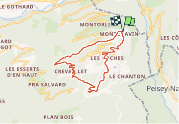
Trail Walking La Plagne-Tarentaise - Montchavin tourbière la noir - Photo

Montchavin tourbière la noir

© OpenStreetMap contributors
Length
Length
8.4 km
Max alt
Max alt
1717 m
Uphill gradient
Uphill gradient
544 m
Km-Effort
Km-Effort  
15.6 km
Min alt
Min alt
1196 m
Downhill gradient
Downhill gradient
546 m
Boucle
Boucle
Yes
Creation date :
2024-08-10 14:41:03.494
Updated on :
2024-08-10 16:33:50.713

(0 Reviews)

Walking
Walking
1h50
Difficulty : Difficult

Scan this QR Code to open this trail in the SityTrail application

FREE GPS app for hiking

Logo SityTrail SityTrail

IGN / Geographical institutes

Download SityTrail from the App Store Download SityTrail from Google Play

Logo SityTrail SityTrail World

The world is yours!

Download SityTrail from the App Store Download SityTrail from Google Play Download SityTrail on Huawei AppGallery

About

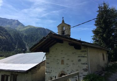
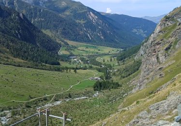
Trail Walking of 8.4 km to be discovered at Auvergne-Rhône-Alpes, Savoy, La Plagne-Tarentaise. This trail is proposed by Robertplessier.

Description

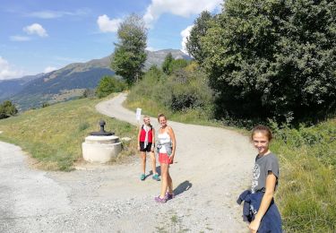
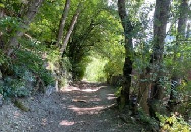
Montée par le sentier découverte, très bien. Descente au jugé au plus court  dans les pistes : très  faisable si sec et un peu sportif.

Elevation profile

Positioning

Country:
France
Region :
Auvergne-Rhône-Alpes
Department/Province :
Savoy
Municipality :
La Plagne-Tarentaise
Location:
Bellentre
Start:(UTM)
323467 ; 5047667 (32T) N.

Trails nearby

Trail Walking Landry - Landry... Circuit des Poussettes - Photo
Walking
Mimicrea

Walking

(1)
Landry, Auvergne-Rhône-Alpes, Savoy, France
4.6 km | 6.2 km-effort
2h 50min
No
Trail Walking La Plagne-Tarentaise - Les Fours  - Photo
Walking
jpduc

Walking

Easy
(2)
La Plagne-Tarentaise, Auvergne-Rhône-Alpes, Savoy, France
8.4 km | 11.7 km-effort
2h 50min
Yes
Trail Walking Peisey-Nancroix - Roselend- chapelle des Vernettes  - Photo
Walking
GUIDE
GEGERANDO17

Walking

Easy
Peisey-Nancroix, Auvergne-Rhône-Alpes, Savoy, France
10.4 km | 16.6 km-effort
3h 18min
Yes
Trail Walking Peisey-Nancroix - la chapelle - Photo
Walking
Grégory Letoquart

Walking

Very easy
(1)
Peisey-Nancroix, Auvergne-Rhône-Alpes, Savoy, France
4.8 km | 7.3 km-effort
1h 34min
Yes
Trail Walking Peisey-Nancroix - Balade du Sanctuaire ND des Vernettes - Photo
Walking
GUIDE
Desrumaux

Walking

Medium
(1)
Peisey-Nancroix, Auvergne-Rhône-Alpes, Savoy, France
11.7 km | 21 km-effort
4h 11min
Yes
Trail Snowshoes Peisey-Nancroix - Autour de Rosuel - Photo
Snowshoes
GUIDE
pascalou73

Snowshoes

Medium
Peisey-Nancroix, Auvergne-Rhône-Alpes, Savoy, France
6.1 km | 7.5 km-effort
2h 0min
Yes
Trail Snowshoes Peisey-Nancroix - Le sanctuaire des Vernettes - Photo
Snowshoes
GUIDE
pascalou73

Snowshoes

Easy
Peisey-Nancroix, Auvergne-Rhône-Alpes, Savoy, France
5.8 km | 8.4 km-effort
2h 0min
Yes
Trail Walking Peisey-Nancroix - Cascades de Nant Putor et le Musée de la mine - Photo
Walking
Jean-marc77

Walking

Easy
Peisey-Nancroix, Auvergne-Rhône-Alpes, Savoy, France
10.6 km | 15.8 km-effort
5h 24min
Yes
Trail Walking Peisey-Nancroix - Peisey Vallandry Les Rossets Col d'Entreporte  - Photo
Walking
GUIDE
lhomme.ph

Walking

Difficult
Peisey-Nancroix, Auvergne-Rhône-Alpes, Savoy, France
14.3 km | 26 km-effort
4h 51min
Yes


Close
My subscriptions