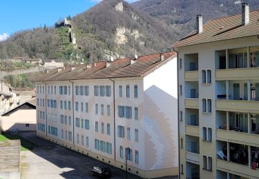
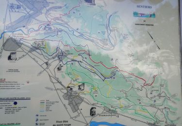
Trail Walking Torcieu - Boucle de Montferrand, Cleyzieu, Mont de l'Ange - Photo

Boucle de Montferrand, Cleyzieu, Mont de l'Ange

 adelore
adelore

User

© OpenStreetMap contributors
Length
Length
13.2 km
Max alt
Max alt
738 m
Uphill gradient
Uphill gradient
536 m
Km-Effort
Km-Effort  
20 km
Min alt
Min alt
271 m
Downhill gradient
Downhill gradient
534 m
Boucle
Boucle
Yes
Creation date :
2024-08-06 18:05:30.253
Updated on :
2024-08-06 18:06:34.821

(0 Reviews)

Walking
Walking
4h37
Difficulty : Very difficult

Scan this QR Code to open this trail in the SityTrail application

FREE GPS app for hiking

Logo SityTrail SityTrail

IGN / Geographical institutes

Download SityTrail from the App Store Download SityTrail from Google Play

Logo SityTrail SityTrail World

The world is yours!

Download SityTrail from the App Store Download SityTrail from Google Play Download SityTrail on Huawei AppGallery

About

Trail Walking of 13.2 km to be discovered at Auvergne-Rhône-Alpes, Ain, Torcieu. This trail is proposed by adelore.

Elevation profile

Points of interest

Point of interest Torcieu - Parking de Montferrand - Photo
adelore
Point of interest Torcieu - Barrière - Photo
adelore
TORCIEU 
Point of interest Torcieu - D60 - Photo
adelore
TORCIEU 
Point of interest Torcieu - Carrefour avant Dorvan - Photo
adelore
Point of interest Cleyzieu - Bief Ravinet - Photo
adelore
CLEYZIEU 
Point of interest Cleyzieu - Pont - Photo
adelore
CLEYZIEU 
Point of interest Cleyzieu - Grand lavoir  - Photo
adelore
CLEYZIEU 
Point of interest Cleyzieu - Cleyzieu - Photo
adelore
CLEYZIEU 
Point of interest Cleyzieu - Carrefour variante - Photo
adelore
Point of interest Cleyzieu - Carrefour boucle forêt - Photo
adelore
Point of interest Cleyzieu - Point haut - Photo
adelore
CLEYZIEU 
Point of interest Cleyzieu - Creux de Lent - Photo
adelore
CLEYZIEU 
Point of interest Torcieu - Mont de l'Ange - Photo
adelore
Point of interest Torcieu - Parking de Montferrand - Photo
adelore

Positioning

Country:
France
Region :
Auvergne-Rhône-Alpes
Department/Province :
Ain
Municipality :
Torcieu
Location:
Unknown
Start:(UTM)
686844 ; 5088726 (31T) N.

Trails nearby

Trail Walking Ambérieu-en-Bugey - Trail Planner Map - Photo
Walking
jcaufin

Walking

Difficult
(1)
Ambérieu-en-Bugey, Auvergne-Rhône-Alpes, Ain, France
11.3 km | 16.4 km-effort
3h 44min
Yes
Trail Other activity Ambérieu-en-Bugey - Ronde des grangeons - Photo
Other activity
loicbarouch

Other activity

Very easy
(1)
Ambérieu-en-Bugey, Auvergne-Rhône-Alpes, Ain, France
16.7 km | 24 km-effort
1h 45min
Yes
Trail Walking Saint-Rambert-en-Bugey - st rambert - Photo
Walking
loca.yves

Walking

Difficult
Saint-Rambert-en-Bugey, Auvergne-Rhône-Alpes, Ain, France
10 km | 16.2 km-effort
3h 49min
Yes
Trail Walking Saint-Sorlin-en-Bugey - 01-St-Sorlin-Bugey-17km-680m-aout21 - Photo
Walking
SyMA

Walking

Medium
Saint-Sorlin-en-Bugey, Auvergne-Rhône-Alpes, Ain, France
16.6 km | 26 km-effort
4h 5min
Yes
Trail Walking Torcieu - Dornan et ses grottes - Photo
Walking
Frasco01

Walking

Medium
Torcieu, Auvergne-Rhône-Alpes, Ain, France
5.9 km | 9.7 km-effort
2h 12min
Yes
Trail Walking Torcieu - Montferrand/Torcieu 18,8 km - D. 709 m - Photo
Walking
Thomasdanielle

Walking

Medium
Torcieu, Auvergne-Rhône-Alpes, Ain, France
18.8 km | 28 km-effort
5h 53min
Yes
Trail Walking Ambérieu-en-Bugey - les brosses.  douvre .les allymes - Photo
Walking
jackyfum

Walking

Easy
(2)
Ambérieu-en-Bugey, Auvergne-Rhône-Alpes, Ain, France
9.3 km | 12.4 km-effort
2h 28min
Yes
Trail Walking Vaux-en-Bugey -  vaux en bucey - Photo
Walking
colomb24

Walking

Easy
Vaux-en-Bugey, Auvergne-Rhône-Alpes, Ain, France
3.3 km | 4 km-effort
1h 24min
Yes
Trail Horseback riding Vaux-en-Bugey - rando Bugey j4 samedi - Photo
Horseback riding
lau74

Horseback riding

Medium
Vaux-en-Bugey, Auvergne-Rhône-Alpes, Ain, France
15.9 km | 24 km-effort
4h 56min
No


Close
My subscriptions