Trail Mountain bike Lourmarin - Lourmarin -Mourre Negre- Auribeau- AiguëBrun - Photo

Lourmarin -Mourre Negre- Auribeau- AiguëBrun

 DG01
DG01

User

© OpenStreetMap contributors
Length
Length
44 km
Max alt
Max alt
1102 m
Uphill gradient
Uphill gradient
1238 m
Km-Effort
Km-Effort  
61 km
Min alt
Min alt
201 m
Downhill gradient
Downhill gradient
1244 m
Boucle
Boucle
No
Creation date :
2024-08-05 05:49:10.0
Updated on :
2024-08-05 10:33:06.389

(0 Reviews)

Mountain bike
Mountain bike
4h12
Difficulty : Very difficult

Scan this QR Code to open this trail in the SityTrail application

FREE GPS app for hiking

Logo SityTrail SityTrail

IGN / Geographical institutes

Download SityTrail from the App Store Download SityTrail from Google Play

Logo SityTrail SityTrail World

The world is yours!

Download SityTrail from the App Store Download SityTrail from Google Play Download SityTrail on Huawei AppGallery

About

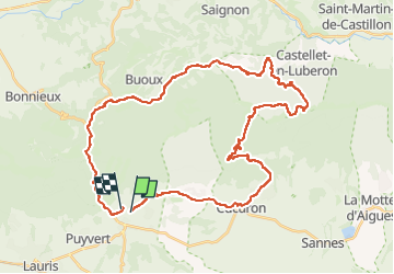
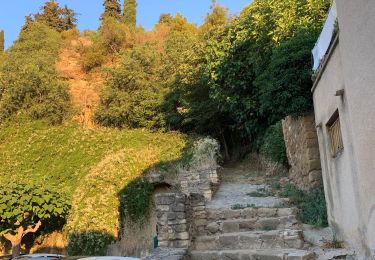
Trail Mountain bike of 44 km to be discovered at Provence-Alpes-Côte d'Azur, Vaucluse, Lourmarin. This trail is proposed by DG01.

Description

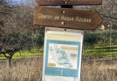
Depuis Cucuron, monter le DFCI (1h30 environ) jusqu’au Mourre Negre, puis descendre le chemin de Marauviere (début quelconque, mais devient ensuite un super single (2-3 passages à pied) jusqu’à Auribeau).
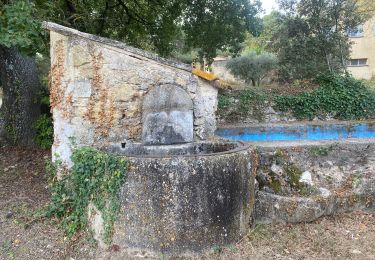
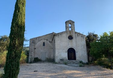
Remonter légèrement jusqu’à la chapelle pour ensuite descendre le long de L’Aigue Brun (magnifique single, mais attention aux randonneurs).
En résumé, tour absolument magnifique pour la beauté des paysages, les singles de qualité, mais exigeant.

Elevation profile

Positioning

Country:
France
Region :
Provence-Alpes-Côte d'Azur
Department/Province :
Vaucluse
Municipality :
Lourmarin
Location:
Unknown
Start:(UTM)
690687 ; 4849185 (31T) N.

Trails nearby

Trail Walking Cadenet - Cadenet -Lourmarin - Photo
Walking

Walking

Very easy
(1)
Cadenet, Provence-Alpes-Côte d'Azur, Vaucluse, France
12.1 km | 15.3 km-effort
5h 43min
Yes
Trail Walking Vaugines - Vaugines - roque rousse. -  Vaugines - Photo
Walking
Dadou 1

Walking

Medium
Vaugines, Provence-Alpes-Côte d'Azur, Vaucluse, France
6 km | 9 km-effort
2h 3min
Yes
Trail Walking Vaugines - SityTrail - PF-Vaugines - Le Mourre Nègre à partir de Vaugines - Var - Photo
Walking
MicDul

Walking

Very difficult
(1)
Vaugines, Provence-Alpes-Côte d'Azur, Vaucluse, France
20 km | 32 km-effort
7h 14min
Yes
Trail On foot Lourmarin - Lourmarin - Cadenet - Lourmarin  - Photo
On foot
Dadou 1

On foot

Easy
Lourmarin, Provence-Alpes-Côte d'Azur, Vaucluse, France
11.5 km | 14.6 km-effort
3h 19min
Yes
Trail Walking Vaugines - Luberon Vaugines Cucuron  - Photo
Walking
jll7513

Walking

Easy
Vaugines, Provence-Alpes-Côte d'Azur, Vaucluse, France
10.6 km | 14 km-effort
3h 11min
Yes
Trail Walking Vaugines - PF-Vaugines - Cucuron - l'Ermitage - Vaugines - 17.06.2021 - Photo
Walking
MicDul

Walking

Medium
(1)
Vaugines, Provence-Alpes-Côte d'Azur, Vaucluse, France
8.3 km | 10.8 km-effort
2h 22min
Yes
Trail Walking Cadenet - Cadenet Lourmarin Cadenet - Photo
Walking
jll7513

Walking

Easy
Cadenet, Provence-Alpes-Côte d'Azur, Vaucluse, France
10.5 km | 13.3 km-effort
3h 1min
Yes
Trail Mountain bike Lourmarin - lourmarin-émetteur Mourre Nègre - Photo
Mountain bike
Papou27

Mountain bike

Difficult
Lourmarin, Provence-Alpes-Côte d'Azur, Vaucluse, France
38 km | 53 km-effort
3h 24min
Yes
Trail Cycle Lourmarin - Lourmarin par Cucuron - Photo
Cycle
rikkitis

Cycle

Easy
(2)
Lourmarin, Provence-Alpes-Côte d'Azur, Vaucluse, France
19.2 km | 23 km-effort
2h 0min
Yes


Close
My subscriptions