Trail Walking Chamonix-Mont-Blanc - TMB Étape 8 : Tré-le-Champ à Les Houches par Col du Brévent via GR Principal  - Photo

TMB Étape 8 : Tré-le-Champ à Les Houches par Col du Brévent via GR Principal

© OpenStreetMap contributors
Length
Length
24 km
Max alt
Max alt
2487 m
Uphill gradient
Uphill gradient
1602 m
Km-Effort
Km-Effort  
47 km
Min alt
Min alt
975 m
Downhill gradient
Downhill gradient
1992 m
Boucle
Boucle
No
Creation date :
2024-08-04 20:50:53.601
Updated on :
2024-08-04 21:18:37.935

(0 Reviews)

Walking
Walking
10h35
Difficulty : Very difficult

Scan this QR Code to open this trail in the SityTrail application

FREE GPS app for hiking

Logo SityTrail SityTrail

IGN / Geographical institutes

Download SityTrail from the App Store Download SityTrail from Google Play

Logo SityTrail SityTrail World

The world is yours!

Download SityTrail from the App Store Download SityTrail from Google Play Download SityTrail on Huawei AppGallery

About

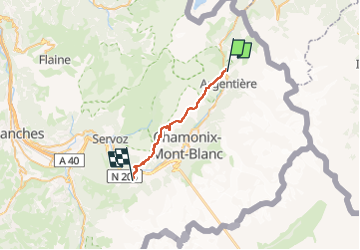
Trail Walking of 24 km to be discovered at Auvergne-Rhône-Alpes, Upper Savoy, Chamonix-Mont-Blanc. This trail is proposed by Timothée ZARAGORI.

Description

- 13,5 km : 1400 de D , 400 de D-, prévisionnel de 6H30
Tête aux vents
La Flégère
Col du Brévent

- 10 km: 200 de D , 1600 de D-, prévisionnel de 3H50
Refuge de Bellachat : ARRET pour déjeuner ? 3,5km - 1H30 depuis le col du Brévent.
➡️ Les Houches

Elevation profile

Positioning

Country:
France
Region :
Auvergne-Rhône-Alpes
Department/Province :
Upper Savoy
Municipality :
Chamonix-Mont-Blanc
Location:
Unknown
Start:(UTM)
339512 ; 5095574 (32T) N.

Trails nearby

Trail Walking Vallorcine - Le Buet - Vallorcine - Photo
Walking
tracegps

Walking

Difficult
(1)
Vallorcine, Auvergne-Rhône-Alpes, Upper Savoy, France
9 km | 27 km-effort
7h 0min
No
Trail Walking Chamonix-Mont-Blanc - Aiguillette des Posettes 2201m 6.7.22 - Photo
Walking
GUIDE
fredetpascale

Walking

Easy
Chamonix-Mont-Blanc, Auvergne-Rhône-Alpes, Upper Savoy, France
8.4 km | 17.8 km-effort
3h 30min
Yes
Trail Winter sports Vallorcine - vers Finhaut - Photo
Winter sports
fpitance

Winter sports

Medium
(1)
Vallorcine, Auvergne-Rhône-Alpes, Upper Savoy, France
22 km | 40 km-effort
5h 0min
No
Trail Walking Chamonix-Mont-Blanc - Argentiere - Photo
Walking
michauxpaul

Walking

Difficult
Chamonix-Mont-Blanc, Auvergne-Rhône-Alpes, Upper Savoy, France
5.9 km | 12.7 km-effort
4h 23min
No
Trail Walking Chamonix-Mont-Blanc - Le tour des Aiguilles Rouges : J3 - Photo
Walking
Greg813

Walking

Medium
Chamonix-Mont-Blanc, Auvergne-Rhône-Alpes, Upper Savoy, France
10.5 km | 19.4 km-effort
3h 13min
No
Trail Walking Vallorcine - Le tour des Aiguilles Rouges : J1 - Photo
Walking
Greg813

Walking

Very difficult
Vallorcine, Auvergne-Rhône-Alpes, Upper Savoy, France
16 km | 32 km-effort
5h 2min
No
Trail Walking Chamonix-Mont-Blanc - Randonnée dans la Vallée de Chamonix - Photo
Walking
jeff2

Walking

Easy
Chamonix-Mont-Blanc, Auvergne-Rhône-Alpes, Upper Savoy, France
12.5 km | 15.3 km-effort
3h 13min
No
Trail Walking Chamonix-Mont-Blanc - Les aiguilles Rouges Chamonix Argentière  - Photo
Walking
jcboutin

Walking

Difficult
Chamonix-Mont-Blanc, Auvergne-Rhône-Alpes, Upper Savoy, France
11.9 km | 25 km-effort
7h 32min
Yes
Trail Walking Chamonix-Mont-Blanc - Hôtel la Flégère - GR TMB - Lacs de Chéserys - Photo
Walking
LtZIP

Walking

Difficult
Chamonix-Mont-Blanc, Auvergne-Rhône-Alpes, Upper Savoy, France
8 km | 13.6 km-effort
3h 5min
Yes


Close
My subscriptions