![](/images/other/stat-length.png)
![Trail Walking Courmayeur - TMB Étape 3 : Refuge Elisabetha Soldini au Camping des Grandes Jorasses par le GR principal - Photo](https://media.geolcdn.com/t/1900/400/ext.pjpeg?maxdim=2&url=https%3A%2F%2Fstatic1.geolcdn.com%2Fsiteimages%2Fupload%2Ffiles%2F1553511878bg_sport_marche.png)
TMB Étape 3 : Refuge Elisabetha Soldini au Camping des Grandes Jorasses par le GR principal
Timothée ZARAGORI
User
![Length](/images/other/stat-length.png)
![Max alt](https://static1.geolcdn.com/siteimages/upload/files/1508320355ic_sort_altitude_max_24dp.png)
![Uphill gradient](https://static1.geolcdn.com/siteimages/upload/files/1508320355ic_sort_den_pos_24dp.png)
![Km-Effort](/images/other/stat-length.png)
![Min alt](https://static1.geolcdn.com/siteimages/upload/files/1508320355ic_sort_altitude_min_24dp.png)
![Downhill gradient](https://static1.geolcdn.com/siteimages/upload/files/1508320355ic_sort_den_neg_24dp.png)
![Boucle](https://static1.geolcdn.com/siteimages/upload/files/16400158638029165_repeat_loop_refresh_sync_direction_icon.png)
![Walking](https://static1.geolcdn.com/sitytour/trail-icons/101.png)
7h58
Difficulty : Very difficult
![Scan this QR Code to open this trail in the SityTrail application](https://capi.geolives.com/qq0zvz2zws4bq2lad0pu/sitytour/trails/4144652/qr.png?size=200)
FREE GPS app for hiking
About
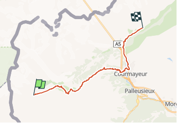
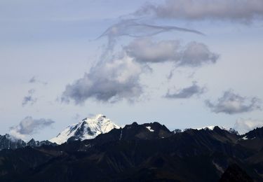
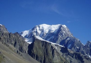
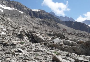
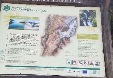
Trail Walking of 21 km to be discovered at Aosta Valley, Unknown, Courmayeur. This trail is proposed by Timothée ZARAGORI.
Description
21km : de 1000 D , de 1490 D-, prévisionnel de 6H00 de randonnée.
https://fr.wikiloc.com/itineraires-randonnee/4-9-tour-du-mont-blanc-rifugio-elisabetta-soldini-rifugio-g-bertone-19180881
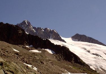
➡️ Lac Combal
➡️ Refuge Maison Vielle/Col Checrouit
➡️ Courmayeur
➡️ATTENTION, bien prendre la bonne direction après Courmayeur, probablement pas la même direction que refuge de Giorgio Bertone: (Refuge Giorgio Bertone)
➡️CAMPING GRANDES JORASSES: sur le secteur Planpincieux (Tronchey)
Positioning
Comments
Trails nearby
![Trail On foot Courmayeur - Alta Via n. 2 della Valle d'Aosta - Tappa 2 - Photo](https://media.geolcdn.com/t/375/260/1a96e093-87d3-42ba-8bbf-a0f169e367d1.jpeg&format=jpg&maxdim=2)
![On foot On foot](https://static1.geolcdn.com/sitytour/trail-icons/100.png)
On foot
![](/images/other/stat-length.png)
![](https://static1.geolcdn.com/siteimages/upload/files/16400158638029165_repeat_loop_refresh_sync_direction_icon.png)
![Trail On foot Courmayeur - (SI F07) Rifugio Elisabetta - Courmayeur - Photo](https://media.geolcdn.com/t/375/260/08d2089a-21fe-43f9-b227-bb1850f9ac87.jpeg&format=jpg&maxdim=2)
![On foot On foot](https://static1.geolcdn.com/sitytour/trail-icons/100.png)
On foot
![](/images/other/stat-length.png)
![](https://static1.geolcdn.com/siteimages/upload/files/16400158638029165_repeat_loop_refresh_sync_direction_icon.png)
![Trail On foot Courmayeur - IT-14 - Photo](https://media.geolcdn.com/t/375/260/80f72700-2fda-487a-9270-867a97225db3.jpeg&format=jpg&maxdim=2)
![On foot On foot](https://static1.geolcdn.com/sitytour/trail-icons/100.png)
![Trail On foot Courmayeur - Mont Fortin - Photo](https://media.geolcdn.com/t/375/260/877d53f2-6de8-4d5f-a42a-b4510e3a1b5a.jpeg&format=jpg&maxdim=2)
![On foot On foot](https://static1.geolcdn.com/sitytour/trail-icons/100.png)
On foot
![](/images/other/stat-length.png)
![](https://static1.geolcdn.com/siteimages/upload/files/16400158638029165_repeat_loop_refresh_sync_direction_icon.png)
![Trail Walking Bourg-Saint-Maurice - Col de Seigne - Photo](https://media.geolcdn.com/t/375/260/63610327-66f4-46b0-9c2e-7a86da45bce8.jpg&format=jpg&maxdim=2)
![Walking Walking](https://static1.geolcdn.com/sitytour/trail-icons/101.png)
Walking
![](/images/other/stat-length.png)
![](https://static1.geolcdn.com/siteimages/upload/files/16400158638029165_repeat_loop_refresh_sync_direction_icon.png)
![Trail Walking Bourg-Saint-Maurice - les Lanchettes refuge Robert Blanc - Photo](https://media.geolcdn.com/t/375/260/dffd4f94-01cd-45a7-9114-d414b27208e5.jpg&format=jpg&maxdim=2)
![Walking Walking](https://static1.geolcdn.com/sitytour/trail-icons/101.png)
Walking
![](/images/other/stat-length.png)
![](https://static1.geolcdn.com/siteimages/upload/files/16400158638029165_repeat_loop_refresh_sync_direction_icon.png)
![Trail Walking Bourg-Saint-Maurice - sentier Thomas Roques - Photo](https://media.geolcdn.com/t/375/260/ext.jpg?maxdim=2&url=https%3A%2F%2Fservices.sitytrail.com%2FGeolivesWS%2FDownloadMedia.ashx%3FTrailID%3D803256%26Media%3Dfix__20170802103029.jpg)
![Walking Walking](https://static1.geolcdn.com/sitytour/trail-icons/101.png)
Walking
![](/images/other/stat-length.png)
![](https://static1.geolcdn.com/siteimages/upload/files/16400158638029165_repeat_loop_refresh_sync_direction_icon.png)
![Trail Walking Bourg-Saint-Maurice - TMB J6 Les MOTTETS- Les CONTAMINES/MONJOIE - Photo](https://media.geolcdn.com/t/375/260/ext.jpg?maxdim=2&url=https%3A%2F%2Fservices.sitytrail.com%2FGeolivesWS%2FDownloadMedia.ashx%3FTrailID%3D594955%26Media%3Dfix__20160708152946.jpg)
![Walking Walking](https://static1.geolcdn.com/sitytour/trail-icons/101.png)
Walking
![](/images/other/stat-length.png)
![](https://static1.geolcdn.com/siteimages/upload/files/16400158638029165_repeat_loop_refresh_sync_direction_icon.png)
![Trail Walking Bourg-Saint-Maurice - Chalet Robert Blanc - Les Chapieux - Photo](https://media.geolcdn.com/t/375/260/ext.jpg?maxdim=2&url=https%3A%2F%2Fservices.sitytrail.com%2FGeolivesWS%2FDownloadMedia.ashx%3FTrailID%3D107646%26Media%3D12638_5.jpg)
![Walking Walking](https://static1.geolcdn.com/sitytour/trail-icons/101.png)
Walking
![](/images/other/stat-length.png)
![](https://static1.geolcdn.com/siteimages/upload/files/16400158638029165_repeat_loop_refresh_sync_direction_icon.png)