Trail Walking Avezé - Les bois de Beauvais - Photo

Les bois de Beauvais

 darkpapa
darkpapa

User

© OpenStreetMap contributors
Length
Length
11.2 km
Max alt
Max alt
177 m
Uphill gradient
Uphill gradient
258 m
Km-Effort
Km-Effort  
14.6 km
Min alt
Min alt
91 m
Downhill gradient
Downhill gradient
258 m
Boucle
Boucle
Yes
Creation date :
2024-07-31 06:26:49.991
Updated on :
2024-08-25 09:42:54.715

(0 Reviews)

Walking
Walking
3h19
Difficulty : Medium

Scan this QR Code to open this trail in the SityTrail application

FREE GPS app for hiking

Logo SityTrail SityTrail

IGN / Geographical institutes

Download SityTrail from the App Store Download SityTrail from Google Play

Logo SityTrail SityTrail World

The world is yours!

Download SityTrail from the App Store Download SityTrail from Google Play Download SityTrail on Huawei AppGallery

About

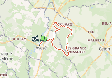
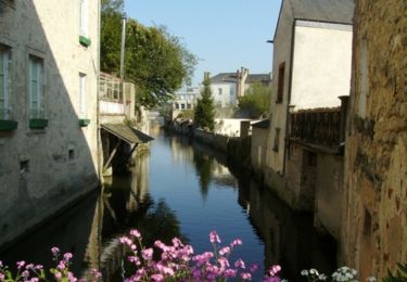
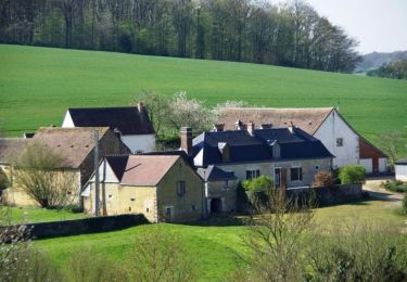
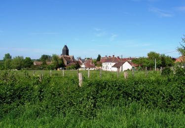
Trail Walking of 11.2 km to be discovered at Pays de la Loire, Sarthe, Avezé. This trail is proposed by darkpapa.

Description

départ retour parking salle polyvalente
danger traversée de la rd 923
cheminement très agréable en été car ombragé

Elevation profile

Positioning

Country:
France
Region :
Pays de la Loire
Department/Province :
Sarthe
Municipality :
Avezé
Location:
Unknown
Start:(UTM)
327514 ; 5344202 (31U) N.

Trails nearby

Trail Walking Val-au-Perche - Le Theil-sur-Huisne (Val-au-Perche)-Saint-Germain-de-la-Coudre - 7,4 Km - Photo
Walking

Walking

Medium
Val-au-Perche, Normandy, Orne, France
7.4 km | 9.6 km-effort
2h 3min
No
Trail Walking Avezé - avezé Sarthe  - Photo
Walking
werth

Walking

Easy
Avezé, Pays de la Loire, Sarthe, France
13.4 km | 15.9 km-effort
4h 17min
Yes
Trail Walking Val-au-Perche - Le Theil-sur-Huisne (Val-au-Perche) - Saint-Cyr-la-Rosière 11 km - Photo
Walking

Walking

Easy
Val-au-Perche, Normandy, Orne, France
11.2 km | 13.6 km-effort
2h 52min
No
Trail Walking Cherré-Au - Cherreau - Sur le sentier des lièvres - Photo
Walking
tracegps

Walking

Medium
Cherré-Au, Pays de la Loire, Sarthe, France
6.7 km | 8.4 km-effort
1h 30min
Yes
Trail Walking Souvigné-sur-Même - Souvigné sur Même - Paysages de la Vallée de l'Huisne - Photo
Walking
tracegps

Walking

Medium
Souvigné-sur-Même, Pays de la Loire, Sarthe, France
6 km | 7.8 km-effort
1h 30min
Yes
Trail Walking Avezé - Avezé - Au coeur du bocage percheron - Photo
Walking
tracegps

Walking

Medium
Avezé, Pays de la Loire, Sarthe, France
14.6 km | 17.7 km-effort
3h 30min
Yes
Trail Running La Ferté-Bernard - La Ferté Bernard trace - Photo
Running
Pierrannick

Running

La Ferté-Bernard, Pays de la Loire, Sarthe, France
9.4 km | 10.1 km-effort
1h 5min
Yes
Trail Walking Souvigné-sur-Même - Souvigné-sur-Même 10,1km - Photo
Walking
ODDAD78

Walking

Easy
(1)
Souvigné-sur-Même, Pays de la Loire, Sarthe, France
10.1 km | 12.2 km-effort
2h 40min
Yes
Trail Walking Val-au-Perche - Mâle Vallée de la Jambette 8.4 Km - Photo
Walking
ODDAD78

Walking

Easy
Val-au-Perche, Normandy, Orne, France
8.4 km | 10.8 km-effort
2h 48min
Yes


Close
My subscriptions