Trail Walking Val-Cenis - Bellecombe / Entre deux eaux / Refuges plan du lac /la blanc - Photo

Bellecombe / Entre deux eaux / Refuges plan du lac /la blanc

 zazie
zazie

User

© OpenStreetMap contributors
Length
Length
11 km
Max alt
Max alt
2388 m
Uphill gradient
Uphill gradient
573 m
Km-Effort
Km-Effort  
17.8 km
Min alt
Min alt
2052 m
Downhill gradient
Downhill gradient
322 m
Boucle
Boucle
No
Creation date :
2024-07-28 08:52:40.457
Updated on :
2024-07-28 14:33:39.122

(0 Reviews)

Walking
Walking
3h02
Difficulty : Medium

Scan this QR Code to open this trail in the SityTrail application

FREE GPS app for hiking

Logo SityTrail SityTrail

IGN / Geographical institutes

Download SityTrail from the App Store Download SityTrail from Google Play

Logo SityTrail SityTrail World

The world is yours!

Download SityTrail from the App Store Download SityTrail from Google Play Download SityTrail on Huawei AppGallery

About

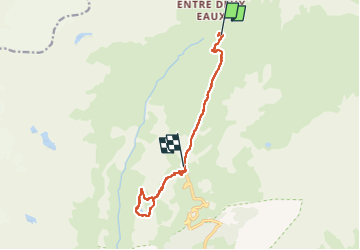
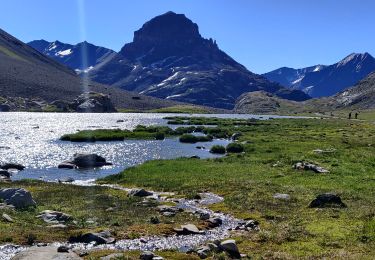
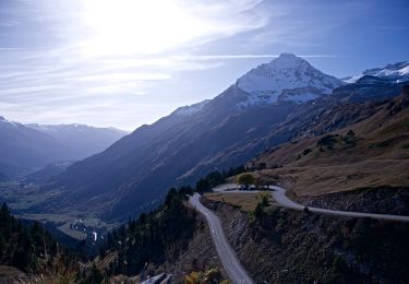
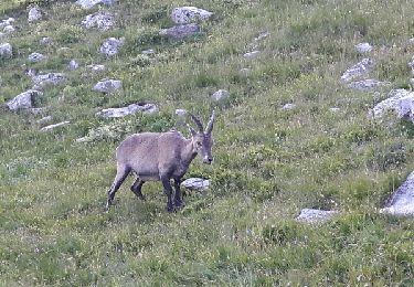
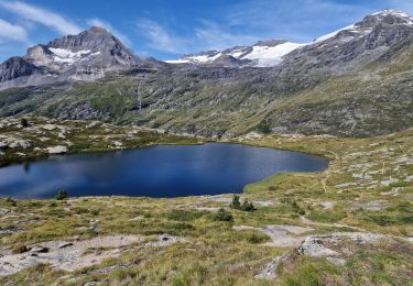
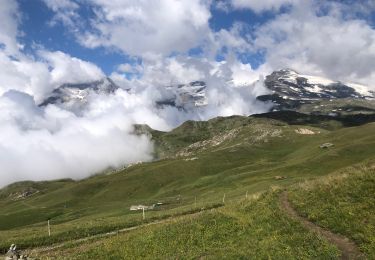
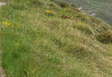
Trail Walking of 11 km to be discovered at Auvergne-Rhône-Alpes, Savoy, Val-Cenis. This trail is proposed by zazie.

Description

Parking Bellecombe
Navette pour Entre deux eaux (payant)
Chapelle
Refuge du Plan du lac
Parking Bellecombe
Refuge Lac Blanc
Lac bkanc
Retour par les chaumes

Elevation profile

Photos

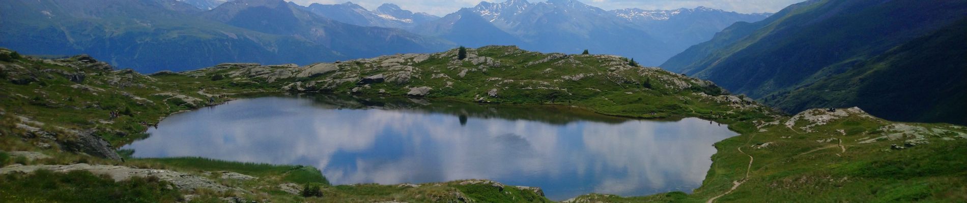
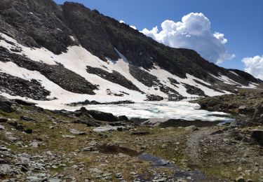
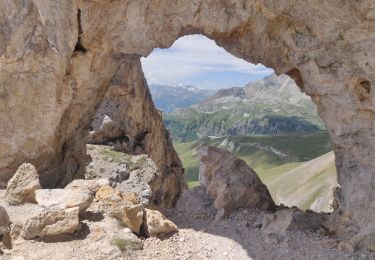
26 photos in total. Please click on a photo to see them all in the gallery.

Positioning

Country:
France
Region :
Auvergne-Rhône-Alpes
Department/Province :
Savoy
Municipality :
Val-Cenis
Location:
Termignon
Start:(UTM)
330980 ; 5025323 (32T) N.

Trails nearby

Trail Walking Pralognan-la-Vanoise - Vanoise 2021 : refuge de la Vanoise au refuge de la Valette par les glacier et le dôme des Sonnailles (-07-18).ori - Photo
Walking
PatDev

Walking

Very difficult
(1)
Pralognan-la-Vanoise, Auvergne-Rhône-Alpes, Savoy, France
12.4 km | 26 km-effort
10h 10min
No
Trail Walking Val-Cenis - 2022-06-26 Marche TGV Refuge Arpont Refuge Fond Aussois - Photo
Walking
GUIDE
holtzv

Walking

Difficult
Val-Cenis, Auvergne-Rhône-Alpes, Savoy, France
22 km | 37 km-effort
7h 52min
No
Trail Walking Pralognan-la-Vanoise - 2022-06-25 Marche TGV Refuge Col de la Vanoise Refuge Arpont - Photo
Walking
GUIDE
holtzv

Walking

Medium
Pralognan-la-Vanoise, Auvergne-Rhône-Alpes, Savoy, France
15.5 km | 22 km-effort
5h 52min
No
Trail On foot Val-Cenis - Boucle du Lac Blanc - Photo
On foot
PRO

On foot

Easy
Val-Cenis, Auvergne-Rhône-Alpes, Savoy, France
6.2 km | 10.9 km-effort
2h 29min
Yes
Trail Walking Val-Cenis - Lacs des lozières, de la Roche Ferran et du Pelve - Photo
Walking
GUIDE
amiral13

Walking

Difficult
Val-Cenis, Auvergne-Rhône-Alpes, Savoy, France
14.6 km | 27 km-effort
6h 38min
Yes
Trail Walking Val-Cenis - Lacs autour de Bellecombe - Photo
Walking
phila128

Walking

Easy
(2)
Val-Cenis, Auvergne-Rhône-Alpes, Savoy, France
10 km | 14.5 km-effort
3h 8min
Yes
Trail Walking Val-Cenis - Les lacs de Bellecombe - Photo
Walking
lpratz

Walking

Medium
Val-Cenis, Auvergne-Rhône-Alpes, Savoy, France
10.9 km | 16 km-effort
5h 47min
Yes
Trail Walking Val-Cenis - Parking Bellecombe - Col du Grand Vallon - Photo
Walking
yves12

Walking

Difficult
Val-Cenis, Auvergne-Rhône-Alpes, Savoy, France
17.4 km | 30 km-effort
8h 44min
Yes
Trail Walking Val-Cenis - 73 - Val Cenis Termignon Pkg Bellecombe - Photo
Walking
chris13370

Walking

Medium
Val-Cenis, Auvergne-Rhône-Alpes, Savoy, France
16.4 km | 25 km-effort
4h 8min
No


Close
My subscriptions