Trail Walking Huisseau-sur-Cosson - Domaine de Chambord - Photo
© OpenStreetMap contributors
Length
Length
59 km
Max alt
Max alt
125 m
Uphill gradient
Uphill gradient
440 m
Km-Effort
Km-Effort  
65 km
Min alt
Min alt
51 m
Downhill gradient
Downhill gradient
465 m
Boucle
Boucle
No
Creation date :
2015-04-28 00:00:00.0
Updated on :
2015-04-28 00:00:00.0

(1 Reviews)

Walking
Walking
4h39
Difficulty : Easy

Scan this QR Code to open this trail in the SityTrail application

FREE GPS app for hiking

Logo SityTrail SityTrail

IGN / Geographical institutes

Download SityTrail from the App Store Download SityTrail from Google Play

Logo SityTrail SityTrail World

The world is yours!

Download SityTrail from the App Store Download SityTrail from Google Play Download SityTrail on Huawei AppGallery

About

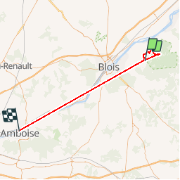
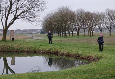
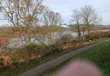
Trail Walking of 59 km to be discovered at Centre-Loire Valley, Loir-et-Cher, Huisseau-sur-Cosson. This trail is proposed by Samuel88300.

Description

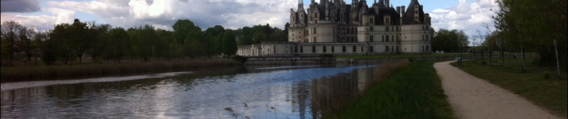
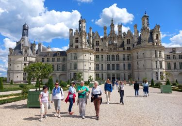
Découverte du domaine et du château de Chambord au départ de La Chaussée-le-Comte

Elevation profile

Photos

Positioning

Country:
France
Region :
Centre-Loire Valley
Department/Province :
Loir-et-Cher
Municipality :
Huisseau-sur-Cosson
Location:
Unknown
Start:(UTM)
385373 ; 5273151 (31T) N.

Comments

Please log in to post a review or rate the element


comporte un déplacement sans capture en voiture sans doute


Trails nearby

Trail On foot Huisseau-sur-Cosson - Château de Saumery - Photo
On foot
GUIDE+

On foot

Easy
Huisseau-sur-Cosson, Centre-Loire Valley, Loir-et-Cher, France
8.2 km | 8.9 km-effort
2h 1min
Yes
Trail On foot Huisseau-sur-Cosson - Château de Nanteuil - Photo
On foot
GUIDE+

On foot

Easy
Huisseau-sur-Cosson, Centre-Loire Valley, Loir-et-Cher, France
9.8 km | 10.8 km-effort
2h 27min
Yes
Trail On foot Huisseau-sur-Cosson - La Plaine des Landes - Photo
On foot
GUIDE+

On foot

Easy
Huisseau-sur-Cosson, Centre-Loire Valley, Loir-et-Cher, France
6.9 km | 7.5 km-effort
1h 41min
Yes
Trail Walking Chambord - chambord chateau  - Photo
Walking
nicole.reine@wanadoo.fr

Walking

Easy
Chambord, Centre-Loire Valley, Loir-et-Cher, France
3.8 km | 4.5 km-effort
3h 34min
Yes
Trail On foot Chambord - petite marche 6 km dans chambord - Photo
On foot
Billonmichel

On foot

Easy
(1)
Chambord, Centre-Loire Valley, Loir-et-Cher, France
6.1 km | 6.9 km-effort
1h 33min
Yes
Trail Electric bike Mont-près-Chambord - Tour en sologne blois  - Photo
Electric bike
GUIDE
antignacs

Electric bike

Very easy
Mont-près-Chambord, Centre-Loire Valley, Loir-et-Cher, France
42 km | 47 km-effort
3h 38min
No
Trail Mountain bike Chambord - chambord-cheverny - Photo
Mountain bike
Dp35

Mountain bike

Easy
(1)
Chambord, Centre-Loire Valley, Loir-et-Cher, France
23 km | 25 km-effort
1h 41min
No
Trail Walking Saint-Claude-de-Diray - St Claude de diray - Photo
Walking
Gablier

Walking

Very easy
Saint-Claude-de-Diray, Centre-Loire Valley, Loir-et-Cher, France
12.6 km | 13.5 km-effort
2h 39min
Yes
Trail Walking Saint-Claude-de-Diray - St Claude de Diray  - Photo
Walking
Gablier

Walking

Very easy
Saint-Claude-de-Diray, Centre-Loire Valley, Loir-et-Cher, France
11.8 km | 12.7 km-effort
3h 2min
Yes


Close
My subscriptions