Trail Bicycle tourism Donaueschingen - RHIN 11 - Photo
 vinwee
vinwee

User

© OpenStreetMap contributors
Length
Length
25 km
Max alt
Max alt
1050 m
Uphill gradient
Uphill gradient
529 m
Km-Effort
Km-Effort  
31 km
Min alt
Min alt
671 m
Downhill gradient
Downhill gradient
157 m
Boucle
Boucle
No
Creation date :
2024-07-23 07:53:55.976
Updated on :
2024-07-26 06:56:58.875

(0 Reviews)

Bicycle tourism
Bicycle tourism
3h52
Difficulty : Difficult

Scan this QR Code to open this trail in the SityTrail application

FREE GPS app for hiking

Logo SityTrail SityTrail

IGN / Geographical institutes

Download SityTrail from the App Store Download SityTrail from Google Play

Logo SityTrail SityTrail World

The world is yours!

Download SityTrail from the App Store Download SityTrail from Google Play Download SityTrail on Huawei AppGallery

About

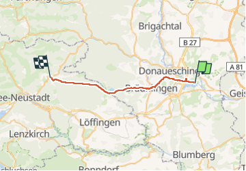
Trail Bicycle tourism of 25 km to be discovered at Baden-Württemberg, Schwarzwald-Baar-Kreis, Donaueschingen. This trail is proposed by vinwee.

Elevation profile

Positioning

Country:
Germany
Region :
Baden-Württemberg
Department/Province :
Schwarzwald-Baar-Kreis
Municipality :
Donaueschingen
Location:
Unknown
Start:(UTM)
465277 ; 5309422 (32T) N.

Trails nearby

Trail Cycle Donaueschingen - donausclingen alt - Photo
Cycle
plevier

Cycle

Very easy
Donaueschingen, Baden-Württemberg, Schwarzwald-Baar-Kreis, Germany
34 km | 38 km-effort
3h 23min
No
Trail Other activity Donaueschingen - Freiburg-Budapest - Photo
Other activity
plevier

Other activity

Very easy
Donaueschingen, Baden-Württemberg, Schwarzwald-Baar-Kreis, Germany
203 km | 231 km-effort
Unknown
No


Close
My subscriptions