Trail Walking Sangatte - CANI-RADO TOUR (boucle Cap Blanc nez) - Photo

CANI-RADO TOUR (boucle Cap Blanc nez)

© OpenStreetMap contributors
Length
Length
19 km
Max alt
Max alt
130 m
Uphill gradient
Uphill gradient
325 m
Km-Effort
Km-Effort  
23 km
Min alt
Min alt
-1 m
Downhill gradient
Downhill gradient
324 m
Boucle
Boucle
Yes
Creation date :
2024-07-25 09:43:13.036
Updated on :
2024-07-25 23:50:09.077

(0 Reviews)

Walking
Walking
5h45
Difficulty : Medium

Scan this QR Code to open this trail in the SityTrail application

FREE GPS app for hiking

Logo SityTrail SityTrail

IGN / Geographical institutes

Download SityTrail from the App Store Download SityTrail from Google Play

Logo SityTrail SityTrail World

The world is yours!

Download SityTrail from the App Store Download SityTrail from Google Play Download SityTrail on Huawei AppGallery

About

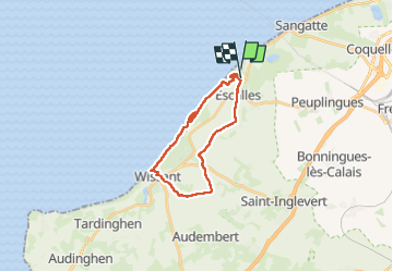
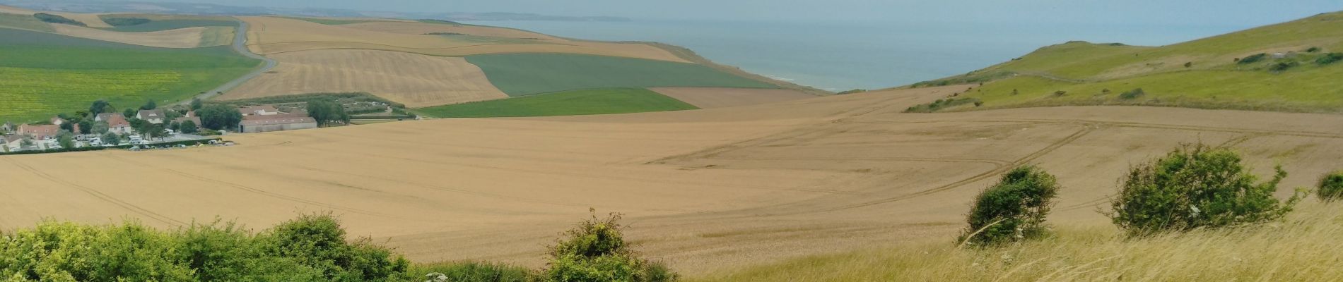
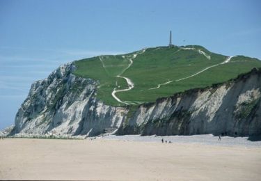
Trail Walking of 19 km to be discovered at Hauts-de-France, Pas-de-Calais, Sangatte. This trail is proposed by Godasses et Grosses Pattes.

Description

Belle boucle de 19km terre et mer,
attention vous devez connaître les horaires de marée pour ne pas être coincé au pied des falaises .
les chiens sont interdits même en laisse à beaucoup d'endroits plage ville... et oui triste ils ne sont pas les bienvenus 😥 même en ville !!!
ils sont autorisés sur le parcours que j'ai tracé ,
très peu de poubelle sur le trajet
et trop de mode en juillet et août.

Elevation profile

Photos

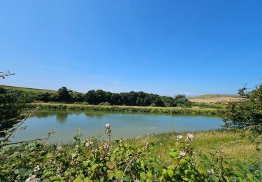
29 photos in total. Please click on a photo to see them all in the gallery.

Positioning

Country:
France
Region :
Hauts-de-France
Department/Province :
Pas-de-Calais
Municipality :
Sangatte
Location:
Unknown
Start:(UTM)
409666 ; 5642254 (31U) N.

Trails nearby

Trail Walking Wissant - Wissant-Mont de Couple- retour par la plage - Photo
Walking
Vagabond gaumardennais

Walking

Difficult
(1)
Wissant, Hauts-de-France, Pas-de-Calais, France
14.3 km | 0 m-effort
2h 53min
Yes
Trail Walking Wissant - Le Fartz - Photo
Walking
terminio

Walking

Very easy
(1)
Wissant, Hauts-de-France, Pas-de-Calais, France
5.5 km | 6.2 km-effort
1h 29min
Yes
Trail Walking Escalles - Les balcons d'Escalles  - Photo
Walking
tracegps

Walking

Medium
(5)
Escalles, Hauts-de-France, Pas-de-Calais, France
7.8 km | 10.5 km-effort
2h 0min
Yes
Trail Walking Sangatte - Le Site des 2 Caps - Les Falaises du Cap Blanc Nez et le Mont d'Hubert - Photo
Walking
tracegps

Walking

Medium
(3)
Sangatte, Hauts-de-France, Pas-de-Calais, France
11.2 km | 14.7 km-effort
3h 0min
Yes
Trail Walking Sangatte - Les Noires Mottes - Sangatte - Photo
Walking
tracegps

Walking

Medium
(1)
Sangatte, Hauts-de-France, Pas-de-Calais, France
19.6 km | 25 km-effort
4h 0min
No
Trail Walking Wissant - Le Site des 2 Caps - Le Sentier du Phartz et de la Dune d'Aval - Photo
Walking
GUIDE
Desrumaux

Walking

Easy
(3)
Wissant, Hauts-de-France, Pas-de-Calais, France
7.4 km | 8.3 km-effort
1h 50min
Yes
Trail Walking Sangatte - Le Site des 2 Caps - Les Falaises du Cap Blanc Nez et le Mont d'Hubert - Photo
Walking
GUIDE
Desrumaux

Walking

Easy
(4)
Sangatte, Hauts-de-France, Pas-de-Calais, France
11.2 km | 14.7 km-effort
2h 50min
Yes
Trail Walking Wissant - 20240719 - TOTEMUS Wissant - 4.9 Km - Photo
Walking
GUIDE
pierreh01

Walking

Easy
Wissant, Hauts-de-France, Pas-de-Calais, France
4.9 km | 5.6 km-effort
2h 26min
Yes
Trail Walking Escalles - ⛺️ Les Érables - Cap Blanc-Nez  - Photo
Walking
GUIDE
mumu.larandonneuse

Walking

Medium
Escalles, Hauts-de-France, Pas-de-Calais, France
6.9 km | 9.3 km-effort
1h 53min
Yes


Close
My subscriptions