![](/images/other/stat-length.png)
![Trail Walking Florenville - Balade à Chassepierre - Photo](https://media.geolcdn.com/t/1900/400/aef376fc-0c0b-4745-9011-e1936c12c98b.jpg&format=pjpeg&maxdim=2)
Balade à Chassepierre
Desrumaux
User GUIDE
![Length](/images/other/stat-length.png)
Length
5.2 km
![Max alt](https://static1.geolcdn.com/siteimages/upload/files/1508320355ic_sort_altitude_max_24dp.png)
Max alt
335 m
![Uphill gradient](https://static1.geolcdn.com/siteimages/upload/files/1508320355ic_sort_den_pos_24dp.png)
Uphill gradient
111 m
![Km-Effort](/images/other/stat-length.png)
Km-Effort
6.6 km
![Min alt](https://static1.geolcdn.com/siteimages/upload/files/1508320355ic_sort_altitude_min_24dp.png)
Min alt
275 m
![Downhill gradient](https://static1.geolcdn.com/siteimages/upload/files/1508320355ic_sort_den_neg_24dp.png)
Downhill gradient
109 m
![Boucle](https://static1.geolcdn.com/siteimages/upload/files/16400158638029165_repeat_loop_refresh_sync_direction_icon.png)
Boucle
Yes
Creation date :
2024-07-24 10:52:52.593
Updated on :
2024-07-27 11:43:52.059
![Walking](https://static1.geolcdn.com/sitytour/trail-icons/101.png)
1h30
Difficulty : Medium
![Scan this QR Code to open this trail in the SityTrail application](https://capi.geolives.com/qq0zvz2zws4bq2lad0pu/sitytour/trails/4133019/qr.png?size=200)
FREE GPS app for hiking
About
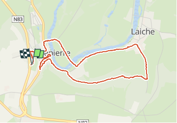
Trail Walking of 5.2 km to be discovered at Wallonia, Luxembourg, Florenville. This trail is proposed by Desrumaux.
Description
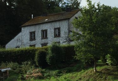
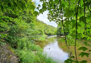
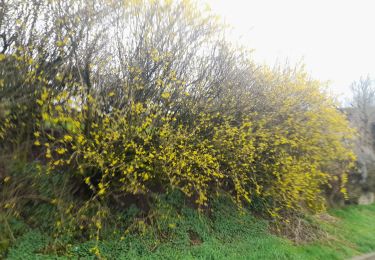
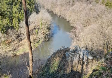
Jolie balade au départ du village de Chassepierre classé parmi les plus beaux villages de Wallonie.
Départ parking du point de vue sur la N83
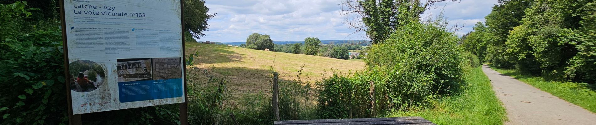
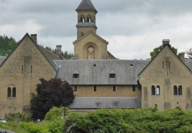
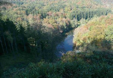
Positioning
Country:
Belgium
Region :
Wallonia
Department/Province :
Luxembourg
Municipality :
Florenville
Location:
Unknown
Start:(Dec)
Start:(UTM)
662929 ; 5508434 (31U) N.
Comments
Trails nearby
![Walking Walking](https://static1.geolcdn.com/sitytour/trail-icons/101.png)
RB-Lu-19_Chameleux_via-racc-2
Walking
Very easy
(2)
Florenville,
Wallonia,
Luxembourg,
Belgium
![](/images/other/stat-length.png)
18 km | 22 km-effort
4h 43min
![](https://static1.geolcdn.com/siteimages/upload/files/16400158638029165_repeat_loop_refresh_sync_direction_icon.png)
Yes
![Trail Walking Florenville - RB-LUX-14 - Raccourci - Dans les méandres de la Semois - Photo](https://media.geolcdn.com/t/375/260/ext.jpg?maxdim=2&url=https%3A%2F%2Fservices.sitytrail.com%2FGeolivesWS%2FDownloadMedia.ashx%3FTrailID%3D216822%26Media%3D4ddebe42-f4ef-4430-a594-18137c26d0fd.jpg)
![Walking Walking](https://static1.geolcdn.com/sitytour/trail-icons/101.png)
RB-LUX-14 - Raccourci - Dans les méandres de la Semois
Walking
Very difficult
(2)
Florenville,
Wallonia,
Luxembourg,
Belgium
![](/images/other/stat-length.png)
19.9 km | 25 km-effort
5h 34min
![](https://static1.geolcdn.com/siteimages/upload/files/16400158638029165_repeat_loop_refresh_sync_direction_icon.png)
Yes
![Trail Walking Florenville - RB-LUX-14 _ Dans les méandres de la Semois - Photo](https://media.geolcdn.com/t/375/260/ext.jpg?maxdim=2&url=https%3A%2F%2Fservices.sitytrail.com%2FGeolivesWS%2FDownloadMedia.ashx%3FTrailID%3D179620%26Media%3D4ddebe42-f4ef-4430-a594-18137c26d0fd.jpg)
![Walking Walking](https://static1.geolcdn.com/sitytour/trail-icons/101.png)
RB-LUX-14 _ Dans les méandres de la Semois
Walking
Medium
(4)
Florenville,
Wallonia,
Luxembourg,
Belgium
![](/images/other/stat-length.png)
24 km | 31 km-effort
6h 8min
![](https://static1.geolcdn.com/siteimages/upload/files/16400158638029165_repeat_loop_refresh_sync_direction_icon.png)
Yes
![Trail Walking Chiny - Semois, rochers et étangs - Photo](https://media.geolcdn.com/t/375/260/aad7bb70-f961-4423-a769-93d92e58c39f.jpg&format=jpg&maxdim=2)
![Walking Walking](https://static1.geolcdn.com/sitytour/trail-icons/101.png)
Semois, rochers et étangs
Walking
Difficult
(2)
Chiny,
Wallonia,
Luxembourg,
Belgium
![](/images/other/stat-length.png)
14.8 km | 19.4 km-effort
2h 41min
![](https://static1.geolcdn.com/siteimages/upload/files/16400158638029165_repeat_loop_refresh_sync_direction_icon.png)
Yes
![Trail Walking Florenville - 14km St Cécile vers Herbeumont - Photo](https://media.geolcdn.com/t/375/260/ext.jpg?maxdim=2&url=https%3A%2F%2Fservices.sitytrail.com%2FGeolivesWS%2FDownloadMedia.ashx%3FTrailID%3D1023598%26Media%3Dfix__20180817123348.jpg)
![Walking Walking](https://static1.geolcdn.com/sitytour/trail-icons/101.png)
14km St Cécile vers Herbeumont
Walking
Medium
(1)
Florenville,
Wallonia,
Luxembourg,
Belgium
![](/images/other/stat-length.png)
14 km | 18.1 km-effort
2h 56min
![](https://static1.geolcdn.com/siteimages/upload/files/16400158638029165_repeat_loop_refresh_sync_direction_icon.png)
Yes
![Trail Walking Florenville - RB-Lu-19_Chameleux_via-racc-1 - Photo](https://media.geolcdn.com/t/375/260/ext.jpg?maxdim=2&url=https%3A%2F%2Fstatic1.geolcdn.com%2Fsiteimages%2Fupload%2Ffiles%2F1553511878bg_sport_marche.png)
![Walking Walking](https://static1.geolcdn.com/sitytour/trail-icons/101.png)
RB-Lu-19_Chameleux_via-racc-1
Walking
Very easy
(1)
Florenville,
Wallonia,
Luxembourg,
Belgium
![](/images/other/stat-length.png)
12.6 km | 16.3 km-effort
3h 32min
![](https://static1.geolcdn.com/siteimages/upload/files/16400158638029165_repeat_loop_refresh_sync_direction_icon.png)
Yes
![Trail Walking Florenville - Le Point de vue la Bohanan - Chassepierre - Photo](https://media.geolcdn.com/t/375/260/750e4baa-8750-4090-97c8-f07ce4931baa.jpg&format=jpg&maxdim=2)
![Walking Walking](https://static1.geolcdn.com/sitytour/trail-icons/101.png)
Le Point de vue la Bohanan - Chassepierre
Walking
Medium
Florenville,
Wallonia,
Luxembourg,
Belgium
![](/images/other/stat-length.png)
6.9 km | 8.5 km-effort
1h 56min
![](https://static1.geolcdn.com/siteimages/upload/files/16400158638029165_repeat_loop_refresh_sync_direction_icon.png)
Yes
![Trail Walking Florenville - marche ADEPS à Chassepierre. - Photo](https://media.geolcdn.com/t/375/260/c3422bd1-8f1e-4c26-a509-39433ec6f633.jpg&format=jpg&maxdim=2)
![Walking Walking](https://static1.geolcdn.com/sitytour/trail-icons/101.png)
marche ADEPS à Chassepierre.
Walking
Medium
(2)
Florenville,
Wallonia,
Luxembourg,
Belgium
![](/images/other/stat-length.png)
11.4 km | 14.3 km-effort
2h 49min
![](https://static1.geolcdn.com/siteimages/upload/files/16400158638029165_repeat_loop_refresh_sync_direction_icon.png)
Yes
![Trail Walking Florenville - Marche ADEPS Chassepierre - Photo](https://media.geolcdn.com/t/375/260/a02e2830-f1b1-4b5d-b569-0006471ce904.jpg&format=jpg&maxdim=2)
![Walking Walking](https://static1.geolcdn.com/sitytour/trail-icons/101.png)
Marche ADEPS Chassepierre
Walking
Difficult
(1)
Florenville,
Wallonia,
Luxembourg,
Belgium
![](/images/other/stat-length.png)
13.1 km | 16.3 km-effort
3h 2min
![](https://static1.geolcdn.com/siteimages/upload/files/16400158638029165_repeat_loop_refresh_sync_direction_icon.png)
Yes