![](/images/other/stat-length.png)
![Trail Other activity Attinghausen - Brüsti-Fürenalp - Photo](https://media.geolcdn.com/t/1900/400/ext.pjpeg?maxdim=2&url=https%3A%2F%2Fstatic1.geolcdn.com%2Fsiteimages%2Fupload%2Ffiles%2F1545311037marcheuse_200dpi.jpg)
Brüsti-Fürenalp
Dgubler
User
![Length](/images/other/stat-length.png)
Length
13 km
![Max alt](https://static1.geolcdn.com/siteimages/upload/files/1508320355ic_sort_altitude_max_24dp.png)
Max alt
2285 m
![Uphill gradient](https://static1.geolcdn.com/siteimages/upload/files/1508320355ic_sort_den_pos_24dp.png)
Uphill gradient
1070 m
![Km-Effort](/images/other/stat-length.png)
Km-Effort
26 km
![Min alt](https://static1.geolcdn.com/siteimages/upload/files/1508320355ic_sort_altitude_min_24dp.png)
Min alt
1529 m
![Downhill gradient](https://static1.geolcdn.com/siteimages/upload/files/1508320355ic_sort_den_neg_24dp.png)
Downhill gradient
768 m
![Boucle](https://static1.geolcdn.com/siteimages/upload/files/16400158638029165_repeat_loop_refresh_sync_direction_icon.png)
Boucle
No
Creation date :
2014-12-10 00:00:00.0
Updated on :
2014-12-10 00:00:00.0
![Other activity](https://static1.geolcdn.com/sitytour/trail-icons/900.png)
5h56
Difficulty : Unknown
![Scan this QR Code to open this trail in the SityTrail application](https://capi.geolives.com/qq0zvz2zws4bq2lad0pu/sitytour/trails/41315/qr.png?size=200)
FREE GPS app for hiking
About
Trail Other activity of 13 km to be discovered at Uri, Unknown, Attinghausen. This trail is proposed by Dgubler.
Description
De la station supérieure du téléphérique Attinghausen-Brüsti, à celle du téléphérique de la Fürenalp. On peut ensuite rejoindre Engelberg.
Positioning
Country:
Switzerland
Region :
Uri
Department/Province :
Unknown
Municipality :
Attinghausen
Location:
Unknown
Start:(Dec)
Start:(UTM)
470023 ; 5187804 (32T) N.
Comments
Trails nearby
![Trail On foot Erstfeld - Erstfeld-Attighauser Brücke - Photo](https://media.geolcdn.com/t/375/260/e1942dd0-5fcb-4813-a706-7d12a0769b00.jpeg&format=jpg&maxdim=2)
![On foot On foot](https://static1.geolcdn.com/sitytour/trail-icons/100.png)
Erstfeld-Attighauser Brücke
On foot
Easy
Erstfeld,
Uri,
Unknown,
Switzerland
![](/images/other/stat-length.png)
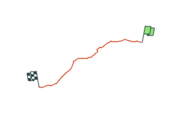
5.5 km | 6.8 km-effort
1h 32min
![](https://static1.geolcdn.com/siteimages/upload/files/16400158638029165_repeat_loop_refresh_sync_direction_icon.png)
No
![Trail On foot Attinghausen - CH-Langschnee - Höchiberg - Photo](https://media.geolcdn.com/t/375/260/dev_578380b9-7c57-4a41-88cf-5ac73470d992.jpeg&format=jpg&maxdim=2)
![On foot On foot](https://static1.geolcdn.com/sitytour/trail-icons/100.png)
CH-Langschnee - Höchiberg
On foot
Easy
Attinghausen,
Uri,
Unknown,
Switzerland
![](/images/other/stat-length.png)
5.1 km | 7.8 km-effort
1h 46min
![](https://static1.geolcdn.com/siteimages/upload/files/16400158638029165_repeat_loop_refresh_sync_direction_icon.png)
No
![Trail On foot Attinghausen - CH-Surenenpass - Blackenalp - Photo](https://media.geolcdn.com/t/375/260/dev_7710e4fa-5349-4767-99c5-40c368918612.jpeg&format=jpg&maxdim=2)
![On foot On foot](https://static1.geolcdn.com/sitytour/trail-icons/100.png)
CH-Surenenpass - Blackenalp
On foot
Easy
Attinghausen,
Uri,
Unknown,
Switzerland
![](/images/other/stat-length.png)
3 km | 4.6 km-effort
1h 3min
![](https://static1.geolcdn.com/siteimages/upload/files/16400158638029165_repeat_loop_refresh_sync_direction_icon.png)
No
![Trail On foot Attinghausen - Höchiberg - FIXME - Photo](https://media.geolcdn.com/t/375/260/dev_578380b9-7c57-4a41-88cf-5ac73470d992.jpeg&format=jpg&maxdim=2)
![On foot On foot](https://static1.geolcdn.com/sitytour/trail-icons/100.png)
Höchiberg - FIXME
On foot
Easy
Attinghausen,
Uri,
Unknown,
Switzerland
![](/images/other/stat-length.png)
3 km | 5.8 km-effort
1h 19min
![](https://static1.geolcdn.com/siteimages/upload/files/16400158638029165_repeat_loop_refresh_sync_direction_icon.png)
No
![Trail Other activity Attinghausen - y10_surenen - Photo](https://media.geolcdn.com/t/375/260/ext.jpg?maxdim=2&url=https%3A%2F%2Fstatic1.geolcdn.com%2Fsiteimages%2Fupload%2Ffiles%2F1545311037marcheuse_200dpi.jpg)
![Other activity Other activity](https://static1.geolcdn.com/sitytour/trail-icons/900.png)
y10_surenen
Other activity
Very easy
Attinghausen,
Uri,
Unknown,
Switzerland
![](/images/other/stat-length.png)
13.3 km | 26 km-effort
Unknown
![](https://static1.geolcdn.com/siteimages/upload/files/16400158638029165_repeat_loop_refresh_sync_direction_icon.png)
No
![Trail Other activity Erstfeld - y10_Erstfeld_Goeschenen - Photo](https://media.geolcdn.com/t/375/260/ext.jpg?maxdim=2&url=https%3A%2F%2Fstatic1.geolcdn.com%2Fsiteimages%2Fupload%2Ffiles%2F1545311037marcheuse_200dpi.jpg)
![Other activity Other activity](https://static1.geolcdn.com/sitytour/trail-icons/900.png)
y10_Erstfeld_Goeschenen
Other activity
Very easy
Erstfeld,
Uri,
Unknown,
Switzerland
![](/images/other/stat-length.png)
23 km | 35 km-effort
8h 51min
![](https://static1.geolcdn.com/siteimages/upload/files/16400158638029165_repeat_loop_refresh_sync_direction_icon.png)
No
![Trail Other activity Erstfeld - y10_Erstfeldertal_Kroenten - Photo](https://media.geolcdn.com/t/375/260/ext.jpg?maxdim=2&url=https%3A%2F%2Fstatic1.geolcdn.com%2Fsiteimages%2Fupload%2Ffiles%2F1545311037marcheuse_200dpi.jpg)
![Other activity Other activity](https://static1.geolcdn.com/sitytour/trail-icons/900.png)
y10_Erstfeldertal_Kroenten
Other activity
Very easy
Erstfeld,
Uri,
Unknown,
Switzerland
![](/images/other/stat-length.png)
9.5 km | 22 km-effort
5h 27min
![](https://static1.geolcdn.com/siteimages/upload/files/16400158638029165_repeat_loop_refresh_sync_direction_icon.png)
No
![Trail Mountain bike Altdorf (UR) - Bike32885 - Photo](https://media.geolcdn.com/t/375/260/ext.jpg?maxdim=2&url=https%3A%2F%2Fstatic1.geolcdn.com%2Fsiteimages%2Fupload%2Ffiles%2F1524743154velo.jpg)
![Mountain bike Mountain bike](https://static1.geolcdn.com/sitytour/trail-icons/202.png)
Bike32885
Mountain bike
Very easy
Altdorf (UR),
Uri,
Unknown,
Switzerland
![](/images/other/stat-length.png)
23 km | 37 km-effort
Unknown
![](https://static1.geolcdn.com/siteimages/upload/files/16400158638029165_repeat_loop_refresh_sync_direction_icon.png)
Yes
![Trail Walking Altdorf (UR) - st_toeff4_b - Photo](https://media.geolcdn.com/t/375/260/ext.jpg?maxdim=2&url=https%3A%2F%2Fstatic1.geolcdn.com%2Fsiteimages%2Fupload%2Ffiles%2F1553511878bg_sport_marche.png)
![Walking Walking](https://static1.geolcdn.com/sitytour/trail-icons/101.png)
st_toeff4_b
Walking
Very easy
Altdorf (UR),
Uri,
Unknown,
Switzerland
![](/images/other/stat-length.png)
374 km | 531 km-effort
91h 43min
![](https://static1.geolcdn.com/siteimages/upload/files/16400158638029165_repeat_loop_refresh_sync_direction_icon.png)
No