Trail Walking Brixen - Bressanone - Plose - Schatzerhütte - Photo
© OpenStreetMap contributors
Length
Length
12.7 km
Max alt
Max alt
2316 m
Uphill gradient
Uphill gradient
504 m
Km-Effort
Km-Effort  
19.4 km
Min alt
Min alt
1888 m
Downhill gradient
Downhill gradient
503 m
Boucle
Boucle
Yes
Creation date :
2024-07-22 08:41:58.135
Updated on :
2024-08-01 11:57:30.358

(0 Reviews)

Walking
Walking
5h08
Difficulty : Medium

Scan this QR Code to open this trail in the SityTrail application

FREE GPS app for hiking

Logo SityTrail SityTrail

IGN / Geographical institutes

Download SityTrail from the App Store Download SityTrail from Google Play

Logo SityTrail SityTrail World

The world is yours!

Download SityTrail from the App Store Download SityTrail from Google Play Download SityTrail on Huawei AppGallery

About

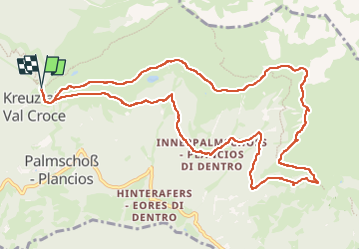
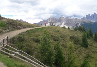
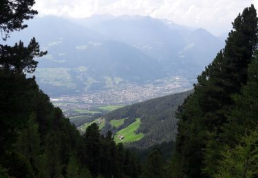
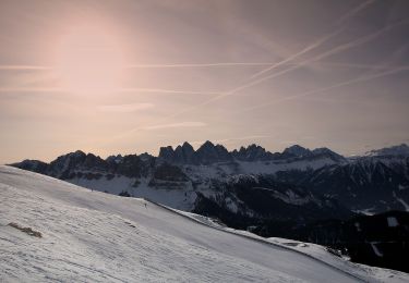
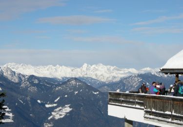
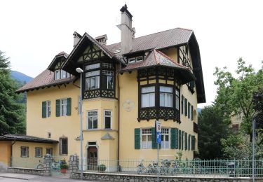
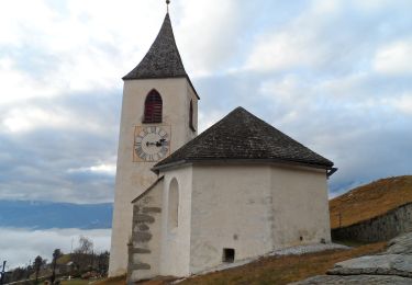
Trail Walking of 12.7 km to be discovered at Trentino-Alto Adige/Südtirol, South Tyrol, Brixen - Bressanone. This trail is proposed by VacheKiri67.

Description

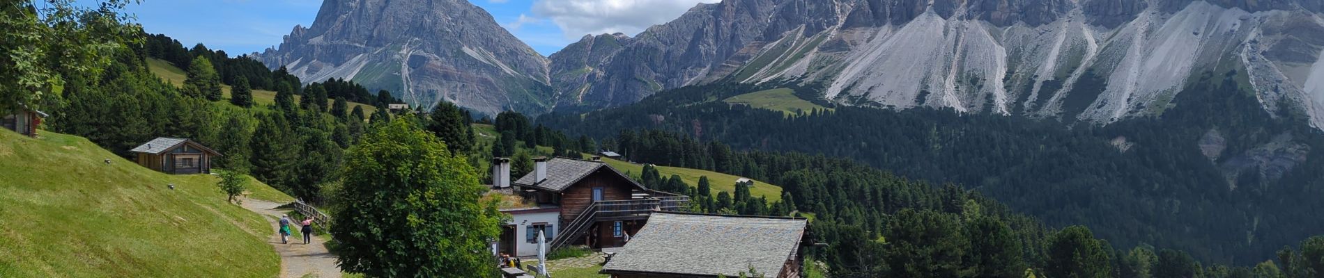
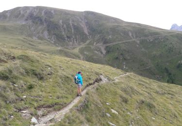
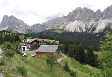
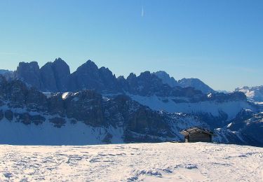
Faite le 22/07/2024. La Schatzerhütte (2004 mètres) est un refuge offrant plaisirs culinaires, un hébergement rustique et un magnifique panorama sur les Dolomites. Il s'y dégage une atmosphère de bien être. Nous n'y avons que des bons souvenirs.
Goûtez les Schlutzkrapfen !
https://www .schatzerhuette.com/

Elevation profile

Photos

78 photos in total. Please click on a photo to see them all in the gallery.

Positioning

Country:
Italy
Region :
Trentino-Alto Adige/Südtirol
Department/Province :
South Tyrol
Municipality :
Brixen - Bressanone
Location:
Unknown
Start:(UTM)
707245 ; 5173752 (32T) N.

Trails nearby

Trail Walking Brixen - Bressanone - Plose - Schatzerhütte - Photo
Walking
VacheKiri67

Walking

Medium
(1)
Brixen - Bressanone, Trentino-Alto Adige/Südtirol, South Tyrol, Italy
9.2 km | 14.2 km-effort
3h 1min
Yes
Trail Walking Brixen - Bressanone - Pfannspitze - Gabler - Skihütte - Photo
Walking
VacheKiri67

Walking

Medium
(1)
Brixen - Bressanone, Trentino-Alto Adige/Südtirol, South Tyrol, Italy
7.8 km | 12.2 km-effort
3h 40min
No
Trail Walking Brixen - Bressanone - Dolomiten Panoramaweg - Photo
Walking
VacheKiri67

Walking

Medium
(1)
Brixen - Bressanone, Trentino-Alto Adige/Südtirol, South Tyrol, Italy
15.6 km | 23 km-effort
5h 10min
Yes
Trail Walking Brixen - Bressanone - Telegraph - Leonharder Kreuz - Photo
Walking
VacheKiri67

Walking

Medium
(1)
Brixen - Bressanone, Trentino-Alto Adige/Südtirol, South Tyrol, Italy
11.5 km | 19.1 km-effort
5h 13min
Yes
Trail On foot Lüsen - Luson - Wanderweg 3 - Lüsen - Photo
On foot
GUIDE+

On foot

Easy
Lüsen - Luson, Trentino-Alto Adige/Südtirol, South Tyrol, Italy
6.8 km | 11.6 km-effort
2h 38min
No
Trail On foot Brixen - Bressanone - Brixener Höhenweg - Photo
On foot
GUIDE+

On foot

Easy
Brixen - Bressanone, Trentino-Alto Adige/Südtirol, South Tyrol, Italy
5.1 km | 7 km-effort
1h 35min
No
Trail On foot Brixen - Bressanone - IT-9 - Photo
On foot
GUIDE+

On foot

Easy
Brixen - Bressanone, Trentino-Alto Adige/Südtirol, South Tyrol, Italy
5.3 km | 6.4 km-effort
1h 26min
No
Trail On foot Brixen - Bressanone - IT-8 - Photo
On foot
GUIDE+

On foot

Easy
Brixen - Bressanone, Trentino-Alto Adige/Südtirol, South Tyrol, Italy
4.2 km | 9.6 km-effort
2h 11min
No
Trail On foot Brixen - Bressanone - 7 - Gablersteig - Photo
On foot
GUIDE+

On foot

Difficult
Brixen - Bressanone, Trentino-Alto Adige/Südtirol, South Tyrol, Italy
16.1 km | 38 km-effort
8h 36min
No


Close
My subscriptions