![](/images/other/stat-length.png)
![Trail Walking Carspach - Entraînement Trek Tignes septembre 5024 - Photo](https://media.geolcdn.com/t/1900/400/139dc24e-6c0b-495f-b090-ab282f1645f4.jpg&format=pjpeg&maxdim=2)
Entraînement Trek Tignes septembre 5024
boubou68
User
![Length](/images/other/stat-length.png)
Length
15.1 km
![Max alt](https://static1.geolcdn.com/siteimages/upload/files/1508320355ic_sort_altitude_max_24dp.png)
Max alt
366 m
![Uphill gradient](https://static1.geolcdn.com/siteimages/upload/files/1508320355ic_sort_den_pos_24dp.png)
Uphill gradient
535 m
![Km-Effort](/images/other/stat-length.png)
Km-Effort
22 km
![Min alt](https://static1.geolcdn.com/siteimages/upload/files/1508320355ic_sort_altitude_min_24dp.png)
Min alt
267 m
![Downhill gradient](https://static1.geolcdn.com/siteimages/upload/files/1508320355ic_sort_den_neg_24dp.png)
Downhill gradient
531 m
![Boucle](https://static1.geolcdn.com/siteimages/upload/files/16400158638029165_repeat_loop_refresh_sync_direction_icon.png)
Boucle
Yes
Creation date :
2024-07-20 05:42:30.123
Updated on :
2024-07-20 08:45:49.433
![Walking](https://static1.geolcdn.com/sitytour/trail-icons/101.png)
3h02
Difficulty : Very difficult
![Scan this QR Code to open this trail in the SityTrail application](https://capi.geolives.com/qq0zvz2zws4bq2lad0pu/sitytour/trails/4127798/qr.png?size=200)
FREE GPS app for hiking
About
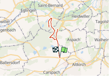
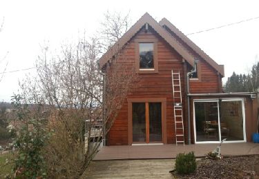
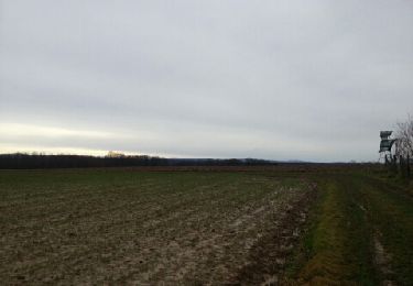
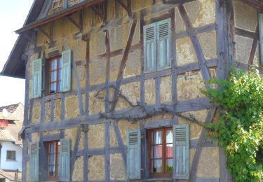
Trail Walking of 15.1 km to be discovered at Grand Est, Haut-Rhin, Carspach. This trail is proposed by boubou68.
Description
Aujourd'hui j'avais la " niaque"..pour être en accord avec mon profil d'entraînement, je devrai parcourir au moins 20 km avec au moins 800 m de D /-..
A suivre !!
Positioning
Country:
France
Region :
Grand Est
Department/Province :
Haut-Rhin
Municipality :
Carspach
Location:
Unknown
Start:(Dec)
Start:(UTM)
366183 ; 5276678 (32T) N.
Comments
Trails nearby
![Trail Walking Altkirch - Rando Les Copains d'abord.. 04/03/2022 - Photo](https://media.geolcdn.com/t/375/260/914309fc-ad37-47d5-9c82-2ec00ee37f80.jpg&format=jpg&maxdim=2)
![Walking Walking](https://static1.geolcdn.com/sitytour/trail-icons/101.png)
Rando Les Copains d'abord.. 04/03/2022
Walking
Medium
Altkirch,
Grand Est,
Haut-Rhin,
France
![](/images/other/stat-length.png)
21 km | 27 km-effort
4h 36min
![](https://static1.geolcdn.com/siteimages/upload/files/16400158638029165_repeat_loop_refresh_sync_direction_icon.png)
Yes
![Trail Walking Illfurth - Illfurth Luemschwillrr Obermorschwiller - Photo](https://media.geolcdn.com/t/375/260/46e592e4-24b9-41f2-97e3-216d8904300e.jpg&format=jpg&maxdim=2)
![Walking Walking](https://static1.geolcdn.com/sitytour/trail-icons/101.png)
Illfurth Luemschwillrr Obermorschwiller
Walking
Easy
Illfurth,
Grand Est,
Haut-Rhin,
France
![](/images/other/stat-length.png)
28 km | 34 km-effort
3h 28min
![](https://static1.geolcdn.com/siteimages/upload/files/16400158638029165_repeat_loop_refresh_sync_direction_icon.png)
No
![Trail Walking Carspach - Carspach (21/02/2019) - Photo](https://media.geolcdn.com/t/375/260/cfc93ddd-5602-4f71-87a7-bb22a3daa167.jpeg&format=jpg&maxdim=2)
![Walking Walking](https://static1.geolcdn.com/sitytour/trail-icons/101.png)
Carspach (21/02/2019)
Walking
Easy
Carspach,
Grand Est,
Haut-Rhin,
France
![](/images/other/stat-length.png)
13.2 km | 17.7 km-effort
3h 8min
![](https://static1.geolcdn.com/siteimages/upload/files/16400158638029165_repeat_loop_refresh_sync_direction_icon.png)
Yes
![Trail Walking Walheim - Walheim-Illfuhrt (1-3-2018) - Photo](https://media.geolcdn.com/t/375/260/ext.jpg?maxdim=2&url=https%3A%2F%2Fservices.sitytrail.com%2FGeolivesWS%2FDownloadMedia.ashx%3FTrailID%3D915181%26Media%3Dfix__20180301135138.jpg)
![Walking Walking](https://static1.geolcdn.com/sitytour/trail-icons/101.png)
Walheim-Illfuhrt (1-3-2018)
Walking
Easy
Walheim,
Grand Est,
Haut-Rhin,
France
![](/images/other/stat-length.png)
13.6 km | 18.2 km-effort
3h 32min
![](https://static1.geolcdn.com/siteimages/upload/files/16400158638029165_repeat_loop_refresh_sync_direction_icon.png)
Yes
![Trail Mountain bike Hirsingue - La Schwalmala - 42 km - Photo](https://media.geolcdn.com/t/375/260/ext.jpg?maxdim=2&url=https%3A%2F%2Fstatic1.geolcdn.com%2Fsiteimages%2Fupload%2Ffiles%2F1524743154velo.jpg)
![Mountain bike Mountain bike](https://static1.geolcdn.com/sitytour/trail-icons/202.png)
La Schwalmala - 42 km
Mountain bike
Easy
(1)
Hirsingue,
Grand Est,
Haut-Rhin,
France
![](/images/other/stat-length.png)
41 km | 50 km-effort
3h 13min
![](https://static1.geolcdn.com/siteimages/upload/files/16400158638029165_repeat_loop_refresh_sync_direction_icon.png)
Yes
![Trail Running Walheim - noel - Photo](https://media.geolcdn.com/t/375/260/ext.jpg?maxdim=2&url=https%3A%2F%2Fservices.sitytrail.com%2FGeolivesWS%2FDownloadMedia.ashx%3FTrailID%3D167185%26Media%3D20121225131934.jpeg)
![Running Running](https://static1.geolcdn.com/sitytour/trail-icons/103.png)
![Trail Running Walheim - noel - Photo](https://media.geolcdn.com/t/375/260/ext.jpg?maxdim=2&url=https%3A%2F%2Fservices.sitytrail.com%2FGeolivesWS%2FDownloadMedia.ashx%3FTrailID%3D167140%26Media%3D20121225125537.jpeg)
![Running Running](https://static1.geolcdn.com/sitytour/trail-icons/103.png)
![Trail Mountain bike Walheim - 2010-10-31 - 10h56m09 - Photo](https://media.geolcdn.com/t/375/260/ext.jpg?maxdim=2&url=https%3A%2F%2Fservices.sitytrail.com%2FGeolivesWS%2FDownloadMedia.ashx%3FTrailID%3D47733%26Media%3Dimage8.jpg)
![Mountain bike Mountain bike](https://static1.geolcdn.com/sitytour/trail-icons/202.png)
2010-10-31 - 10h56m09
Mountain bike
Very easy
Walheim,
Grand Est,
Haut-Rhin,
France
![](/images/other/stat-length.png)
34 km | 42 km-effort
Unknown
![](https://static1.geolcdn.com/siteimages/upload/files/16400158638029165_repeat_loop_refresh_sync_direction_icon.png)
Yes
![Walking Walking](https://static1.geolcdn.com/sitytour/trail-icons/101.png)
68 Hirtzbach - Hirsingue
Walking
Easy
Hirtzbach,
Grand Est,
Haut-Rhin,
France
![](/images/other/stat-length.png)
11.6 km | 14.2 km-effort
3h 13min
![](https://static1.geolcdn.com/siteimages/upload/files/16400158638029165_repeat_loop_refresh_sync_direction_icon.png)
No