Trail Electric bike Chassignelles - Canal de Bourgogne_Etape 3 - Photo

Canal de Bourgogne_Etape 3

 mimi53
mimi53

User

© OpenStreetMap contributors
Length
Length
41 km
Max alt
Max alt
237 m
Uphill gradient
Uphill gradient
272 m
Km-Effort
Km-Effort  
45 km
Min alt
Min alt
173 m
Downhill gradient
Downhill gradient
215 m
Boucle
Boucle
No
Creation date :
2024-07-06 20:36:51.042
Updated on :
2024-08-13 19:30:53.964

(0 Reviews)

Electric bike
Electric bike
0m
Difficulty : Very easy

Scan this QR Code to open this trail in the SityTrail application

FREE GPS app for hiking

Logo SityTrail SityTrail

IGN / Geographical institutes

Download SityTrail from the App Store Download SityTrail from Google Play

Logo SityTrail SityTrail World

The world is yours!

Download SityTrail from the App Store Download SityTrail from Google Play Download SityTrail on Huawei AppGallery

About

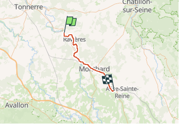
Trail Electric bike of 41 km to be discovered at Bourgogne-Franche-Comté, Yonne, Chassignelles. This trail is proposed by mimi53.

Description

Chassignelles vers Venaray Les Laumes

Elevation profile

Positioning

Country:
France
Region :
Bourgogne-Franche-Comté
Department/Province :
Yonne
Municipality :
Chassignelles
Location:
Unknown
Start:(UTM)
587941 ; 5290240 (31T) N.

Trails nearby

Trail Walking Ancy-le-Franc - 7 canal de Bourgogne Tonnerre - Photo
Walking
BrassensJC

Walking

Medium
Ancy-le-Franc, Bourgogne-Franche-Comté, Yonne, France
30 km | 32 km-effort
6h 56min
No
Trail Other activity Ravières - raid armançon  18km 17 09 2016 - Photo
Other activity
ghjpmlo

Other activity

Very easy
Ravières, Bourgogne-Franche-Comté, Yonne, France
21 km | 25 km-effort
2h 13min
Yes
Trail Bicycle tourism Ancy-le-Franc - TB 14 Ancy le franc - Venarey les Laumes - Photo
Bicycle tourism
famiski

Bicycle tourism

Very difficult
Ancy-le-Franc, Bourgogne-Franche-Comté, Yonne, France
42 km | 46 km-effort
3h 43min
No


Close
My subscriptions