![](/images/other/stat-length.png)
![Trail Cycle La Martre - Les clues et les cols - Photo](https://media.geolcdn.com/t/1900/400/ext.pjpeg?maxdim=2&url=https%3A%2F%2Fstatic1.geolcdn.com%2Fsiteimages%2Fupload%2Ffiles%2F1524743154velo.jpg)
Les clues et les cols
Sugg
User
![Length](/images/other/stat-length.png)
![Max alt](https://static1.geolcdn.com/siteimages/upload/files/1508320355ic_sort_altitude_max_24dp.png)
![Uphill gradient](https://static1.geolcdn.com/siteimages/upload/files/1508320355ic_sort_den_pos_24dp.png)
![Km-Effort](/images/other/stat-length.png)
![Min alt](https://static1.geolcdn.com/siteimages/upload/files/1508320355ic_sort_altitude_min_24dp.png)
![Downhill gradient](https://static1.geolcdn.com/siteimages/upload/files/1508320355ic_sort_den_neg_24dp.png)
![Boucle](https://static1.geolcdn.com/siteimages/upload/files/16400158638029165_repeat_loop_refresh_sync_direction_icon.png)
![Cycle](https://static1.geolcdn.com/sitytour/trail-icons/200.png)
8h19
Difficulty : Difficult
![Scan this QR Code to open this trail in the SityTrail application](https://capi.geolives.com/qq0zvz2zws4bq2lad0pu/sitytour/trails/411263/qr.png?size=200)
FREE GPS app for hiking
About
Trail Cycle of 110 km to be discovered at Provence-Alpes-Côte d'Azur, Var, La Martre. This trail is proposed by Sugg.
Description
Sortie vélo du 22 avril 2015 au départ du Logis du Pin.
Groupe 1 de Restons en Forme
10 courageux au départ,
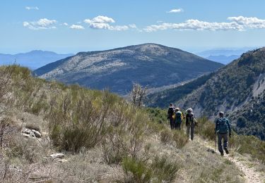
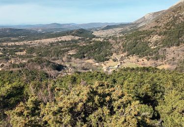
Très beau parcours, magnifiques paysages sous le soleil, des passages difficiles voir long ( col de Pinpinier ) et la touche finale avec Le col de Bleine.
5h50 de pédalage, pause casse croûte à SIGALE.
A refaire avec des braquets adaptés, pour moi le 34x25 était parfois un peu juste.
@ CDT
Positioning
Comments
Trails nearby
![Trail Walking Mons - tour du Mt Lachens - Photo](https://media.geolcdn.com/t/375/260/ext.jpg?maxdim=2&url=https%3A%2F%2Fservices.sitytrail.com%2FGeolivesWS%2FDownloadMedia.ashx%3FTrailID%3D167544%26Media%3D20121228095006.jpg)
![Walking Walking](https://static1.geolcdn.com/sitytour/trail-icons/101.png)
Walking
![](/images/other/stat-length.png)
![](https://static1.geolcdn.com/siteimages/upload/files/16400158638029165_repeat_loop_refresh_sync_direction_icon.png)
![Trail Walking Séranon - Seranon Sommet du Bauroux Caille La Mouliere La clue trace réelle - Photo](https://media.geolcdn.com/t/375/260/c7ed52be-7174-4392-85b5-b26f672c5acb.jpg&format=jpg&maxdim=2)
![Walking Walking](https://static1.geolcdn.com/sitytour/trail-icons/101.png)
Walking
![](/images/other/stat-length.png)
![](https://static1.geolcdn.com/siteimages/upload/files/16400158638029165_repeat_loop_refresh_sync_direction_icon.png)
![Trail Walking La Bastide - Lachens le tour trace réelle - Photo](https://media.geolcdn.com/t/375/260/2bcc9855-0aa8-43b5-8275-4dbc1ebfe660.jpg&format=jpg&maxdim=2)
![Walking Walking](https://static1.geolcdn.com/sitytour/trail-icons/101.png)
Walking
![](/images/other/stat-length.png)
![](https://static1.geolcdn.com/siteimages/upload/files/16400158638029165_repeat_loop_refresh_sync_direction_icon.png)
![Trail On foot Séranon - Crêtes du Bauroux - Photo](https://media.geolcdn.com/t/375/260/608405c7-47cb-4d38-8b04-423595896dc9.jpeg&format=jpg&maxdim=2)
![On foot On foot](https://static1.geolcdn.com/sitytour/trail-icons/100.png)
On foot
![](/images/other/stat-length.png)
![](https://static1.geolcdn.com/siteimages/upload/files/16400158638029165_repeat_loop_refresh_sync_direction_icon.png)
![Trail Walking La Bastide - Mont Lachens depuis La Bastide - Photo](https://media.geolcdn.com/t/375/260/56f0544f-2b76-496c-a00e-0afd7a0a58b8.jpg&format=jpg&maxdim=2)
![Walking Walking](https://static1.geolcdn.com/sitytour/trail-icons/101.png)
Walking
![](/images/other/stat-length.png)
![](https://static1.geolcdn.com/siteimages/upload/files/16400158638029165_repeat_loop_refresh_sync_direction_icon.png)
![Trail Walking Séranon - Seranon <-> Caille - Photo](https://media.geolcdn.com/t/375/260/55d1be7e-e0ec-4c06-a993-d30288ee612d.jpg&format=jpg&maxdim=2)
![Walking Walking](https://static1.geolcdn.com/sitytour/trail-icons/101.png)
Walking
![](/images/other/stat-length.png)
![](https://static1.geolcdn.com/siteimages/upload/files/16400158638029165_repeat_loop_refresh_sync_direction_icon.png)
![Trail Walking La Bastide - Le Lachens 2024 - Photo](https://media.geolcdn.com/t/375/260/913959e8-b638-421e-a577-0b933e0f73a7.jpg&format=jpg&maxdim=2)
![Walking Walking](https://static1.geolcdn.com/sitytour/trail-icons/101.png)
Walking
![](/images/other/stat-length.png)
![](https://static1.geolcdn.com/siteimages/upload/files/16400158638029165_repeat_loop_refresh_sync_direction_icon.png)
![Trail Walking La Bastide - Le Lachens-la Bastide-20-03-23 - Photo](https://media.geolcdn.com/t/375/260/0ef2ca21-f587-4552-959d-c511cb58eebf.jpg&format=jpg&maxdim=2)
![Walking Walking](https://static1.geolcdn.com/sitytour/trail-icons/101.png)
Walking
![](/images/other/stat-length.png)
![](https://static1.geolcdn.com/siteimages/upload/files/16400158638029165_repeat_loop_refresh_sync_direction_icon.png)
![Trail Walking La Bastide - 2023-03-03 Col de Clavel - Pont de Madame - Photo](https://media.geolcdn.com/t/375/260/ac865133-01d0-47e1-90eb-10e680f9bbbf.jpg&format=jpg&maxdim=2)
![Walking Walking](https://static1.geolcdn.com/sitytour/trail-icons/101.png)
Walking
![](/images/other/stat-length.png)
![](https://static1.geolcdn.com/siteimages/upload/files/16400158638029165_repeat_loop_refresh_sync_direction_icon.png)