Trail Walking Trèves - Treves- grotte st Firmin-Comeiras-cote 1232 - Photo

Treves- grotte st Firmin-Comeiras-cote 1232

 grageot
grageot

User

© OpenStreetMap contributors
Length
Length
20 km
Max alt
Max alt
1250 m
Uphill gradient
Uphill gradient
971 m
Km-Effort
Km-Effort  
33 km
Min alt
Min alt
561 m
Downhill gradient
Downhill gradient
980 m
Boucle
Boucle
Yes
Creation date :
2015-04-24 00:00:00.0
Updated on :
2015-04-24 00:00:00.0

(0 Reviews)

Walking
Walking
6h48
Difficulty : Difficult

Scan this QR Code to open this trail in the SityTrail application

FREE GPS app for hiking

Logo SityTrail SityTrail

IGN / Geographical institutes

Download SityTrail from the App Store Download SityTrail from Google Play

Logo SityTrail SityTrail World

The world is yours!

Download SityTrail from the App Store Download SityTrail from Google Play Download SityTrail on Huawei AppGallery

About

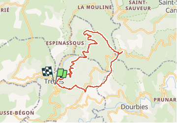
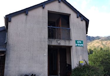
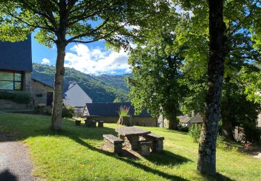
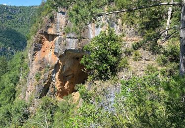
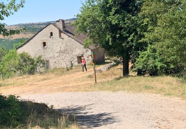
Trail Walking of 20 km to be discovered at Occitania, Gard, Trèves. This trail is proposed by grageot.

Description

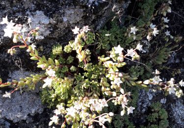
Très belle randonnée au dessus des gorges Trevezel et sur l'arête du Suquet. Un sentier pour aller jusqu'à la grotte St Firmin et ensuite une trace le long de la falaise pour rejoindre le sentier balisé. Un petit détour mérité pour voir le "hêtre remarquable"

Elevation profile

Positioning

Country:
France
Region :
Occitania
Department/Province :
Gard
Municipality :
Trèves
Location:
Unknown
Start:(UTM)
531201 ; 4880381 (31T) N.

Trails nearby

Trail Walking Dourbies - DOURBIE LE SUQUET - Photo
Walking
Georgesferrier

Walking

Medium
(1)
Dourbies, Occitania, Gard, France
12.5 km | 19.3 km-effort
4h 21min
Yes
Trail Walking Dourbies - RANDO DOURBIE - Photo
Walking
Georgesferrier

Walking

Medium
(1)
Dourbies, Occitania, Gard, France
8.6 km | 12.7 km-effort
2h 55min
Yes
Trail Walking Saint-Sauveur-Camprieu - Dourbies Camprieu boucle - Photo
Walking
GUIDE
Roger Philippe Wallez

Walking

Very difficult
Saint-Sauveur-Camprieu, Occitania, Gard, France
21 km | 29 km-effort
7h 34min
No
Trail Walking Dourbies - Dourbies à Camprieu en boucle  - Photo
Walking
GUIDE
nadinebondoux

Walking

Difficult
Dourbies, Occitania, Gard, France
24 km | 35 km-effort
7h 20min
Yes
Trail Walking Dourbies - rando 2 jours  - Photo
Walking
GUIDE
nadinebondoux

Walking

Difficult
Dourbies, Occitania, Gard, France
14.7 km | 23 km-effort
5h 2min
No
Trail Walking Trèves - rando 2 jours  - Photo
Walking
GUIDE
nadinebondoux

Walking

Medium
Trèves, Occitania, Gard, France
8.9 km | 15.6 km-effort
2h 56min
No
Trail Walking Dourbies - Dourbies -Meyruis 23 km - deuxième étape tour du mont Aigual - Photo
Walking
GUIDE
rvapeldo

Walking

Medium
Dourbies, Occitania, Gard, France
23 km | 34 km-effort
8h 16min
No
Trail Walking Trèves - st firmin - Photo
Walking
aldeu

Walking

Medium
(1)
Trèves, Occitania, Gard, France
6.9 km | 11.9 km-effort
2h 38min
Yes
Trail Walking Trèves - Trêves via Dourbies - Photo
Walking
GUIDE
Roger Philippe Wallez

Walking

Very difficult
Trèves, Occitania, Gard, France
163 km | 205 km-effort
10h 6min
No


Close
My subscriptions