Trail Walking Crupies - tour de jumel - Photo
 parastat
parastat

User

© OpenStreetMap contributors
Length
Length
9.5 km
Max alt
Max alt
907 m
Uphill gradient
Uphill gradient
424 m
Km-Effort
Km-Effort  
15.1 km
Min alt
Min alt
512 m
Downhill gradient
Downhill gradient
424 m
Boucle
Boucle
Yes
Creation date :
2024-07-04 08:46:13.056
Updated on :
2024-07-04 14:11:04.184

(0 Reviews)

Walking
Walking
3h24
Difficulty : Difficult

Scan this QR Code to open this trail in the SityTrail application

FREE GPS app for hiking

Logo SityTrail SityTrail

IGN / Geographical institutes

Download SityTrail from the App Store Download SityTrail from Google Play

Logo SityTrail SityTrail World

The world is yours!

Download SityTrail from the App Store Download SityTrail from Google Play Download SityTrail on Huawei AppGallery

About

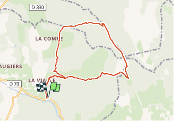
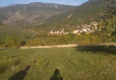
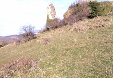
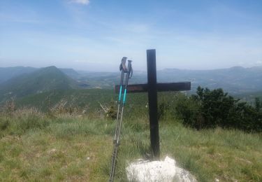
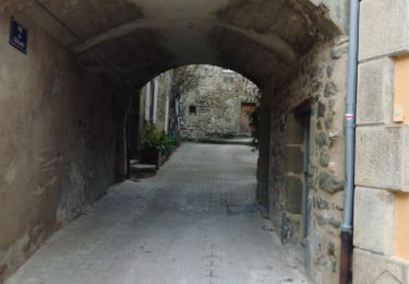
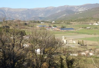
Trail Walking of 9.5 km to be discovered at Auvergne-Rhône-Alpes, Drôme, Crupies. This trail is proposed by parastat.

Description

Rando assez variée.

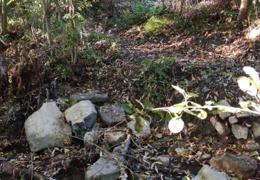
Entre le km 2 et le col de Moune le sentier est remplacé par une large piste; accès pompier dans un endroit très sensible aux feux?
La description dans «les bons plans à pied, pays Dieulefit-Bourdeaux», de très bonne qualité , à mon avis, indique que la fin de la rando, après le collet de Vialle,  suit un sentier qui descend fortement; je ne trouve pas la pente si importante, mais un peu caillouteuse.
Le« parking» près du pont du Rif est petit.

Elevation profile

Positioning

Country:
France
Region :
Auvergne-Rhône-Alpes
Department/Province :
Drôme
Municipality :
Crupies
Location:
Unknown
Start:(UTM)
673420 ; 4935412 (31T) N.

Trails nearby

Trail Walking Bourdeaux - Chemin des protestants- Bourdaux - Photo
Walking
crocau

Walking

Medium
(1)
Bourdeaux, Auvergne-Rhône-Alpes, Drôme, France
7.9 km | 11.2 km-effort
2h 48min
Yes
Trail Walking Bouvières - 26 mielandre 09.2023 - Photo
Walking
GUIDE
randodyssée

Walking

Medium
Bouvières, Auvergne-Rhône-Alpes, Drôme, France
16 km | 31 km-effort
7h 37min
No
Trail Walking Bourdeaux - 26 bourreaux huguenot 31.12.22 - Photo
Walking
GUIDE
randodyssée

Walking

Medium
Bourdeaux, Auvergne-Rhône-Alpes, Drôme, France
15 km | 23 km-effort
5h 45min
No
Trail sport Vesc - Wikiloc - Vesc - Photo
sport
johnw

sport

Very easy
(1)
Vesc, Auvergne-Rhône-Alpes, Drôme, France
8 km | 12.9 km-effort
Unknown
Yes
Trail Walking Vesc - bec de jus - Photo
Walking
Vero7684

Walking

Difficult
Vesc, Auvergne-Rhône-Alpes, Drôme, France
13.6 km | 25 km-effort
5h 51min
Yes
Trail Walking Bourdeaux - col de Boutière 1 - Photo
Walking
AIGUIER

Walking

Medium
(1)
Bourdeaux, Auvergne-Rhône-Alpes, Drôme, France
13.3 km | 19 km-effort
5h 18min
Yes
Trail Walking Vesc - VESC3 - Photo
Walking
GUIDE
thonyc

Walking

Difficult
Vesc, Auvergne-Rhône-Alpes, Drôme, France
17.5 km | 27 km-effort
5h 0min
Yes
Trail Walking Vesc - Hubac de Ruy - Photo
Walking
AIGUIER

Walking

Medium
(1)
Vesc, Auvergne-Rhône-Alpes, Drôme, France
13.9 km | 20 km-effort
5h 24min
Yes
Trail Walking Bourdeaux - bourdeaux col de boutière projet pb - Photo
Walking
philippebrondel

Walking

Easy
(1)
Bourdeaux, Auvergne-Rhône-Alpes, Drôme, France
9.1 km | 13.6 km-effort
3h 0min
Yes


Close
My subscriptions