Trail Mountain bike Nandax - 3965657541_1473_circuit_12_noir_base_charlieu - Photo

3965657541_1473_circuit_12_noir_base_charlieu

 jpc42
jpc42

User

© OpenStreetMap contributors
Length
Length
53 km
Max alt
Max alt
600 m
Uphill gradient
Uphill gradient
1378 m
Km-Effort
Km-Effort  
72 km
Min alt
Min alt
298 m
Downhill gradient
Downhill gradient
1383 m
Boucle
Boucle
Yes
Creation date :
2024-07-04 08:00:29.716
Updated on :
2024-07-04 08:11:05.849

(0 Reviews)

Mountain bike
Mountain bike
4h58
Difficulty : Very difficult

Scan this QR Code to open this trail in the SityTrail application

FREE GPS app for hiking

Logo SityTrail SityTrail

IGN / Geographical institutes

Download SityTrail from the App Store Download SityTrail from Google Play

Logo SityTrail SityTrail World

The world is yours!

Download SityTrail from the App Store Download SityTrail from Google Play Download SityTrail on Huawei AppGallery

About

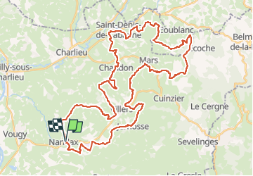
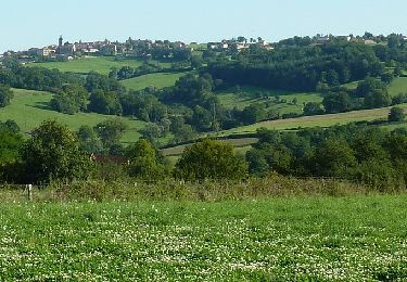
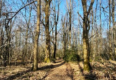
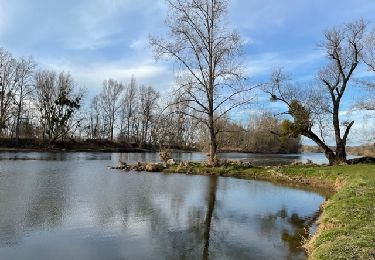
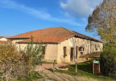
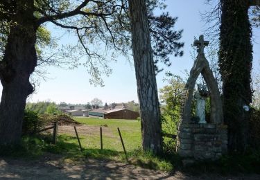
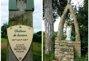
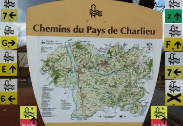
Trail Mountain bike of 53 km to be discovered at Auvergne-Rhône-Alpes, Loire, Nandax. This trail is proposed by jpc42.

Description

Trace GPX fournie par Charlieu-Belmont Communauté. Licence Ouverte 2.0.

Elevation profile

Positioning

Country:
France
Region :
Auvergne-Rhône-Alpes
Department/Province :
Loire
Municipality :
Nandax
Location:
Unknown
Start:(UTM)
590149 ; 5105633 (31T) N.

Trails nearby

Trail Walking Coutouvre -  Circuit des 2 chapelles - Coutouvre - Photo
Walking
tracegps

Walking

Difficult
(2)
Coutouvre, Auvergne-Rhône-Alpes, Loire, France
9.9 km | 13.4 km-effort
2h 30min
Yes
Trail Walking Villers - Villers : Marigny et Bois Noé - Photo
Walking
Jgar

Walking

Medium
Villers, Auvergne-Rhône-Alpes, Loire, France
14 km | 17.5 km-effort
4h 3min
Yes
Trail Walking Vougy - Vougy : Pouilly-sous-Charlieu et rives de Loire  - Photo
Walking
Jgar

Walking

Medium
Vougy, Auvergne-Rhône-Alpes, Loire, France
20 km | 22 km-effort
5h 27min
Yes
Trail Walking Saint-Hilaire-sous-Charlieu - St-Hilaire-sous-Charlieu : grand couvert - Photo
Walking
Jgar

Walking

Medium
Saint-Hilaire-sous-Charlieu, Auvergne-Rhône-Alpes, Loire, France
10.6 km | 13.4 km-effort
3h 48min
Yes
Trail Mountain bike Nandax - Rando la Fourchemolle (2014-VTT-40km) - Nandax-Ressins - Photo
Mountain bike
tracegps

Mountain bike

Difficult
Nandax, Auvergne-Rhône-Alpes, Loire, France
41 km | 53 km-effort
3h 30min
Yes
Trail Mountain bike Nandax - EQUIVTT 2013 - Nandax-Ressins - Photo
Mountain bike
tracegps

Mountain bike

Difficult
(1)
Nandax, Auvergne-Rhône-Alpes, Loire, France
32 km | 42 km-effort
3h 0min
Yes
Trail Walking Coutouvre - Circuit de Coutouvre - 11km - Photo
Walking
tracegps

Walking

Medium
Coutouvre, Auvergne-Rhône-Alpes, Loire, France
11.4 km | 15.9 km-effort
2h 45min
Yes
Trail Mountain bike Vougy - VTT en Pays de Charlieu : Vougy, Saint-Hilaire-sous-Charlieu, Villers, Jarnosse, Boyer et Nandax - Photo
Mountain bike
tracegps

Mountain bike

Medium
Vougy, Auvergne-Rhône-Alpes, Loire, France
36 km | 44 km-effort
3h 0min
Yes
Trail Walking Saint-Hilaire-sous-Charlieu - Marche des Grands Couverts à St Hilaire sous Charlieu - Photo
Walking
tracegps

Walking

Medium
Saint-Hilaire-sous-Charlieu, Auvergne-Rhône-Alpes, Loire, France
16 km | 20 km-effort
3h 30min
Yes


Close
My subscriptions