Trail Walking Belverne - Belverne - grotte des prisonniers allemands - Etobon - Photo

Belverne - grotte des prisonniers allemands - Etobon

 Bart2015
Bart2015

User

© OpenStreetMap contributors
Length
Length
15 km
Max alt
Max alt
578 m
Uphill gradient
Uphill gradient
480 m
Km-Effort
Km-Effort  
21 km
Min alt
Min alt
335 m
Downhill gradient
Downhill gradient
480 m
Boucle
Boucle
Yes
Creation date :
2024-07-02 08:48:43.727
Updated on :
2024-07-06 12:49:12.384

(0 Reviews)

Walking
Walking
2h56
Difficulty : Medium

Scan this QR Code to open this trail in the SityTrail application

FREE GPS app for hiking

Logo SityTrail SityTrail

IGN / Geographical institutes

Download SityTrail from the App Store Download SityTrail from Google Play

Logo SityTrail SityTrail World

The world is yours!

Download SityTrail from the App Store Download SityTrail from Google Play Download SityTrail on Huawei AppGallery

About

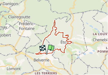
Trail Walking of 15 km to be discovered at Bourgogne-Franche-Comté, Haute-Saône, Belverne. This trail is proposed by Bart2015.

Description

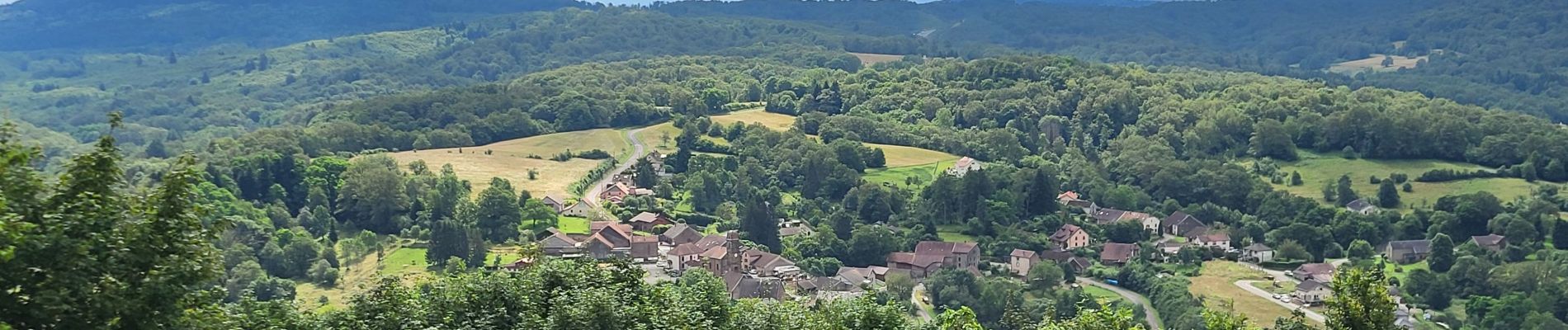
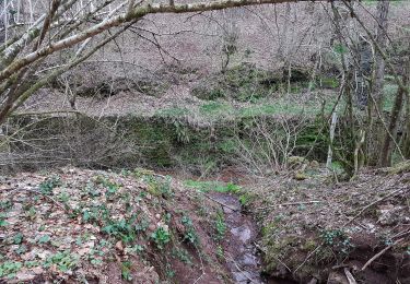
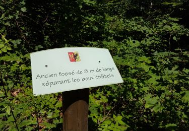
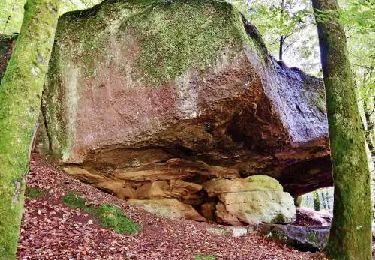
Randonnée qui emprunte le sentier des Princes qui surplombe Belverne et Etobon. Passage par la grotte qui a servi d'abri à des prisonniers allemands pendant la seconde guerre mondiale. Passage par les ruines du château d'Etobon (il ne reste que les souvenirs) avant un retour à Belverne.
La randonnée emprunte de beaux sentiers qui peuvent être envahis par les fougères ou être boueux en période de pluie.
Bonne rando ...

Elevation profile

Photos

23 photos in total. Please click on a photo to see them all in the gallery.

Positioning

Country:
France
Region :
Bourgogne-Franche-Comté
Department/Province :
Haute-Saône
Municipality :
Belverne
Location:
Unknown
Start:(UTM)
323628 ; 5278352 (32T) N.

Trails nearby

Trail Walking Champagney - Champagney - canal de la Haute-Saône - tunnel - Photo
Walking
Bart2015

Walking

Medium
Champagney, Bourgogne-Franche-Comté, Haute-Saône, France
5.5 km | 7.5 km-effort
1h 10min
Yes
Trail Walking Champagney - Grotte prisonniers allemands - château Etobon - Etobon - Photo
Walking
Bart2015

Walking

Medium
(1)
Champagney, Bourgogne-Franche-Comté, Haute-Saône, France
15 km | 22 km-effort
4h 36min
Yes
Trail Walking Étobon - Etobon - Photo
Walking
bmorel@orange.fr

Walking

Very easy
(2)
Étobon, Bourgogne-Franche-Comté, Haute-Saône, France
8.9 km | 12.8 km-effort
4h 0min
Yes
Trail Nordic walking Magny-Danigon - marche nordique magny d'agnygon - Photo
Nordic walking
frfl70

Nordic walking

Very easy
Magny-Danigon, Bourgogne-Franche-Comté, Haute-Saône, France
7.7 km | 9.9 km-effort
1h 48min
Yes
Trail Walking Chenebier - chenebier - Photo
Walking
jeanmarche

Walking

Medium
Chenebier, Bourgogne-Franche-Comté, Haute-Saône, France
5.3 km | 6.7 km-effort
2h 27min
Yes
Trail Walking Frédéric-Fontaine - Frédéric-fontaine  Roche-des-Sarrasins - Photo
Walking
randovoujo

Walking

Difficult
Frédéric-Fontaine, Bourgogne-Franche-Comté, Haute-Saône, France
10.8 km | 14.6 km-effort
3h 19min
Yes
Trail Walking Belverne - etobon
Walking
bernardrampft

Walking

Easy
Belverne, Bourgogne-Franche-Comté, Haute-Saône, France
4.6 km | 5.9 km-effort
2h 6min
Yes
Trail Walking Luze - Hautes Valettes/Vieille Verrière... - Photo
Walking
SOYARD

Walking

Difficult
Luze, Bourgogne-Franche-Comté, Haute-Saône, France
9.9 km | 13.9 km-effort
3h 10min
Yes
Trail Mountain bike Étobon - Étobon Cyclisme - Photo
Mountain bike
benoit747

Mountain bike

Difficult
Étobon, Bourgogne-Franche-Comté, Haute-Saône, France
24 km | 33 km-effort
2h 17min
Yes


Close
My subscriptions