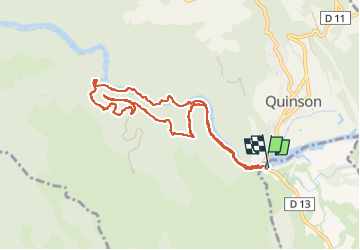
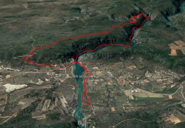
![](/images/other/stat-length.png)
![Trail Walking Montmeyan - Quinson, Gorges basses du Verdon/chapelle Ste Maxime - Photo](https://media.geolcdn.com/t/1900/400/86e41310-a6a1-4450-8498-153a74c58f37.jpg&format=pjpeg&maxdim=2)
Quinson, Gorges basses du Verdon/chapelle Ste Maxime
PVERTICAL
User
![Length](/images/other/stat-length.png)
![Max alt](https://static1.geolcdn.com/siteimages/upload/files/1508320355ic_sort_altitude_max_24dp.png)
![Uphill gradient](https://static1.geolcdn.com/siteimages/upload/files/1508320355ic_sort_den_pos_24dp.png)
![Km-Effort](/images/other/stat-length.png)
![Min alt](https://static1.geolcdn.com/siteimages/upload/files/1508320355ic_sort_altitude_min_24dp.png)
![Downhill gradient](https://static1.geolcdn.com/siteimages/upload/files/1508320355ic_sort_den_neg_24dp.png)
![Boucle](https://static1.geolcdn.com/siteimages/upload/files/16400158638029165_repeat_loop_refresh_sync_direction_icon.png)
![Walking](https://static1.geolcdn.com/sitytour/trail-icons/101.png)
2h41
Difficulty : Medium
![Scan this QR Code to open this trail in the SityTrail application](https://capi.geolives.com/qq0zvz2zws4bq2lad0pu/sitytour/trails/4105470/qr.png?size=200)
FREE GPS app for hiking
About
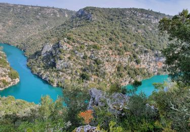
Trail Walking of 9.6 km to be discovered at Provence-Alpes-Côte d'Azur, Var, Montmeyan. This trail is proposed by PVERTICAL.
Description
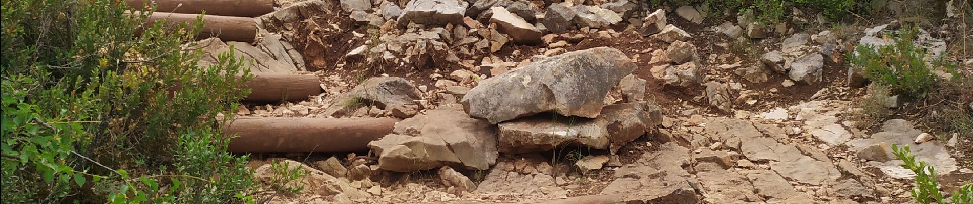
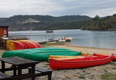
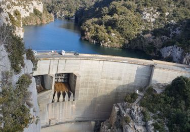
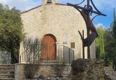
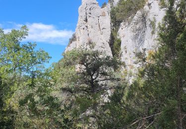
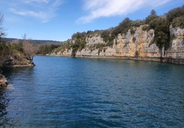
départ, places de stationnement payantes sauf accotements. belle randonnée assez ombragée, qui suit d'abord l'ancien canal du Verdon pour ensuite bifurquer en montant moyennement vers la chapelle Ste Maxime. Descente pour retrouver le canal et le point de départ. Possibilité de rester en crête au lieu de redescendre vers le sentier du canal mais cela rallonge.
Positioning
Comments
Trails nearby
![Trail Walking Quinson - basses-gorges-du-verdon-quinson - Photo](https://media.geolcdn.com/t/375/260/fd6a35eb-1609-4929-b5d2-8a81203636d1.jpg&format=jpg&maxdim=2)
![Walking Walking](https://static1.geolcdn.com/sitytour/trail-icons/101.png)
Walking
![](/images/other/stat-length.png)
![](https://static1.geolcdn.com/siteimages/upload/files/16400158638029165_repeat_loop_refresh_sync_direction_icon.png)
![Trail Walking Montagnac-Montpezat - coteau Chiron - Photo](https://media.geolcdn.com/t/375/260/3e187ac9-75e1-43c3-8947-48bfa083c064.jpg&format=jpg&maxdim=2)
![Walking Walking](https://static1.geolcdn.com/sitytour/trail-icons/101.png)
Walking
![](/images/other/stat-length.png)
![](https://static1.geolcdn.com/siteimages/upload/files/16400158638029165_repeat_loop_refresh_sync_direction_icon.png)
![Trail Walking Quinson - 2023-01-27 Quinson - Chemin de l'eau et retour rive droite - Photo](https://media.geolcdn.com/t/375/260/97297413-2275-4ba1-859c-43dda520a147.jpg&format=jpg&maxdim=2)
![Walking Walking](https://static1.geolcdn.com/sitytour/trail-icons/101.png)
Walking
![](/images/other/stat-length.png)
![](https://static1.geolcdn.com/siteimages/upload/files/16400158638029165_repeat_loop_refresh_sync_direction_icon.png)
![Trail Walking Artignosc-sur-Verdon - 11-10-2022 Artignosc - Baudinard - Photo](https://media.geolcdn.com/t/375/260/6319543e-3c6d-4edb-87fc-022f3d7ccfd0.jpg&format=jpg&maxdim=2)
![Walking Walking](https://static1.geolcdn.com/sitytour/trail-icons/101.png)
Walking
![](/images/other/stat-length.png)
![](https://static1.geolcdn.com/siteimages/upload/files/16400158638029165_repeat_loop_refresh_sync_direction_icon.png)
![Trail Walking Quinson - 02/10/2022 Quinson - Sentier de la préhistoire - Source de Poiraque - Photo](https://media.geolcdn.com/t/375/260/8826c718-a889-4bcd-aa44-238ee7e3a913.jpg&format=jpg&maxdim=2)
![Walking Walking](https://static1.geolcdn.com/sitytour/trail-icons/101.png)
Walking
![](/images/other/stat-length.png)
![](https://static1.geolcdn.com/siteimages/upload/files/16400158638029165_repeat_loop_refresh_sync_direction_icon.png)
![Trail Walking Saint-Laurent-du-Verdon - 02-04-2022 Saint Laurent et son lac - Photo](https://media.geolcdn.com/t/375/260/c2cf26e1-67cf-4a0d-981e-e145b4285aa4.jpg&format=jpg&maxdim=2)
![Walking Walking](https://static1.geolcdn.com/sitytour/trail-icons/101.png)
Walking
![](/images/other/stat-length.png)
![](https://static1.geolcdn.com/siteimages/upload/files/16400158638029165_repeat_loop_refresh_sync_direction_icon.png)
![Trail Walking Montmeyan - Verdon Sentier garde canal 05/03/2021 - Photo](https://media.geolcdn.com/t/375/260/ce25aa7b-f9a3-4891-9d04-b5ec9e3a380b.jpg&format=jpg&maxdim=2)
![Walking Walking](https://static1.geolcdn.com/sitytour/trail-icons/101.png)
Walking
![](/images/other/stat-length.png)
![](https://static1.geolcdn.com/siteimages/upload/files/16400158638029165_repeat_loop_refresh_sync_direction_icon.png)
![Trail Walking Quinson - Chapelle Ste maxime, par les basses gorges du Verdon - Photo](https://media.geolcdn.com/t/375/260/ext.jpg?maxdim=2&url=https%3A%2F%2Fstatic1.geolcdn.com%2Fsiteimages%2Fupload%2Ffiles%2F1553511878bg_sport_marche.png)
![Walking Walking](https://static1.geolcdn.com/sitytour/trail-icons/101.png)
Walking
![](/images/other/stat-length.png)
![](https://static1.geolcdn.com/siteimages/upload/files/16400158638029165_repeat_loop_refresh_sync_direction_icon.png)
![Trail Walking Quinson - Circuit Saint Maxime-basses gorges - Photo](https://media.geolcdn.com/t/375/260/ext.jpg?maxdim=2&url=https%3A%2F%2Fstatic1.geolcdn.com%2Fsiteimages%2Fupload%2Ffiles%2F1553511878bg_sport_marche.png)
![Walking Walking](https://static1.geolcdn.com/sitytour/trail-icons/101.png)
Walking
![](/images/other/stat-length.png)
![](https://static1.geolcdn.com/siteimages/upload/files/16400158638029165_repeat_loop_refresh_sync_direction_icon.png)