Trail Walking Montner - Montner Força Réal et château de Caladroy - Photo

Montner Força Réal et château de Caladroy

© OpenStreetMap contributors
Length
Length
18.4 km
Max alt
Max alt
493 m
Uphill gradient
Uphill gradient
540 m
Km-Effort
Km-Effort  
26 km
Min alt
Min alt
129 m
Downhill gradient
Downhill gradient
534 m
Boucle
Boucle
Yes
Creation date :
2024-06-24 06:34:00.0
Updated on :
2024-06-24 12:58:02.674

(0 Reviews)

Walking
Walking
5h43
Difficulty : Difficult

Scan this QR Code to open this trail in the SityTrail application

FREE GPS app for hiking

Logo SityTrail SityTrail

IGN / Geographical institutes

Download SityTrail from the App Store Download SityTrail from Google Play

Logo SityTrail SityTrail World

The world is yours!

Download SityTrail from the App Store Download SityTrail from Google Play Download SityTrail on Huawei AppGallery

About

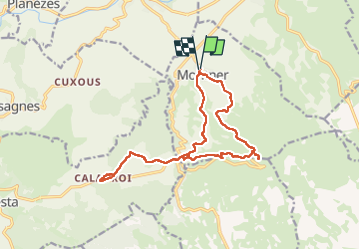
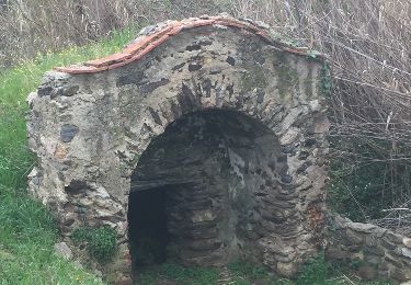
Trail Walking of 18.4 km to be discovered at Occitania, Pyrénées-Orientales, Montner. This trail is proposed by francineposkin.

Description

Superbe randonnée mais un peu de route 4 km… et peu ombragé

Elevation profile

Photos

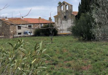
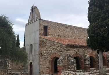
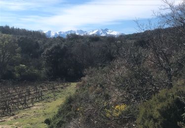
30 photos in total. Please click on a photo to see them all in the gallery.

Positioning

Country:
France
Region :
Occitania
Department/Province :
Pyrénées-Orientales
Municipality :
Montner
Location:
Unknown
Start:(UTM)
473580 ; 4733103 (31T) N.

Trails nearby

Trail On foot Corneilla-la-Rivière - Sentier Lambert Narach - Photo
On foot
PRO

On foot

Easy
Corneilla-la-Rivière, Occitania, Pyrénées-Orientales, France
6.7 km | 11.4 km-effort
2h 35min
No
Trail Walking Estagel - ESTAGEL Chapelle St Laurent MARDI FAIT - Photo
Walking
MarcOBRECHT

Walking

Medium
Estagel, Occitania, Pyrénées-Orientales, France
12.2 km | 16.9 km-effort
3h 26min
Yes
Trail Walking Latour-de-France - Latour de France 08/12/2021 - Photo
Walking
andre66

Walking

Medium
Latour-de-France, Occitania, Pyrénées-Orientales, France
12.4 km | 16.2 km-effort
3h 12min
Yes
Trail Walking Estagel - 20201216 Estagel - Calce  - Photo
Walking
ThonyM

Walking

Medium
Estagel, Occitania, Pyrénées-Orientales, France
15.8 km | 22 km-effort
3h 36min
Yes
Trail Walking Bélesta - Caladroy  - Photo
Walking
ThonyM

Walking

Medium
Bélesta, Occitania, Pyrénées-Orientales, France
15.9 km | 22 km-effort
4h 20min
Yes
Trail Walking Latour-de-France - 66 LATOUR-DE-FRANCE, visite du village, massif de Tourèze et vallée de l'Agly - Photo
Walking
Phidel66

Walking

Medium
Latour-de-France, Occitania, Pyrénées-Orientales, France
8.3 km | 11 km-effort
1h 47min
Yes
Trail Walking Planèzes - PLANÈZES (10/10/2017) - Photo
Walking
Richard68500

Walking

Easy
Planèzes, Occitania, Pyrénées-Orientales, France
9.9 km | 13.6 km-effort
3h 0min
Yes
Trail Walking Latour-de-France - au départ de la Tour de France - Photo
Walking
ThonyM

Walking

Easy
Latour-de-France, Occitania, Pyrénées-Orientales, France
19.9 km | 27 km-effort
4h 57min
Yes
Trail Walking Montner - autour de Montner - Photo
Walking
ThonyM

Walking

Easy
Montner, Occitania, Pyrénées-Orientales, France
18.5 km | 24 km-effort
4h 36min
Yes


Close
My subscriptions