


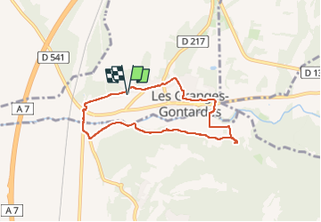

12.6 km | 16.6 km-effort


User


FREE GPS app for hiking
 SityTrail
IGN / Geographical institutes
SityTrail World
The world is yours!
Trail Walking of 7.1 km to be discovered at Auvergne-Rhône-Alpes, Drôme, Les Granges-Gontardes. This trail is proposed by FromHere.
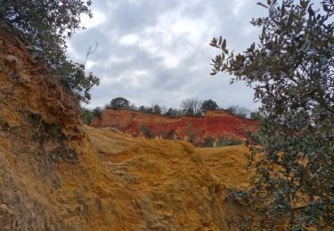
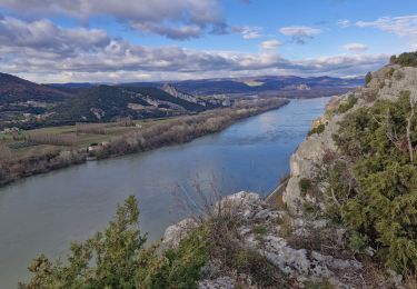
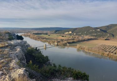
facile, semi ombragé, traversée du village, lavandes, ocres à mi parcours, rivière accessible aux chiens à mi parcours
Walking

Walking
Walking

Walking

Walking

Walking

Walking

Walking
Walking