Trail Walking Villeberny - Van - Photo
© OpenStreetMap contributors
Length
Length
535 m
Max alt
Max alt
491 m
Uphill gradient
Uphill gradient
3 m
Km-Effort
Km-Effort  
591 m
Min alt
Min alt
480 m
Downhill gradient
Downhill gradient
8 m
Boucle
Boucle
No
Creation date :
2024-06-24 09:05:53.0
Updated on :
2024-06-24 09:15:54.627

(0 Reviews)

Walking
Walking
9m
Difficulty : Unknown

Scan this QR Code to open this trail in the SityTrail application

FREE GPS app for hiking

Logo SityTrail SityTrail

IGN / Geographical institutes

Download SityTrail from the App Store Download SityTrail from Google Play

Logo SityTrail SityTrail World

The world is yours!

Download SityTrail from the App Store Download SityTrail from Google Play Download SityTrail on Huawei AppGallery

About

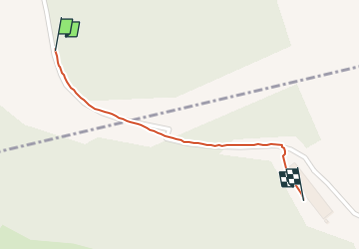
Trail Walking of 535 m to be discovered at Bourgogne-Franche-Comté, Côte-d'Or, Villeberny. This trail is proposed by 001106.b03c6ab378234ee8ab477692e52e09bf.1051.

Description

Attente van

Elevation profile

Positioning

Country:
France
Region :
Bourgogne-Franche-Comté
Department/Province :
Côte-d'Or
Municipality :
Villeberny
Location:
Unknown
Start:(UTM)
622575 ; 5255633 (31T) N.

Trails nearby

Trail Walking Champrenault - Champrenault 07 04 24 - Photo
Walking
marchalombre

Walking

Very difficult
Champrenault, Bourgogne-Franche-Comté, Côte-d'Or, France
13.8 km | 20 km-effort
5h 31min
Yes
Trail Walking Villy-en-Auxois - Abc willy 7-05-2022 - Photo
Walking
jeanyvesjacquetton

Walking

Very difficult
Villy-en-Auxois, Bourgogne-Franche-Comté, Côte-d'Or, France
21 km | 28 km-effort
7h 28min
Yes
Trail Walking Hauteroche - Hauteroche falaises village - Photo
Walking
hueco

Walking

Very easy
Hauteroche, Bourgogne-Franche-Comté, Côte-d'Or, France
7.2 km | 9.2 km-effort
1h 40min
Yes


Close
My subscriptions