Trail Walking Boeschepe - Les Monts de Flandres - Photo

Les Monts de Flandres

 Greg813
Greg813

User

© OpenStreetMap contributors
Length
Length
21 km
Max alt
Max alt
133 m
Uphill gradient
Uphill gradient
344 m
Km-Effort
Km-Effort  
25 km
Min alt
Min alt
25 m
Downhill gradient
Downhill gradient
344 m
Boucle
Boucle
Yes
Creation date :
2024-06-23 06:56:17.759
Updated on :
2024-07-27 09:44:34.219

(0 Reviews)

Walking
Walking
5h42
Difficulty : Medium

Scan this QR Code to open this trail in the SityTrail application

FREE GPS app for hiking

Logo SityTrail SityTrail

IGN / Geographical institutes

Download SityTrail from the App Store Download SityTrail from Google Play

Logo SityTrail SityTrail World

The world is yours!

Download SityTrail from the App Store Download SityTrail from Google Play Download SityTrail on Huawei AppGallery

About

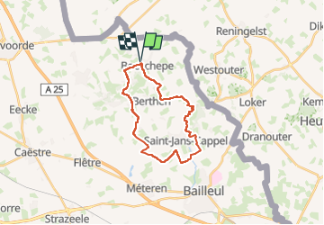
Trail Walking of 21 km to be discovered at Hauts-de-France, Nord, Boeschepe. This trail is proposed by Greg813.

Description

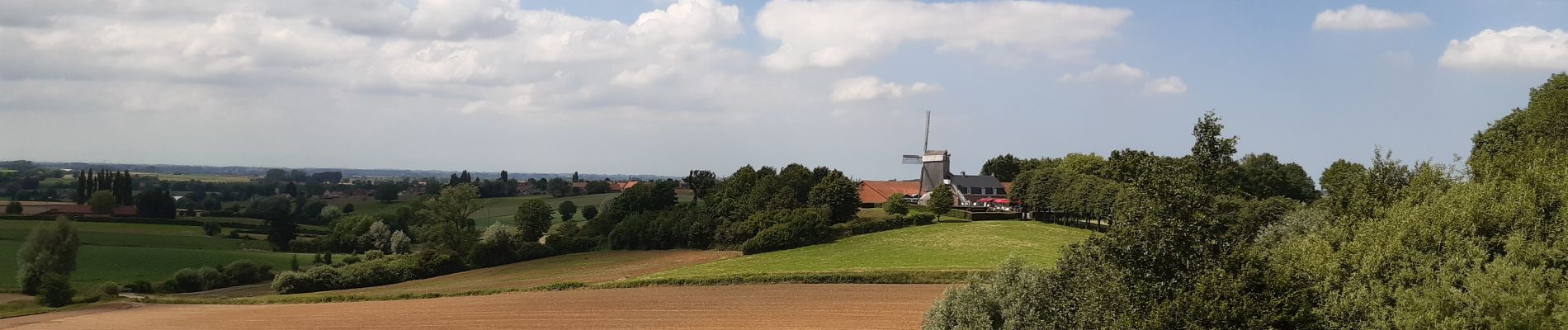
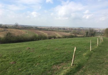
Randonnée avec Mettons le Monde en Marche dans les Monts de Flandres. Au départ du Moulin de Boeschepe (Ondankmeulen = Moulin de l’Ingratitude), ce parcours vous fera passer du côté du Mont de Boeschepe pour rallier Saint-Jean-Cappels et le Parc Marguerite Yourcenar. Retour en longeant le Mont Noir et le Mont Kokereel.

Elevation profile

Photos

Positioning

Country:
France
Region :
Hauts-de-France
Department/Province :
Nord
Municipality :
Boeschepe
Location:
Unknown
Start:(UTM)
477936 ; 5627832 (31U) N.

Trails nearby

Trail Walking Heuvelland - Monts Rouge et Noir - Photo
Walking
Greg813

Walking

Difficult
(1)
Heuvelland, Flanders, West Flanders, Belgium
24 km | 30 km-effort
5h 27min
Yes
Trail Walking Berthen - Autour du monastère - Godewaersvelde - Photo
Walking
tracegps

Walking

Difficult
(3)
Berthen, Hauts-de-France, Nord, France
11.8 km | 15.6 km-effort
3h 0min
Yes
Trail On foot Heuvelland - Tweebergen wandelroute - Photo
On foot
GUIDE+

On foot

Easy
Heuvelland, Flanders, West Flanders, Belgium
7.3 km | 9 km-effort
2h 2min
Yes
Trail Walking Heuvelland - Westouter langs tweetermen - Photo
Walking
Wesley Samyn

Walking

Difficult
(1)
Heuvelland, Flanders, West Flanders, Belgium
7.5 km | 9.1 km-effort
2h 4min
Yes
Trail Walking Saint-Jans-Cappel - sentier des jacynthes - Photo
Walking
Bernard.voyageur

Walking

Medium
(1)
Saint-Jans-Cappel, Hauts-de-France, Nord, France
7.3 km | 9.2 km-effort
2h 1min
Yes
Trail Walking Bailleul - camping de la Ferme des Saules à côté de Bailleul, arrivée Deulemont - Photo
Walking
jeff2

Walking

Medium
Bailleul, Hauts-de-France, Nord, France
32 km | 34 km-effort
9h 10min
No
Trail Walking Boeschepe - Boeschepe - Photo
Walking
fif59280

Walking

Difficult
Boeschepe, Hauts-de-France, Nord, France
10.6 km | 13 km-effort
2h 26min
No
Trail On foot Poperinge - Helleketelbos - Photo
On foot
GUIDE+

On foot

Easy
Poperinge, Flanders, West Flanders, Belgium
10.8 km | 12.5 km-effort
2h 49min
Yes
Trail Walking Heuvelland - Heuvelland  - Photo
Walking
Deroubaix David

Walking

Heuvelland, Flanders, West Flanders, Belgium
10.5 km | 12.8 km-effort
3h 10min
Yes


Close
My subscriptions