Trail Walking Berrien - BERRIEN  - Photo
© OpenStreetMap contributors
Length
Length
21 km
Max alt
Max alt
314 m
Uphill gradient
Uphill gradient
347 m
Km-Effort
Km-Effort  
26 km
Min alt
Min alt
158 m
Downhill gradient
Downhill gradient
330 m
Boucle
Boucle
No
Creation date :
2024-06-23 08:31:16.412
Updated on :
2024-06-23 18:25:25.976

(0 Reviews)

Walking
Walking
6h31
Difficulty : Medium

Scan this QR Code to open this trail in the SityTrail application

FREE GPS app for hiking

Logo SityTrail SityTrail

IGN / Geographical institutes

Download SityTrail from the App Store Download SityTrail from Google Play

Logo SityTrail SityTrail World

The world is yours!

Download SityTrail from the App Store Download SityTrail from Google Play Download SityTrail on Huawei AppGallery

About

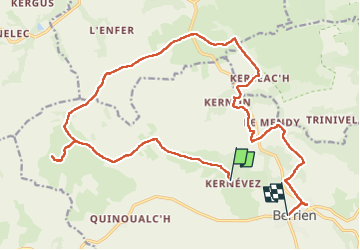
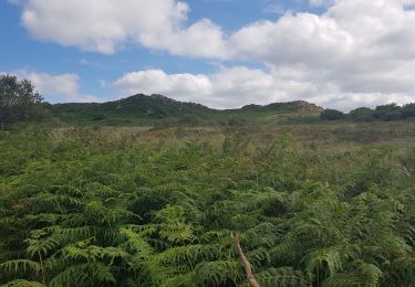
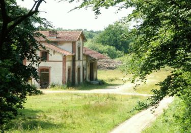
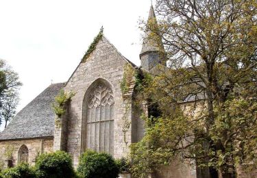
Trail Walking of 21 km to be discovered at Brittany, Finistère, Berrien. This trail is proposed by RonanDAGORN.

Description

4h47 de marche effective

Elevation profile

Photos

Positioning

Country:
France
Region :
Brittany
Department/Province :
Finistère
Municipality :
Berrien
Location:
Unknown
Start:(UTM)
442880 ; 5362354 (30U) N.

Trails nearby

Trail Mountain bike Plounéour-Ménez - Espace VTT-FFC Morlaix Monts d'Arrée, circuit n°7 - Le Cloitre - Photo
Mountain bike
tracegps

Mountain bike

Very difficult
(1)
Plounéour-Ménez, Brittany, Finistère, France
32 km | 39 km-effort
2h 30min
Yes
Trail Walking Huelgoat - Huelgoat - Photo
Walking
dudu42

Walking

Very easy
(1)
Huelgoat, Brittany, Finistère, France
4.5 km | 5.9 km-effort
1h 7min
Yes
Trail Walking Plounéour-Ménez - PLONÉOUR MENEZ - Photo
Walking
RonanDAGORN

Walking

Difficult
Plounéour-Ménez, Brittany, Finistère, France
22 km | 28 km-effort
5h 5min
Yes
Trail Walking Berrien - Circuit du menhir - Berrien - Photo
Walking
tracegps

Walking

Medium
Berrien, Brittany, Finistère, France
11 km | 13.3 km-effort
3h 30min
Yes
Trail On foot Berrien - Circuit de l'abbaye du Relec - Photo
On foot
PRO

On foot

Easy
Berrien, Brittany, Finistère, France
12.6 km | 15.9 km-effort
3h 36min
Yes
Trail Walking Plounéour-Ménez - Balade de l'abbaye de Relecq - Photo
Walking
neleda

Walking

Very easy
(1)
Plounéour-Ménez, Brittany, Finistère, France
13.2 km | 16.5 km-effort
3h 14min
Yes
Trail Walking Plounéour-Ménez - Espace VTT-FFC Morlaix Monts d'Arrée, circuit n°7 - Le Cloitre - Photo
Walking
tracegps

Walking

Very difficult
Plounéour-Ménez, Brittany, Finistère, France
32 km | 39 km-effort
6h 0min
Yes
Trail Mountain bike Plounéour-Ménez - Espace VTT-FFC Morlaix Monts d'Arrée, circuit n°6 - Le Relec - Photo
Mountain bike
tracegps

Mountain bike

Very difficult
Plounéour-Ménez, Brittany, Finistère, France
18.1 km | 22 km-effort
1h 30min
Yes
Trail Walking Plounéour-Ménez - Espace VTT-FFC Morlaix Monts d'Arrée, circuit n°6 - Le Relec - Photo
Walking
tracegps

Walking

Very difficult
Plounéour-Ménez, Brittany, Finistère, France
18.1 km | 22 km-effort
3h 0min
Yes


Close
My subscriptions