Trail Walking Trémouille - Cregut_St_Genes_Champespe - Photo

Cregut_St_Genes_Champespe

 jagarnier
jagarnier

User GUIDE

© OpenStreetMap contributors
Length
Length
15.7 km
Max alt
Max alt
1046 m
Uphill gradient
Uphill gradient
310 m
Km-Effort
Km-Effort  
19.8 km
Min alt
Min alt
863 m
Downhill gradient
Downhill gradient
309 m
Boucle
Boucle
Yes
Creation date :
2024-06-20 14:32:01.899
Updated on :
2024-06-23 07:57:28.916

(0 Reviews)

Walking
Walking
4h45
Difficulty : Medium

Scan this QR Code to open this trail in the SityTrail application

FREE GPS app for hiking

Logo SityTrail SityTrail

IGN / Geographical institutes

Download SityTrail from the App Store Download SityTrail from Google Play

Logo SityTrail SityTrail World

The world is yours!

Download SityTrail from the App Store Download SityTrail from Google Play Download SityTrail on Huawei AppGallery

About

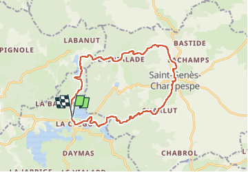
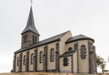
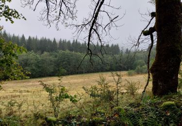
Trail Walking of 15.7 km to be discovered at Auvergne-Rhône-Alpes, Cantal, Trémouille. This trail is proposed by jagarnier.

Description

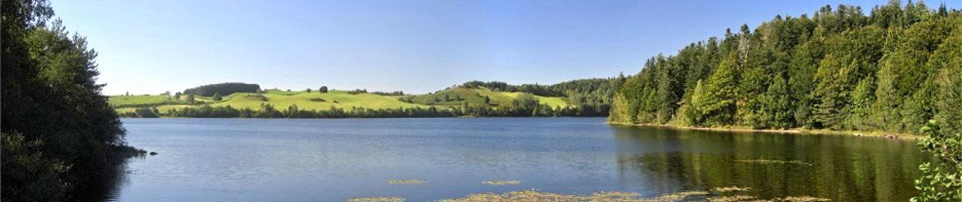
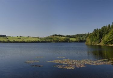
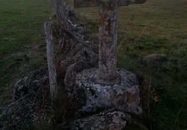
Vous partirez du lac de la Crégut et découvrirez les lacs de barrage du Taurons et du Tact.
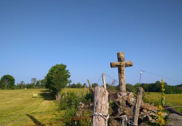
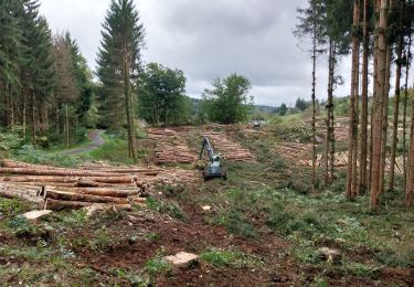
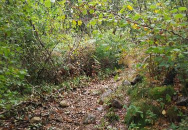
Vous découvrirez le relief tourmenté de l'Artense, alternance de croupes rocheuses, de prairies et de zones humides qui forment le décor de cette très belle randonnée.

Elevation profile

Photos

Positioning

Country:
France
Region :
Auvergne-Rhône-Alpes
Department/Province :
Cantal
Municipality :
Trémouille
Location:
Unknown
Start:(UTM)
474434 ; 5028079 (31T) N.

Trails nearby

Trail Walking Saint-Genès-Champespe - St_Genes_Champespe_Cregut - Photo
Walking
GUIDE
jagarnier

Walking

Medium
(1)
Saint-Genès-Champespe, Auvergne-Rhône-Alpes, Puy-de-Dôme, France
14 km | 17.7 km-effort
4h 15min
Yes
Trail Walking Saint-Genès-Champespe - lac de cregut - Photo
Walking
viam19

Walking

Very easy
(1)
Saint-Genès-Champespe, Auvergne-Rhône-Alpes, Puy-de-Dôme, France
14.7 km | 18.6 km-effort
5h 23min
Yes
Trail On foot Saint-Genès-Champespe - Le Lac de la Crégut - Photo
On foot
PRO

On foot

Easy
Saint-Genès-Champespe, Auvergne-Rhône-Alpes, Puy-de-Dôme, France
14 km | 17.7 km-effort
4h 1min
Yes
Trail Walking Saint-Genès-Champespe - Lac de la Crégut_CG - Photo
Walking
force

Walking

Medium
(1)
Saint-Genès-Champespe, Auvergne-Rhône-Alpes, Puy-de-Dôme, France
14 km | 17.8 km-effort
3h 55min
Yes
Trail Walking Saint-Genès-Champespe - Lac_de_La_Crégut_T - Photo
Walking
force

Walking

Medium
Saint-Genès-Champespe, Auvergne-Rhône-Alpes, Puy-de-Dôme, France
14.1 km | 17.9 km-effort
3h 59min
Yes
Trail On foot Saint-Donat - Le Bois de Caux - Photo
On foot
PRO

On foot

Easy
Saint-Donat, Auvergne-Rhône-Alpes, Puy-de-Dôme, France
6.7 km | 9.1 km-effort
2h 3min
Yes
Trail 4x4 Saint-Genès-Champespe - st genes champespe - Photo
4x4
Martial Faulconnier

4x4

Very easy
Saint-Genès-Champespe, Auvergne-Rhône-Alpes, Puy-de-Dôme, France
7.5 km | 9.1 km-effort
33min
No
Trail Other activity Saint-Genès-Champespe - Sentier des maquisards - Photo
Other activity
perron

Other activity

Very easy
Saint-Genès-Champespe, Auvergne-Rhône-Alpes, Puy-de-Dôme, France
8.4 km | 10.4 km-effort
2h 5min
Yes
Trail Walking Saint-Genès-Champespe - lacs - Photo
Walking
trailer.nono

Walking

Very easy
Saint-Genès-Champespe, Auvergne-Rhône-Alpes, Puy-de-Dôme, France
12.3 km | 15.5 km-effort
3h 8min
Yes


Close
My subscriptions