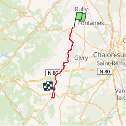
![](/images/other/stat-length.png)
![Trail Walking Mercurey - De Mercurey à Montagny les Buxy par le GR 76 - Photo](https://media.geolcdn.com/t/1900/400/ext.pjpeg?maxdim=2&url=https%3A%2F%2Fstatic1.geolcdn.com%2Fsiteimages%2Fupload%2Ffiles%2F1553511878bg_sport_marche.png)
De Mercurey à Montagny les Buxy par le GR 76
mmx007
User
![Length](/images/other/stat-length.png)
![Max alt](https://static1.geolcdn.com/siteimages/upload/files/1508320355ic_sort_altitude_max_24dp.png)
![Uphill gradient](https://static1.geolcdn.com/siteimages/upload/files/1508320355ic_sort_den_pos_24dp.png)
![Km-Effort](/images/other/stat-length.png)
![Min alt](https://static1.geolcdn.com/siteimages/upload/files/1508320355ic_sort_altitude_min_24dp.png)
![Downhill gradient](https://static1.geolcdn.com/siteimages/upload/files/1508320355ic_sort_den_neg_24dp.png)
![Boucle](https://static1.geolcdn.com/siteimages/upload/files/16400158638029165_repeat_loop_refresh_sync_direction_icon.png)
![Walking](https://static1.geolcdn.com/sitytour/trail-icons/101.png)
6h15
Difficulty : Medium
![Scan this QR Code to open this trail in the SityTrail application](https://capi.geolives.com/qq0zvz2zws4bq2lad0pu/sitytour/trails/409629/qr.png?size=200)
FREE GPS app for hiking
About
Trail Walking of 21 km to be discovered at Bourgogne-Franche-Comté, Saône-et-Loire, Mercurey. This trail is proposed by mmx007.
Description
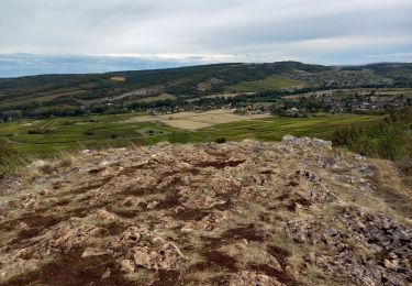
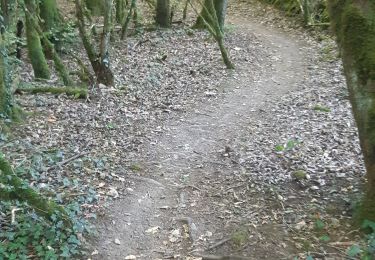
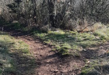
Au départ de Mercurey,il est possible de se ravitailler dans les commerces de la Grande Rue (D978). Ensuite, plus de ravitaillement possible avant St Gengoux le National (32 kms environ). Avant Moroges, le GR fait un détour sur la gauche par Vingelles, mais on peut monter à Moroges directement par la route. Pause possible à Moroge sous un préau à côté de l'église. Avant Montagny lès Buxy on peut prendre un chemin sur la droite plutôt que descendre sur le village par la route qui part à gauche, ce qui évite également de marcher le long de la D983 assez passante.
Positioning
Comments
Trails nearby
![Trail Walking Mellecey - SityTrail - G2 mellecey - Photo](https://media.geolcdn.com/t/375/260/ext.jpg?maxdim=2&url=https%3A%2F%2Fstatic1.geolcdn.com%2Fsiteimages%2Fupload%2Ffiles%2F1553511878bg_sport_marche.png)
![Walking Walking](https://static1.geolcdn.com/sitytour/trail-icons/101.png)
Walking
![](/images/other/stat-length.png)
![](https://static1.geolcdn.com/siteimages/upload/files/16400158638029165_repeat_loop_refresh_sync_direction_icon.png)
![Trail Walking Charrecey - Charrecey Le Montabon page 29 - Photo](https://media.geolcdn.com/t/375/260/ext.jpg?maxdim=2&url=https%3A%2F%2Fstatic1.geolcdn.com%2Fsiteimages%2Fupload%2Ffiles%2F1553511878bg_sport_marche.png)
![Walking Walking](https://static1.geolcdn.com/sitytour/trail-icons/101.png)
Walking
![](/images/other/stat-length.png)
![](https://static1.geolcdn.com/siteimages/upload/files/16400158638029165_repeat_loop_refresh_sync_direction_icon.png)
![Trail Walking Saint-Martin-sous-Montaigu - Saint Martin sous Montaigu la croix de Teu page 31 - Photo](https://media.geolcdn.com/t/375/260/181d7c5e-68f7-4cac-94fb-6346b903bdb6.jpg&format=jpg&maxdim=2)
![Walking Walking](https://static1.geolcdn.com/sitytour/trail-icons/101.png)
Walking
![](/images/other/stat-length.png)
![](https://static1.geolcdn.com/siteimages/upload/files/16400158638029165_repeat_loop_refresh_sync_direction_icon.png)
![Trail Walking Mercurey - Mercurey circuit du mont Morin page 110 - Photo](https://media.geolcdn.com/t/375/260/ext.jpg?maxdim=2&url=https%3A%2F%2Fstatic1.geolcdn.com%2Fsiteimages%2Fupload%2Ffiles%2F1553511878bg_sport_marche.png)
![Walking Walking](https://static1.geolcdn.com/sitytour/trail-icons/101.png)
Walking
![](/images/other/stat-length.png)
![](https://static1.geolcdn.com/siteimages/upload/files/16400158638029165_repeat_loop_refresh_sync_direction_icon.png)
![Trail Walking Fontaines - Fontaines 2024 01 14 - Photo](https://media.geolcdn.com/t/375/260/934ebd29-9a18-48e3-b116-3b32e791aed5.jpg&format=jpg&maxdim=2)
![Walking Walking](https://static1.geolcdn.com/sitytour/trail-icons/101.png)
Walking
![](/images/other/stat-length.png)
![](https://static1.geolcdn.com/siteimages/upload/files/16400158638029165_repeat_loop_refresh_sync_direction_icon.png)
![Trail Walking Mercurey - Touches(Mercurey) Mellecey Aluze Touches - Photo](https://media.geolcdn.com/t/375/260/33d6203b-3ad2-4865-b04b-1f2c55619441.jpg&format=jpg&maxdim=2)
![Walking Walking](https://static1.geolcdn.com/sitytour/trail-icons/101.png)
Walking
![](/images/other/stat-length.png)
![](https://static1.geolcdn.com/siteimages/upload/files/16400158638029165_repeat_loop_refresh_sync_direction_icon.png)
![Trail Walking Mercurey - Mercurey Aluze Mercurey - Photo](https://media.geolcdn.com/t/375/260/12e58c80-1e8b-4f57-9d6d-fa80bd3eeffb.jpg&format=jpg&maxdim=2)
![Walking Walking](https://static1.geolcdn.com/sitytour/trail-icons/101.png)
Walking
![](/images/other/stat-length.png)
![](https://static1.geolcdn.com/siteimages/upload/files/16400158638029165_repeat_loop_refresh_sync_direction_icon.png)
![Trail Walking Mercurey - Mercurey Aluze Mercurey variante - Photo](https://media.geolcdn.com/t/375/260/11654c16-f4f4-4530-a943-dff4b872d609.jpg&format=jpg&maxdim=2)
![Walking Walking](https://static1.geolcdn.com/sitytour/trail-icons/101.png)
Walking
![](/images/other/stat-length.png)
![](https://static1.geolcdn.com/siteimages/upload/files/16400158638029165_repeat_loop_refresh_sync_direction_icon.png)
![Trail Walking Barizey - Bourgogne à pied - Photo](https://media.geolcdn.com/t/375/260/569158ce-f31c-443b-b572-2dbfe697d45d.jpg&format=jpg&maxdim=2)
![Walking Walking](https://static1.geolcdn.com/sitytour/trail-icons/101.png)
Walking
![](/images/other/stat-length.png)
![](https://static1.geolcdn.com/siteimages/upload/files/16400158638029165_repeat_loop_refresh_sync_direction_icon.png)