Trail Equestrian Saint-Clément - 2024-06-16_20h47m36_Chatel_montagne (1) - Photo

2024-06-16_20h47m36_Chatel_montagne (1)

© OpenStreetMap contributors
Length
Length
25 km
Max alt
Max alt
668 m
Uphill gradient
Uphill gradient
743 m
Km-Effort
Km-Effort  
35 km
Min alt
Min alt
368 m
Downhill gradient
Downhill gradient
734 m
Boucle
Boucle
Yes
Creation date :
2024-06-16 18:47:36.105
Updated on :
2024-06-17 18:39:45.408

(0 Reviews)

Equestrian
Equestrian
0m
Difficulty : Medium

Scan this QR Code to open this trail in the SityTrail application

FREE GPS app for hiking

Logo SityTrail SityTrail

IGN / Geographical institutes

Download SityTrail from the App Store Download SityTrail from Google Play

Logo SityTrail SityTrail World

The world is yours!

Download SityTrail from the App Store Download SityTrail from Google Play Download SityTrail on Huawei AppGallery

About

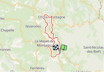
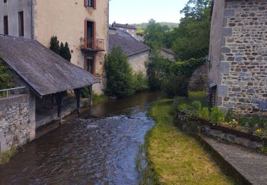
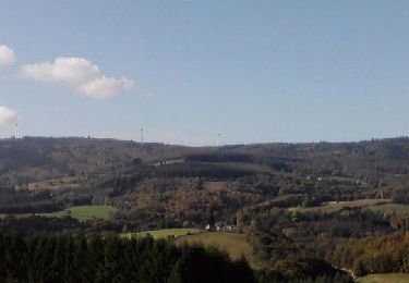
Trail Equestrian of 25 km to be discovered at Auvergne-Rhône-Alpes, Allier, Saint-Clément. This trail is proposed by jacky jouve.

Description

Au départ de Equin'Ox - via Chatel Montagne

Elevation profile

Positioning

Country:
France
Region :
Auvergne-Rhône-Alpes
Department/Province :
Allier
Municipality :
Saint-Clément
Location:
Unknown
Start:(UTM)
554348 ; 5100093 (31T) N.

Trails nearby

Trail Walking Ferrières-sur-Sichon - Balade autour de Ferrières sur Sichon - Photo
Walking
tracegps

Walking

Medium
(1)
Ferrières-sur-Sichon, Auvergne-Rhône-Alpes, Allier, France
7.4 km | 10.8 km-effort
2h 15min
Yes
Trail Walking Ferrières-sur-Sichon - Arboretum  - Photo
Walking
nadd73

Walking

Very easy
Ferrières-sur-Sichon, Auvergne-Rhône-Alpes, Allier, France
3 km | 4.5 km-effort
1h 2min
No
Trail Walking Ferrières-sur-Sichon - Grotte des fées y cascade  - Photo
Walking
nadd73

Walking

Very easy
Ferrières-sur-Sichon, Auvergne-Rhône-Alpes, Allier, France
5.1 km | 6.7 km-effort
1h 15min
Yes
Trail Trail Ferrières-sur-Sichon - circuit du moulin neuf  - Photo
Trail
nadd73

Trail

Easy
Ferrières-sur-Sichon, Auvergne-Rhône-Alpes, Allier, France
12.3 km | 17.8 km-effort
1h 15min
Yes
Trail Walking Le Mayet-de-Montagne - Saint Clément - Photo
Walking
tracegps

Walking

Difficult
Le Mayet-de-Montagne, Auvergne-Rhône-Alpes, Allier, France
15.9 km | 23 km-effort
3h 30min
Yes
Trail Walking Le Mayet-de-Montagne - Le Grand Roc - Le Mallot - Photo
Walking
tracegps

Walking

Medium
Le Mayet-de-Montagne, Auvergne-Rhône-Alpes, Allier, France
10.4 km | 15.2 km-effort
2h 45min
Yes
Trail Walking La Chabanne - Balade autour de Chaudagne - Photo
Walking
tracegps

Walking

Medium
La Chabanne, Auvergne-Rhône-Alpes, Allier, France
8 km | 11.1 km-effort
2h 0min
Yes
Trail Walking La Chabanne - Balade autour de La Chabanne - Photo
Walking
tracegps

Walking

Easy
La Chabanne, Auvergne-Rhône-Alpes, Allier, France
7.1 km | 10.6 km-effort
1h 45min
No
Trail Equestrian Saint-Clément - 2024-06-16_20h48m09_st-clement-03250 - Photo
Equestrian
jacky jouve

Equestrian

Medium
Saint-Clément, Auvergne-Rhône-Alpes, Allier, France
30 km | 42 km-effort
Unknown
Yes


Close
My subscriptions