Trail On foot Matour - sejour-rcy-journee-5-les-cretes-du-haut-beaujolais-OORtbRat2t - Photo

sejour-rcy-journee-5-les-cretes-du-haut-beaujolais-OORtbRat2t

 chessyca
chessyca

User GUIDE

© OpenStreetMap contributors
Length
Length
29 km
Max alt
Max alt
594 m
Uphill gradient
Uphill gradient
605 m
Km-Effort
Km-Effort  
38 km
Min alt
Min alt
233 m
Downhill gradient
Downhill gradient
794 m
Boucle
Boucle
No
Creation date :
2024-06-15 13:32:57.373
Updated on :
2024-06-15 13:38:54.189

(0 Reviews)

On foot
On foot
8h35
Difficulty : Difficult

Scan this QR Code to open this trail in the SityTrail application

FREE GPS app for hiking

Logo SityTrail SityTrail

IGN / Geographical institutes

Download SityTrail from the App Store Download SityTrail from Google Play

Logo SityTrail SityTrail World

The world is yours!

Download SityTrail from the App Store Download SityTrail from Google Play Download SityTrail on Huawei AppGallery

About

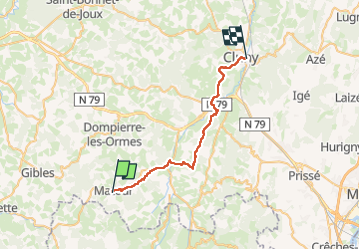
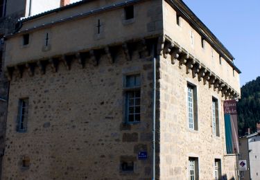
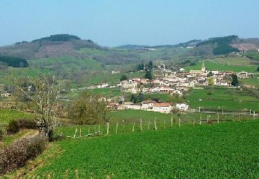
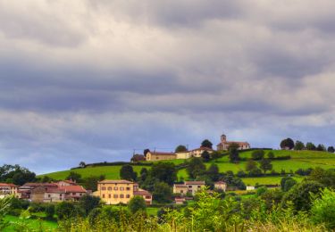
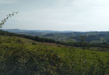
Trail On foot of 29 km to be discovered at Bourgogne-Franche-Comté, Saône-et-Loire, Matour. This trail is proposed by chessyca.

Description

5 ème étape du trek de 6 jours
Matour Cluny
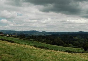
Journée catastrophe avec une météo vraiment pourrie du matin au soir  au point d'en changer le tracé du lendemain .

Elevation profile

Positioning

Country:
France
Region :
Bourgogne-Franche-Comté
Department/Province :
Saône-et-Loire
Municipality :
Matour
Location:
Unknown
Start:(UTM)
614006 ; 5129081 (31T) N.

Trails nearby

Trail On foot Aigueperse - Circuit d'Aigueperse - Photo
On foot
GUIDE+

On foot

Medium
Aigueperse, Auvergne-Rhône-Alpes, Rhône, France
20 km | 29 km-effort
6h 34min
Yes
Trail Walking Trambly - Trambly - Saint Leger sous la Bussière - Photo
Walking
dominiq

Walking

Very easy
Trambly, Bourgogne-Franche-Comté, Saône-et-Loire, France
12.8 km | 18.5 km-effort
3h 54min
Yes
Trail Mountain bike Trambly - Les Serpentines (2012-VTT-25km) - Trambly - Photo
Mountain bike
tracegps

Mountain bike

Difficult
Trambly, Bourgogne-Franche-Comté, Saône-et-Loire, France
25 km | 36 km-effort
2h 30min
Yes
Trail Mountain bike Trambly - Les Serpentines (2012-VTT-35km) - Trambly - Photo
Mountain bike
tracegps

Mountain bike

Very difficult
Trambly, Bourgogne-Franche-Comté, Saône-et-Loire, France
36 km | 52 km-effort
3h 0min
Yes
Trail Walking Deux-Grosnes - Circuit de St-Christophe-la-Montagne (10,5 km)       - Photo
Walking
tracegps

Walking

Medium
Deux-Grosnes, Auvergne-Rhône-Alpes, Rhône, France
10.5 km | 14.8 km-effort
2h 40min
Yes
Trail Walking Deux-Grosnes - Circuit de St-Christophe-la-Montagne (12 km)       - Photo
Walking
tracegps

Walking

Difficult
Deux-Grosnes, Auvergne-Rhône-Alpes, Rhône, France
11.9 km | 18.2 km-effort
3h 0min
Yes
Trail Walking Deux-Grosnes - Circuit de St-Christophe-la-Montagne (4 km) - Photo
Walking
tracegps

Walking

Easy
Deux-Grosnes, Auvergne-Rhône-Alpes, Rhône, France
4 km | 5.5 km-effort
1h 0min
Yes
Trail Walking Deux-Grosnes - Circuit de St-Christophe-la-Montagne (21km) - Photo
Walking
tracegps

Walking

Very difficult
Deux-Grosnes, Auvergne-Rhône-Alpes, Rhône, France
21 km | 31 km-effort
5h 19min
Yes
Trail Walking Saint-Bonnet-des-Bruyères - La Michèle  - Photo
Walking
COLLOMB69

Walking

Medium
(1)
Saint-Bonnet-des-Bruyères, Auvergne-Rhône-Alpes, Rhône, France
12 km | 16.4 km-effort
2h 57min
Yes


Close
My subscriptions