![](/images/other/stat-length.png)
![Trail On foot Rosnoën - Le-Saut-du-Loup-3 - Photo](https://media.geolcdn.com/t/1900/400/ext.pjpeg?maxdim=2&url=https%3A%2F%2Fstatic1.geolcdn.com%2Fsiteimages%2Fupload%2Ffiles%2F1545311037marcheuse_200dpi.jpg)
Le-Saut-du-Loup-3
chessyca
User
![Length](/images/other/stat-length.png)
Length
12.6 km
![Max alt](https://static1.geolcdn.com/siteimages/upload/files/1508320355ic_sort_altitude_max_24dp.png)
Max alt
143 m
![Uphill gradient](https://static1.geolcdn.com/siteimages/upload/files/1508320355ic_sort_den_pos_24dp.png)
Uphill gradient
322 m
![Km-Effort](/images/other/stat-length.png)
Km-Effort
16.9 km
![Min alt](https://static1.geolcdn.com/siteimages/upload/files/1508320355ic_sort_altitude_min_24dp.png)
Min alt
0 m
![Downhill gradient](https://static1.geolcdn.com/siteimages/upload/files/1508320355ic_sort_den_neg_24dp.png)
Downhill gradient
316 m
![Boucle](https://static1.geolcdn.com/siteimages/upload/files/16400158638029165_repeat_loop_refresh_sync_direction_icon.png)
Boucle
Yes
Creation date :
2024-06-15 10:56:24.117
Updated on :
2024-06-15 11:20:18.287
![On foot](https://static1.geolcdn.com/sitytour/trail-icons/100.png)
3h50
Difficulty : Easy
![Scan this QR Code to open this trail in the SityTrail application](https://capi.geolives.com/qq0zvz2zws4bq2lad0pu/sitytour/trails/4091318/qr.png?size=200)
FREE GPS app for hiking
About
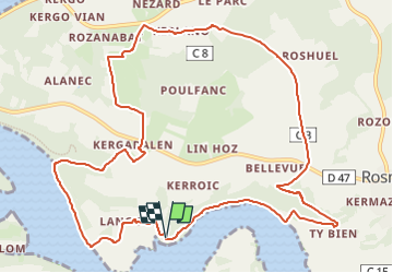
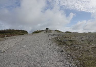
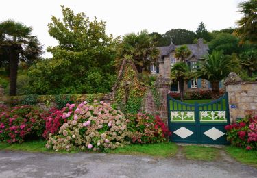
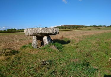
Trail On foot of 12.6 km to be discovered at Brittany, Finistère, Rosnoën. This trail is proposed by chessyca.
Description
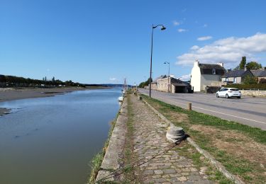
Du belvédère de Bellevue qui domine l’estuaire de l’Aulne maritime, cette randonnée, par vallons et collines, vous permettra de dominer la rivière du Faou et de découvrir le fond de la rade de Brest.
Positioning
Country:
France
Region :
Brittany
Department/Province :
Finistère
Municipality :
Rosnoën
Location:
Unknown
Start:(Dec)
Start:(UTM)
408617 ; 5345663 (30U) N.
Comments
Trails nearby
![Trail Walking Trégarvan - Menez Hom_10,3km_Trace GPS - Photo](https://media.geolcdn.com/t/375/260/ext.jpg?maxdim=2&url=https%3A%2F%2Fstatic1.geolcdn.com%2Fsiteimages%2Fupload%2Ffiles%2F1553511878bg_sport_marche.png)
![Walking Walking](https://static1.geolcdn.com/sitytour/trail-icons/101.png)
Menez Hom_10,3km_Trace GPS
Walking
Medium
(1)
Trégarvan,
Brittany,
Finistère,
France
![](/images/other/stat-length.png)
10.2 km | 14 km-effort
3h 0min
![](https://static1.geolcdn.com/siteimages/upload/files/16400158638029165_repeat_loop_refresh_sync_direction_icon.png)
Yes
![Trail Walking Trégarvan - TREGARVAN_6,7km_Trace GPS - Photo](https://media.geolcdn.com/t/375/260/ext.jpg?maxdim=2&url=https%3A%2F%2Fstatic1.geolcdn.com%2Fsiteimages%2Fupload%2Ffiles%2F1553511878bg_sport_marche.png)
![Walking Walking](https://static1.geolcdn.com/sitytour/trail-icons/101.png)
TREGARVAN_6,7km_Trace GPS
Walking
Easy
(1)
Trégarvan,
Brittany,
Finistère,
France
![](/images/other/stat-length.png)
6.7 km | 8.4 km-effort
1h 50min
![](https://static1.geolcdn.com/siteimages/upload/files/16400158638029165_repeat_loop_refresh_sync_direction_icon.png)
Yes
![Trail Walking Landévennec - LANDÉVENNEC - Photo](https://media.geolcdn.com/t/375/260/ext.jpg?maxdim=2&url=https%3A%2F%2Fmedia.geolcdn.com%2Ff%2F3aa9913a-4da7-4716-a24d-72b5f897ad92.jpg)
![Walking Walking](https://static1.geolcdn.com/sitytour/trail-icons/101.png)
LANDÉVENNEC
Walking
Difficult
Landévennec,
Brittany,
Finistère,
France
![](/images/other/stat-length.png)
19.4 km | 25 km-effort
4h 41min
![](https://static1.geolcdn.com/siteimages/upload/files/16400158638029165_repeat_loop_refresh_sync_direction_icon.png)
No
![Trail Walking Le Faou - GRP_Crozon_CB_01_Le-Faou_Argol_20200919 - Photo](https://media.geolcdn.com/t/375/260/ext.jpg?maxdim=2&url=https%3A%2F%2Fmedia.geolcdn.com%2Ff%2Ffbd34cbb-bebb-46b9-8e23-76c365c1b8c8.jpg)
![Walking Walking](https://static1.geolcdn.com/sitytour/trail-icons/101.png)
GRP_Crozon_CB_01_Le-Faou_Argol_20200919
Walking
Medium
Le Faou,
Brittany,
Finistère,
France
![](/images/other/stat-length.png)
15.9 km | 21 km-effort
4h 31min
![](https://static1.geolcdn.com/siteimages/upload/files/16400158638029165_repeat_loop_refresh_sync_direction_icon.png)
No
![Trail Walking Le Faou - La randonnée du Faou - Photo](https://media.geolcdn.com/t/375/260/ext.jpg?maxdim=2&url=https%3A%2F%2Fmedia.geolcdn.com%2Ff%2F52fdc54d-e20e-467f-ae3e-b4bd86da525e.jpg)
![Walking Walking](https://static1.geolcdn.com/sitytour/trail-icons/101.png)
La randonnée du Faou
Walking
Medium
Le Faou,
Brittany,
Finistère,
France
![](/images/other/stat-length.png)
9.4 km | 11.6 km-effort
3h 37min
![](https://static1.geolcdn.com/siteimages/upload/files/16400158638029165_repeat_loop_refresh_sync_direction_icon.png)
Yes
![Trail On foot Saint-Nic - Circuit du Menez-Hom - Photo](https://media.geolcdn.com/t/375/260/ext.jpg?maxdim=2&url=https%3A%2F%2Fmedia.geolcdn.com%2Ff%2F760775ab-c8f5-4115-9a49-824ff941c9f9.jpeg)
![On foot On foot](https://static1.geolcdn.com/sitytour/trail-icons/100.png)
Circuit du Menez-Hom
On foot
Easy
Saint-Nic,
Brittany,
Finistère,
France
![](/images/other/stat-length.png)
4.8 km | 6 km-effort
1h 22min
![](https://static1.geolcdn.com/siteimages/upload/files/16400158638029165_repeat_loop_refresh_sync_direction_icon.png)
No
![Trail Walking Le Faou - GR_37_FC_14_Le-Faou_Argol_20200919 - Photo](https://media.geolcdn.com/t/375/260/ext.jpg?maxdim=2&url=https%3A%2F%2Fmedia.geolcdn.com%2Ff%2Ffbd34cbb-bebb-46b9-8e23-76c365c1b8c8.jpg)
![Walking Walking](https://static1.geolcdn.com/sitytour/trail-icons/101.png)
GR_37_FC_14_Le-Faou_Argol_20200919
Walking
Medium
Le Faou,
Brittany,
Finistère,
France
![](/images/other/stat-length.png)
15.9 km | 21 km-effort
4h 31min
![](https://static1.geolcdn.com/siteimages/upload/files/16400158638029165_repeat_loop_refresh_sync_direction_icon.png)
No
![Trail Walking Landévennec - Landévennec - boucles locales et GR34 - 13.8km 250m 4h10 (35mn) - 2019 09 12 - Photo](https://media.geolcdn.com/t/375/260/ext.jpg?maxdim=2&url=https%3A%2F%2Fmedia.geolcdn.com%2Ff%2Fed0a847b-b2f3-4f8e-b6b5-8e6353637e62.jpg)
![Walking Walking](https://static1.geolcdn.com/sitytour/trail-icons/101.png)
Landévennec - boucles locales et GR34 - 13.8km 250m 4h10 (35mn) - 2019 09 12
Walking
Easy
Landévennec,
Brittany,
Finistère,
France
![](/images/other/stat-length.png)
13.8 km | 17.2 km-effort
4h 10min
![](https://static1.geolcdn.com/siteimages/upload/files/16400158638029165_repeat_loop_refresh_sync_direction_icon.png)
Yes
![Trail Walking Saint-Nic - Saint Nic - boucle Ménez Hom et Dolmen de Ménez Lié - 11.1km 305m 3h10 - 2019 09 07 - Photo](https://media.geolcdn.com/t/375/260/ext.jpg?maxdim=2&url=https%3A%2F%2Fmedia.geolcdn.com%2Ff%2Ff8f13a6f-f2d0-45cb-84dc-d3b1b35f6896.jpg)
![Walking Walking](https://static1.geolcdn.com/sitytour/trail-icons/101.png)
Saint Nic - boucle Ménez Hom et Dolmen de Ménez Lié - 11.1km 305m 3h10 - 2019...
Walking
Easy
Saint-Nic,
Brittany,
Finistère,
France
![](/images/other/stat-length.png)
11.1 km | 15.2 km-effort
3h 10min
![](https://static1.geolcdn.com/siteimages/upload/files/16400158638029165_repeat_loop_refresh_sync_direction_icon.png)
Yes