


CAP sud corfou

alfreson
User
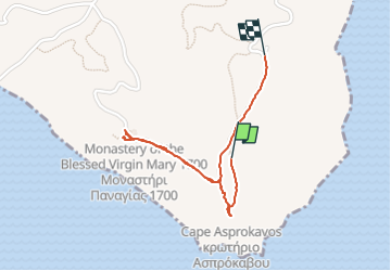

Length
1.7 km

Max alt
121 m

Uphill gradient
29 m
Km-Effort
2.2 km

Min alt
79 m

Downhill gradient
50 m
Boucle
No
Creation date :
2024-06-14 11:42:41.0
Updated on :
2024-06-14 12:25:04.27
42m
Difficulty : Easy

FREE GPS app for hiking
 SityTrail
IGN / Geographical institutes
SityTrail World
The world is yours!
About
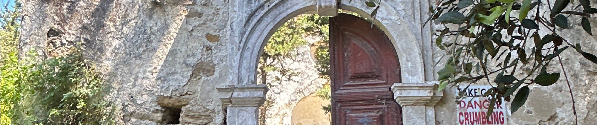
Trail Walking of 1.7 km to be discovered at Peloponnese, Western Greece and the Ionian, Corfu Regional Unit. This trail is proposed by alfreson.
Photos


Positioning
Country:
Greece
Region :
Peloponnese, Western Greece and the Ionian
Department/Province :
Corfu Regional Unit
Municipality :
Unknown
Location:
Unknown
Start:(Dec)
Start:(UTM)
423420 ; 4357495 (34S) N.
Comments
Trails nearby