Trail Walking Aubessagne - Aiguille_Péoume_Via_Lac_Roaffan - Photo

Aiguille_Péoume_Via_Lac_Roaffan

© OpenStreetMap contributors
Length
Length
12.8 km
Max alt
Max alt
1640 m
Uphill gradient
Uphill gradient
765 m
Km-Effort
Km-Effort  
23 km
Min alt
Min alt
1146 m
Downhill gradient
Downhill gradient
765 m
Boucle
Boucle
Yes
Creation date :
2024-06-11 06:57:01.671
Updated on :
2024-06-23 16:49:21.606

(0 Reviews)

Walking
Walking
6h05
Difficulty : Very difficult

Scan this QR Code to open this trail in the SityTrail application

FREE GPS app for hiking

Logo SityTrail SityTrail

IGN / Geographical institutes

Download SityTrail from the App Store Download SityTrail from Google Play

Logo SityTrail SityTrail World

The world is yours!

Download SityTrail from the App Store Download SityTrail from Google Play Download SityTrail on Huawei AppGallery

About

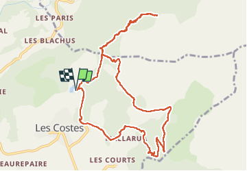
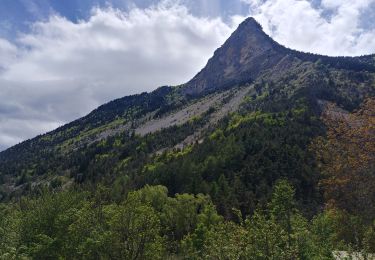
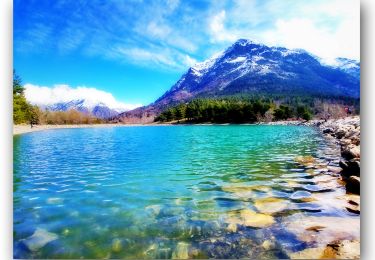
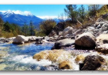
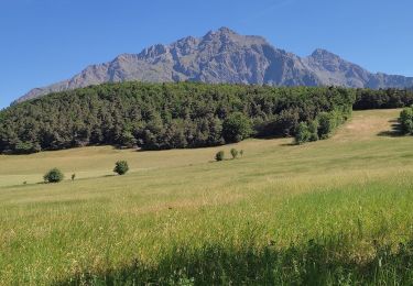
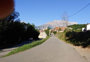
Trail Walking of 12.8 km to be discovered at Provence-Alpes-Côte d'Azur, Hautes-Alpes, Aubessagne. This trail is proposed by PapouBertrand.

Description

Bloqué par des névés, impossible de rejoindre la cabane de la Selle. Terrain très pentue et glissant par temps de pluie.

Elevation profile

Photos

Positioning

Country:
France
Region :
Provence-Alpes-Côte d'Azur
Department/Province :
Hautes-Alpes
Municipality :
Aubessagne
Location:
Les Costes
Start:(UTM)
265484 ; 4959786 (32T) N.

Trails nearby

Trail Walking Saint-Jacques-en-Valgodemard - Tour du Vieux Chaillol 1/5 - Gite Les Paris au Gite Le Casset - Photo
Walking
tracegps

Walking

Medium
(1)
Saint-Jacques-en-Valgodemard, Provence-Alpes-Côte d'Azur, Hautes-Alpes, France
20 km | 27 km-effort
6h 30min
No
Trail Touring skiing Aspres-lès-Corps - tentative du Laton, pic gazonné  - Photo
Touring skiing
nadd73

Touring skiing

Easy
Aspres-lès-Corps, Provence-Alpes-Côte d'Azur, Hautes-Alpes, France
6.9 km | 15.9 km-effort
4h 36min
Yes
Trail Walking Saint-Firmin - Les pres hauts  6 kms - Photo
Walking
peillo

Walking

Saint-Firmin, Provence-Alpes-Côte d'Azur, Hautes-Alpes, France
5.2 km | 9.6 km-effort
1h 55min
Yes
Trail Walking Le Glaizil - 20190528_Chapeau de l'évêque via Le Glaizil - Photo
Walking
PapouBertrand

Walking

Medium
(1)
Le Glaizil, Provence-Alpes-Côte d'Azur, Hautes-Alpes, France
10.8 km | 20 km-effort
4h 46min
Yes
Trail Walking Saint-Jacques-en-Valgodemard - 20190409_Lac de Roaffan - Photo
Walking
PapouBertrand

Walking

Easy
Saint-Jacques-en-Valgodemard, Provence-Alpes-Côte d'Azur, Hautes-Alpes, France
12.3 km | 18 km-effort
5h 47min
Yes
Trail Walking Le Glaizil - Chapeau de l'évêque via le Glaizil - Photo
Walking
PapouBertrand

Walking

Very difficult
Le Glaizil, Provence-Alpes-Côte d'Azur, Hautes-Alpes, France
10.3 km | 19.8 km-effort
3h 56min
Yes
Trail Walking La Motte-en-Champsaur - La Motte le Col de la Blache  - Photo
Walking
sereton

Walking

Medium
La Motte-en-Champsaur, Provence-Alpes-Côte d'Azur, Hautes-Alpes, France
12.8 km | 19.3 km-effort
4h 8min
Yes
Trail Walking La Motte-en-Champsaur - molines - Photo
Walking
pistou

Walking

Very easy
La Motte-en-Champsaur, Provence-Alpes-Côte d'Azur, Hautes-Alpes, France
12 km | 0 m-effort
2h 14min
Yes
Trail Walking Aubessagne - Le Château (la Clappe) par le sentier paysager de Beaurepaire - Photo
Walking
Luc Saint-guillain

Walking

Medium
Aubessagne, Provence-Alpes-Côte d'Azur, Hautes-Alpes, France
5.5 km | 6.7 km-effort
1h 31min
Yes


Close
My subscriptions