Trail Walking Attinghausen - Attinghausen - Engelberg - Photo

Attinghausen - Engelberg

 Dgubler
Dgubler

User

© OpenStreetMap contributors
Length
Length
20 km
Max alt
Max alt
2283 m
Uphill gradient
Uphill gradient
859 m
Km-Effort
Km-Effort  
34 km
Min alt
Min alt
1001 m
Downhill gradient
Downhill gradient
1387 m
Boucle
Boucle
No
Creation date :
2014-12-10 00:00:00.0
Updated on :
2014-12-10 00:00:00.0

(0 Reviews)

Walking
Walking
7h45
Difficulty : Unknown

Scan this QR Code to open this trail in the SityTrail application

FREE GPS app for hiking

Logo SityTrail SityTrail

IGN / Geographical institutes

Download SityTrail from the App Store Download SityTrail from Google Play

Logo SityTrail SityTrail World

The world is yours!

Download SityTrail from the App Store Download SityTrail from Google Play Download SityTrail on Huawei AppGallery

About

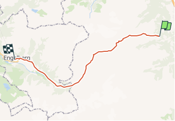
Trail Walking of 20 km to be discovered at Uri, Unknown, Attinghausen. This trail is proposed by Dgubler.

Description

Le sentier part de la station supérieure du téléphérique Attinghausen - Brüsti, il franchit le Surenenpass - haut lieu des conflits entre les Uranais et le couvent d''Englelberg - et redescend sur Engelberg par Blackenalp et Alpenrösli.

A l''Alpe de Blacken, la chapelle St-Antonieus und Wendelin a été construite en 1596.

Un projet de notre famille pour l''été 2010!

Elevation profile

Positioning

Country:
Switzerland
Region :
Uri
Department/Province :
Unknown
Municipality :
Attinghausen
Location:
Unknown
Start:(Dec)
Start:(UTM)
470023 ; 5187804 (32T) N.

Trails nearby

Trail On foot Erstfeld - Erstfeld-Attighauser Brücke - Photo
On foot
GUIDE+

On foot

Easy
Erstfeld, Uri, Unknown, Switzerland
5.5 km | 6.8 km-effort
1h 32min
No
Trail On foot Attinghausen - CH-Langschnee - Höchiberg - Photo
On foot
GUIDE+

On foot

Easy
Attinghausen, Uri, Unknown, Switzerland
5.1 km | 7.8 km-effort
1h 46min
No
Trail On foot Attinghausen - CH-Surenenpass - Blackenalp - Photo
On foot
GUIDE+

On foot

Easy
Attinghausen, Uri, Unknown, Switzerland
3 km | 4.6 km-effort
1h 3min
No
Trail On foot Attinghausen - Höchiberg - FIXME - Photo
On foot
GUIDE+

On foot

Easy
Attinghausen, Uri, Unknown, Switzerland
3 km | 5.8 km-effort
1h 19min
No
Trail Other activity Attinghausen - y10_surenen - Photo
Other activity
GUIDE+

Other activity

Very easy
Attinghausen, Uri, Unknown, Switzerland
13.3 km | 26 km-effort
Unknown
No
Trail Other activity Erstfeld - y10_Erstfeld_Goeschenen - Photo
Other activity
GUIDE+

Other activity

Very easy
Erstfeld, Uri, Unknown, Switzerland
23 km | 35 km-effort
8h 51min
No
Trail Other activity Erstfeld - y10_Erstfeldertal_Kroenten - Photo
Other activity
GUIDE+

Other activity

Very easy
Erstfeld, Uri, Unknown, Switzerland
9.5 km | 22 km-effort
5h 27min
No
Trail Mountain bike Altdorf (UR) - Bike32885 - Photo
Mountain bike
GUIDE+

Mountain bike

Very easy
Altdorf (UR), Uri, Unknown, Switzerland
23 km | 37 km-effort
Unknown
Yes
Trail Walking Altdorf (UR) - st_toeff4_b - Photo
Walking
GUIDE+

Walking

Very easy
Altdorf (UR), Uri, Unknown, Switzerland
374 km | 531 km-effort
91h 43min
No


Close
My subscriptions