


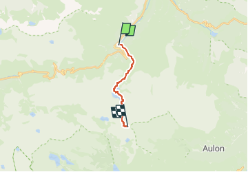


10.2 km | 20 km-effort


User


FREE GPS app for hiking
 SityTrail
IGN / Geographical institutes
SityTrail World
The world is yours!
Trail Walking of 10.5 km to be discovered at Occitania, Hautespyrenees, Bagnères-de-Bigorre. This trail is proposed by DECHAMPD.
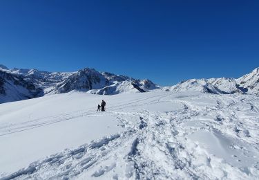
entre les estimes de la haute vallée de Campan où paissent vaches et moutons et les sommets dressés du Bastan et du Portarras, cette randonnée longe une dizaine d’étendues d’eau de toutes tailles et couleurs, du vert forêt au bleu profond.
Cette randonnée difficile nécessite un minimum de préparation: déclivité, dénivelé, cheminement en rochers, pierrier, haute montagne.

Walking

Walking

Walking

On foot

Walking
Walking
Walking

Walking

Walking