Isigny20 SityTrail > Trails > Outdoor > France > Normandy > Calvados > Isigny-sur-Mer SityTrail > Trails > Outdoor > France > Normandy > Calvados > Isigny-sur-Mer Isigny20 papylou7 User 3D © OpenStreetMap contributors Length 21 km Max alt 39 m Uphill gradient 148 m Km-Effort 23 km Min alt -1 m Downhill gradient 147 m Boucle Yes Creation date : 2024-06-06 20:26:29.0 Updated on : 2024-06-06 20:26:31.763 (0 Reviews) FREE GPS app for hiking SityTrail IGN / Geographical institutes SityTrail World The world is yours! About Trail of 21 km to be discovered at Normandy, Calvados, Isigny-sur-Mer. This trail is proposed by papylou7. Legends | More details (PDF) Elevation profile Legends > 15% 15% - 10% 10% - 5% flat 5% - 10% 10% - 15% 15% - 30% > 30% Positioning Country: France Region : Normandy Department/Province : Calvados Municipality : Isigny-sur-Mer Location: Isigny-sur-Mer Start:(Dec) 49.320051 / -1.100762 Start:(UTM) 638019 ; 5464770 (30U) N. Comments Please log in to post a review or rate the element Trails nearby Banaszak ISIGNY Mountain bike Isigny-sur-Mer, Normandy, Calvados, France 
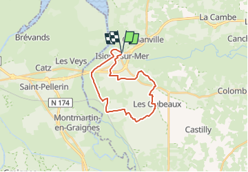
22 km | 24 km-effort 1h 38min Yes loursblanc SityTrail - circuit 3 normandie michelin Camping car Very easy Isigny-sur-Mer, Normandy, Calvados, France 260 km | 294 km-effort Unknown No mich54 Basse Normandie - Ligne 381 - Neuilly-la-Forêt - Isigny-sur-Mer Other activity Very easy Isigny-sur-Mer, Normandy, Calvados, France 6.7 km | 7.1 km-effort 5min No mimi53 2016-Vélofrancette n° 8 Cycle Easy Isigny-sur-Mer, Normandy, Calvados, France 49 km | 54 km-effort 3h 7min No