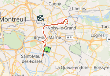
Trail Walking Saint-Maur-des-Fossés - Champigny-NeuillyPlaisance-1-6-2024-20Km - Photo

Champigny-NeuillyPlaisance-1-6-2024-20Km

Nos randonnées en Ile de France

© OpenStreetMap contributors
Length
Length
19.7 km
Max alt
Max alt
75 m
Uphill gradient
Uphill gradient
153 m
Km-Effort
Km-Effort  
22 km
Min alt
Min alt
32 m
Downhill gradient
Downhill gradient
158 m
Boucle
Boucle
No
Creation date :
2024-06-01 06:58:49.667
Updated on :
2024-06-03 15:28:11.506

(0 Reviews)

Walking
Walking
7h11
Difficulty : Easy

Scan this QR Code to open this trail in the SityTrail application

FREE GPS app for hiking

Logo SityTrail SityTrail

IGN / Geographical institutes

Download SityTrail from the App Store Download SityTrail from Google Play

Logo SityTrail SityTrail World

The world is yours!

Download SityTrail from the App Store Download SityTrail from Google Play Download SityTrail on Huawei AppGallery

About

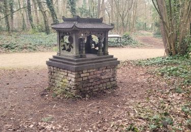
Trail Walking of 19.7 km to be discovered at Ile-de-France, Val-de-Marne, Saint-Maur-des-Fossés. This trail is proposed by Randonneurs du XIème.

Description

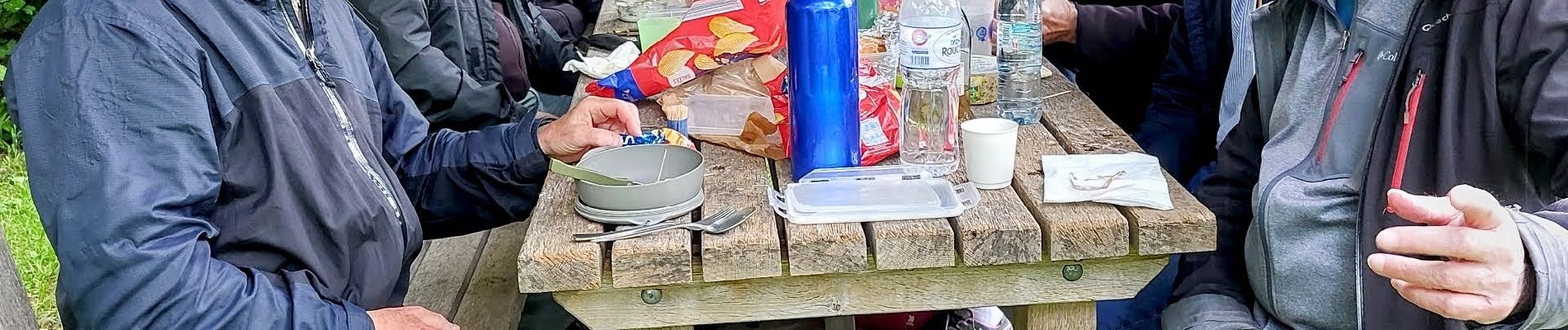
Pique nique au parc de la Haute Île

Elevation profile

Photos

Positioning

Country:
France
Region :
Ile-de-France
Department/Province :
Val-de-Marne
Municipality :
Saint-Maur-des-Fossés
Location:
Unknown
Start:(UTM)
464057 ; 5406110 (31U) N.

Trails nearby

Trail Walking Neuilly-Plaisance - Neuilly Plaisance gare Rer sortie Bords de Marne/ Base Nautique Vaires sur Marne - Photo
Walking
thierry cachot

Walking

Easy
(1)
Neuilly-Plaisance, Ile-de-France, Seine-Saint-Denis, France
15.9 km | 17.1 km-effort
2h 52min
Yes
Trail Walking Noiseau - depuis Noiseau - Photo
Walking
Bernardroland

Walking

Easy
(2)
Noiseau, Ile-de-France, Val-de-Marne, France
17 km | 19.1 km-effort
4h 35min
Yes
Trail Walking Saint-Maur-des-Fossés - Randopolitain les bords de Marne 18 km - Photo
Walking
GUIDE
chessyca

Walking

Easy
Saint-Maur-des-Fossés, Ile-de-France, Val-de-Marne, France
17.2 km | 18.8 km-effort
4h 2min
No
Trail On foot Créteil - JC 84 - La Végétale - 18,2 km - Photo
On foot

On foot

Difficult
(1)
Créteil, Ile-de-France, Val-de-Marne, France
18.3 km | 21 km-effort
4h 40min
No
Trail Walking Sucy-en-Brie - Boucle Sucy en Brie sans difficultés - Photo
Walking
GUIDE
chessyca

Walking

Very easy
Sucy-en-Brie, Ile-de-France, Val-de-Marne, France
19.8 km | 23 km-effort
4h 26min
Yes
Trail On foot Champigny-sur-Marne - Sur les bords de Marne - Photo
On foot
GUIDE
chessyca

On foot

Medium
Champigny-sur-Marne, Ile-de-France, Val-de-Marne, France
32 km | 35 km-effort
7h 52min
Yes
Trail Walking Saint-Maur-des-Fossés - Boucle St Maur - Vincennes - Photo
Walking
GUIDE
chessyca

Walking

Saint-Maur-des-Fossés, Ile-de-France, Val-de-Marne, France
22 km | 24 km-effort
5h 32min
Yes
Trail On foot Sucy-en-Brie - SityTrail - 3143774 - sucyxvincennesx23022022 - Photo
On foot
GUIDE
chessyca

On foot

Medium
Sucy-en-Brie, Ile-de-France, Val-de-Marne, France
27 km | 31 km-effort
6h 58min
No
Trail On foot Sucy-en-Brie - L 08 Sucy en Brie, parc du Morbras - Photo
On foot

On foot

Very easy
(4)
Sucy-en-Brie, Ile-de-France, Val-de-Marne, France
5.7 km | 6.8 km-effort
1h 46min
Yes


Close
My subscriptions