Trail  Peillon - Haut de Peillln - Photo
 jwo47
jwo47

User

© OpenStreetMap contributors
Length
Length
6.8 km
Max alt
Max alt
611 m
Uphill gradient
Uphill gradient
258 m
Km-Effort
Km-Effort  
10.2 km
Min alt
Min alt
351 m
Downhill gradient
Downhill gradient
238 m
Boucle
Boucle
Yes
Creation date :
2024-06-01 10:15:00.0
Updated on :
2024-06-01 12:57:58.578

(0 Reviews)


Scan this QR Code to open this trail in the SityTrail application

FREE GPS app for hiking

Logo SityTrail SityTrail

IGN / Geographical institutes

Download SityTrail from the App Store Download SityTrail from Google Play

Logo SityTrail SityTrail World

The world is yours!

Download SityTrail from the App Store Download SityTrail from Google Play Download SityTrail on Huawei AppGallery

About

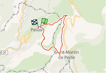
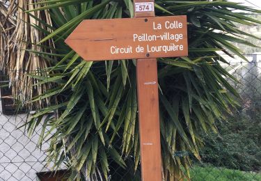
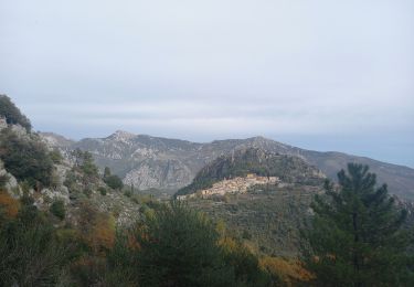
Trail of 6.8 km to be discovered at Provence-Alpes-Côte d'Azur, Maritime Alps, Peillon. This trail is proposed by jwo47.

Description

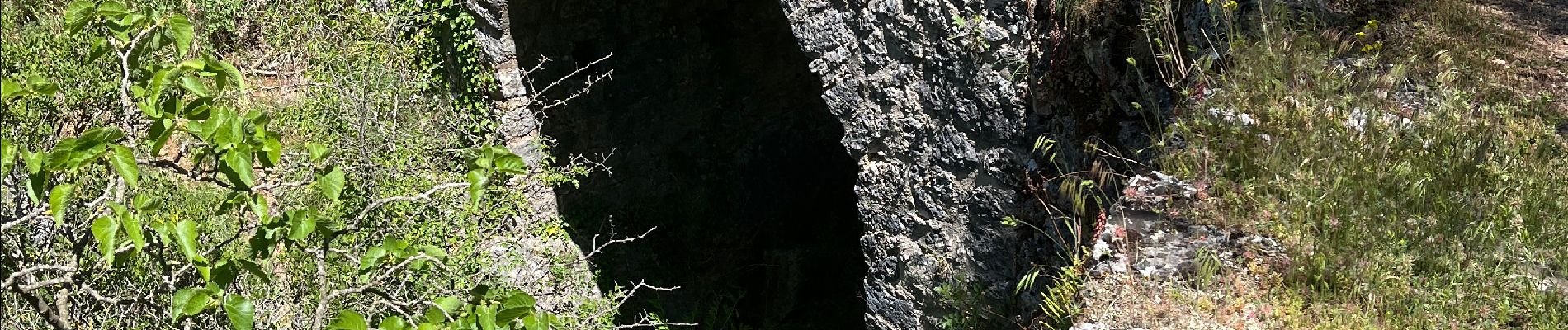
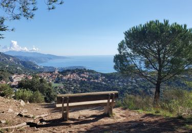
Très belle rando mais avec un chemin très caillouteux. Réservé à des randonneurs avertis.

Elevation profile

Photos

Positioning

Country:
France
Region :
Provence-Alpes-Côte d'Azur
Department/Province :
Maritime Alps
Municipality :
Peillon
Location:
Unknown
Start:(UTM)
369971 ; 4848630 (32T) N.

Trails nearby

Trail Walking Peillon - Via Alpina - R161: Peillon > Monaco - Place du Palais - Photo
Walking
tracegps

Walking

Medium
(2)
Peillon, Provence-Alpes-Côte d'Azur, Maritime Alps, France
10.3 km | 16.7 km-effort
2h 49min
No
Trail On foot Peille - Cime de Baudon - Photo
On foot
GUIDE+

On foot

Easy
Peille, Provence-Alpes-Côte d'Azur, Maritime Alps, France
7 km | 14.7 km-effort
3h 20min
Yes
Trail Walking Gorbio - Gorbio-Circuit des Cabanelles 31-10-2016 - Photo
Walking
GUIDE
fredetpascale

Walking

Medium
(1)
Gorbio, Provence-Alpes-Côte d'Azur, Maritime Alps, France
10.8 km | 21 km-effort
3h 51min
Yes
Trail Other activity La Turbie - fort de la Revere  - Photo
Other activity
juleyann

Other activity

Very easy
(1)
La Turbie, Provence-Alpes-Côte d'Azur, Maritime Alps, France
8.4 km | 12 km-effort
1h 37min
Yes
Trail Walking Èze - eze 221213 - Photo
Walking
legios84

Walking

Medium
(1)
Èze, Provence-Alpes-Côte d'Azur, Maritime Alps, France
9.9 km | 14.7 km-effort
2h 4min
Yes
Trail Walking Peille - Cime de Baudon - Photo
Walking
maxcagaze

Walking

Medium
(1)
Peille, Provence-Alpes-Côte d'Azur, Maritime Alps, France
7.8 km | 15.7 km-effort
4h 15min
Yes
Trail Walking Peille - La Lourquiere au départ de la gare de Grave de Peille - Photo
Walking
Renefrt

Walking

Medium
Peille, Provence-Alpes-Côte d'Azur, Maritime Alps, France
8.5 km | 13.5 km-effort
5h 48min
No
Trail Walking Gorbio - Circuit du Bausson 12.11.22 - Photo
Walking
GUIDE
fredetpascale

Walking

Medium
Gorbio, Provence-Alpes-Côte d'Azur, Maritime Alps, France
11.8 km | 22 km-effort
4h 15min
Yes
Trail Walking Roquebrune-Cap-Martin - Tour du Mont Gros 11.11.22 - Photo
Walking
GUIDE
fredetpascale

Walking

Easy
Roquebrune-Cap-Martin, Provence-Alpes-Côte d'Azur, Maritime Alps, France
4.8 km | 8.2 km-effort
1h 30min
Yes


Close
My subscriptions