Trail Walking Tence - TENCE HL Joux J1 - Photo
© OpenStreetMap contributors
Length
Length
16.1 km
Max alt
Max alt
951 m
Uphill gradient
Uphill gradient
396 m
Km-Effort
Km-Effort  
21 km
Min alt
Min alt
821 m
Downhill gradient
Downhill gradient
398 m
Boucle
Boucle
Yes
Creation date :
2024-05-28 07:13:03.317
Updated on :
2024-05-28 13:09:23.916

(0 Reviews)

Walking
Walking
5h51
Difficulty : Very difficult

Scan this QR Code to open this trail in the SityTrail application

FREE GPS app for hiking

Logo SityTrail SityTrail

IGN / Geographical institutes

Download SityTrail from the App Store Download SityTrail from Google Play

Logo SityTrail SityTrail World

The world is yours!

Download SityTrail from the App Store Download SityTrail from Google Play Download SityTrail on Huawei AppGallery

About

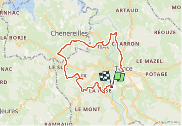
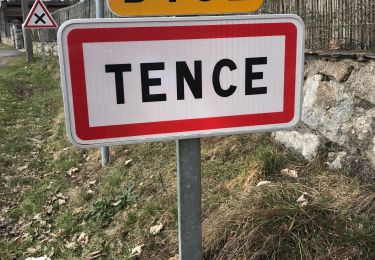
Trail Walking of 16.1 km to be discovered at Auvergne-Rhône-Alpes, Haute-Loire, Tence. This trail is proposed by pascalmilpas.

Description

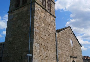
Boucle au départ du VVF et retour par Tence
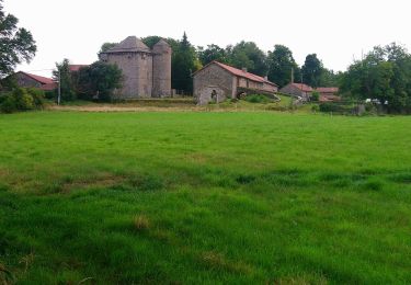
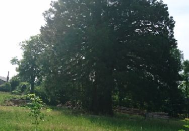
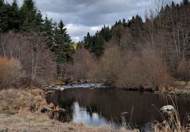
Passage par l'étang et le château de Joux, par La Papeterie...et par de magnifiques forêts
3 premiers kms rustiques et non balisés puis grands chemins ou petit goudron tranquille
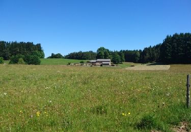
Magnifique paysages

Elevation profile

Positioning

Country:
France
Region :
Auvergne-Rhône-Alpes
Department/Province :
Haute-Loire
Municipality :
Tence
Location:
Unknown
Start:(UTM)
600825 ; 4995598 (31T) N.

Trails nearby

Trail Walking Chenereilles - Chenereilles, Lac de la Valette  - Photo
Walking
Gegetop

Walking

Medium
Chenereilles, Auvergne-Rhône-Alpes, Haute-Loire, France
18.7 km | 24 km-effort
4h 15min
Yes
Trail Walking Chenereilles - Chenereilles, le château de Joux  - Photo
Walking
Gegetop

Walking

Medium
Chenereilles, Auvergne-Rhône-Alpes, Haute-Loire, France
12.3 km | 16.6 km-effort
3h 5min
Yes
Trail Walking Le Chambon-sur-Lignon - Tence-170623 - CreuxLoup-RetourVVF - Photo
Walking
randodan

Walking

Easy
Le Chambon-sur-Lignon, Auvergne-Rhône-Alpes, Haute-Loire, France
6.3 km | 8 km-effort
1h 40min
No
Trail Walking Tence - Tence-170621 - CreuxLoup-Beaudors - Photo
Walking
randodan

Walking

Easy
Tence, Auvergne-Rhône-Alpes, Haute-Loire, France
9.8 km | 13.6 km-effort
3h 0min
No
Trail Walking Tence - Tence-170618 - RocheDruidique-Mazeaux - Photo
Walking
randodan

Walking

Easy
Tence, Auvergne-Rhône-Alpes, Haute-Loire, France
9.2 km | 12.2 km-effort
2h 40min
No
Trail Other activity Tence - autour de tence - Photo
Other activity
olivier4307

Other activity

Very easy
Tence, Auvergne-Rhône-Alpes, Haute-Loire, France
26 km | 33 km-effort
3h 11min
No
Trail Walking Mazet-Saint-Voy - Salettes et Mazalibran - Photo
Walking
mallovon

Walking

Medium
Mazet-Saint-Voy, Auvergne-Rhône-Alpes, Haute-Loire, France
8.8 km | 11.9 km-effort
2h 30min
Yes
Trail Walking Tence - Tence (13 km - D. 330 m) - Photo
Walking
Thomasdanielle

Walking

Difficult
Tence, Auvergne-Rhône-Alpes, Haute-Loire, France
13.4 km | 17.8 km-effort
4h 18min
Yes
Trail Road bike Le Chambon-sur-Lignon - 07,Chambon sur lignon Annonay vélo 21 08 21 - Photo
Road bike
GUIDE
randodyssée

Road bike

Medium
Le Chambon-sur-Lignon, Auvergne-Rhône-Alpes, Haute-Loire, France
73 km | 89 km-effort
6h 17min
No


Close
My subscriptions