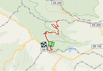
![](/images/other/stat-length.png)
![Trail Walking Arco da Calheta - Levada do 25 fontes - Photo](https://media.geolcdn.com/t/1900/400/6039bf7b-1eb8-4247-b95e-55a7995178bd.jpg&format=pjpeg&maxdim=2)
Levada do 25 fontes
patjobou
User
![Length](/images/other/stat-length.png)
![Max alt](https://static1.geolcdn.com/siteimages/upload/files/1508320355ic_sort_altitude_max_24dp.png)
![Uphill gradient](https://static1.geolcdn.com/siteimages/upload/files/1508320355ic_sort_den_pos_24dp.png)
![Km-Effort](/images/other/stat-length.png)
![Min alt](https://static1.geolcdn.com/siteimages/upload/files/1508320355ic_sort_altitude_min_24dp.png)
![Downhill gradient](https://static1.geolcdn.com/siteimages/upload/files/1508320355ic_sort_den_neg_24dp.png)
![Boucle](https://static1.geolcdn.com/siteimages/upload/files/16400158638029165_repeat_loop_refresh_sync_direction_icon.png)
![Walking](https://static1.geolcdn.com/sitytour/trail-icons/101.png)
3h57
Difficulty : Medium
![Scan this QR Code to open this trail in the SityTrail application](https://capi.geolives.com/qq0zvz2zws4bq2lad0pu/sitytour/trails/4070119/qr.png?size=200)
FREE GPS app for hiking
About
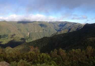
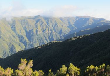
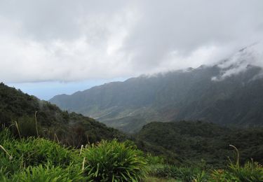
Trail Walking of 10.4 km to be discovered at Madeira, Unknown, Arco da Calheta. This trail is proposed by patjobou.
Description
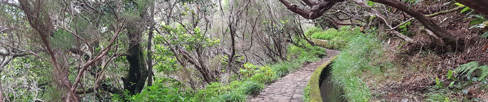
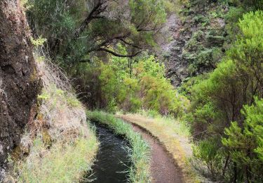
Levada très connue, mais pas forcément la plus belle; déjà beaucoup de monde fin mai, beaucoup de marches et escaliers fatigants. Paysage monotone, tout ça pour voir une cascade qui n'a rien d'extraordinaire. Levada intéressante pour ceux qui n'ont jamais vu de cascade, sinon, pour des belles cascades il y a mieux ! Du monde, donc forcément aussi des gens bruyants; à éviter si on cherche la solitude et le calme.
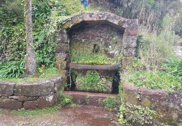
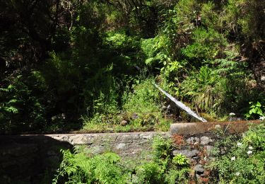
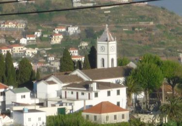
On y accède par 2,5 km de descente sur une route interdite à la circulation ,idem au retour; une navette payante est proposée! Pause bienvenue au refuge avant la remontée.
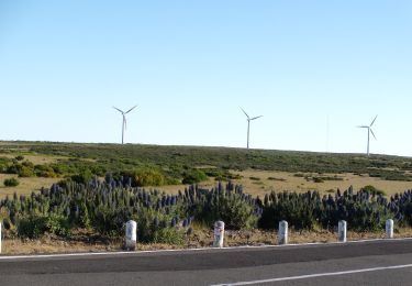
Do Alecrim est parait-il plus sympa.
Positioning
Comments
Trails nearby
![Trail Walking Calheta - chemin des cascades - Photo](https://media.geolcdn.com/t/375/260/c00528eb-97aa-45b4-9ff1-b112575f8736.jpg&format=jpg&maxdim=2)
![Walking Walking](https://static1.geolcdn.com/sitytour/trail-icons/101.png)
Walking
![](/images/other/stat-length.png)
![](https://static1.geolcdn.com/siteimages/upload/files/16400158638029165_repeat_loop_refresh_sync_direction_icon.png)
![Trail Other activity Calheta - levada 25 sources variante 13 km - Photo](https://media.geolcdn.com/t/375/260/ext.jpg?maxdim=2&url=https%3A%2F%2Fstatic1.geolcdn.com%2Fsiteimages%2Fupload%2Ffiles%2F1545311037marcheuse_200dpi.jpg)
![Other activity Other activity](https://static1.geolcdn.com/sitytour/trail-icons/900.png)
Other activity
![](/images/other/stat-length.png)
![](https://static1.geolcdn.com/siteimages/upload/files/16400158638029165_repeat_loop_refresh_sync_direction_icon.png)
![Trail Walking Calheta - Madère : de Rabaçal vers les 25 sources - Photo](https://media.geolcdn.com/t/375/260/c0fcee6c-1b6e-44b1-aed5-efb4d40aa24c.jpg&format=jpg&maxdim=2)
![Walking Walking](https://static1.geolcdn.com/sitytour/trail-icons/101.png)
Walking
![](/images/other/stat-length.png)
![](https://static1.geolcdn.com/siteimages/upload/files/16400158638029165_repeat_loop_refresh_sync_direction_icon.png)
![Trail On foot Ponta do Pargo - Vereda do Galhano - Photo](https://media.geolcdn.com/t/375/260/d5210e3e-3c5f-4efd-8d97-62e17b3ac8f4.jpeg&format=jpg&maxdim=2)
![On foot On foot](https://static1.geolcdn.com/sitytour/trail-icons/100.png)
On foot
![](/images/other/stat-length.png)
![](https://static1.geolcdn.com/siteimages/upload/files/16400158638029165_repeat_loop_refresh_sync_direction_icon.png)
![Trail On foot Calheta - Vereda da Lagoa do Vento - Photo](https://media.geolcdn.com/t/375/260/759818e7-feb7-4f26-8e4c-72cd59be231e.jpeg&format=jpg&maxdim=2)
![On foot On foot](https://static1.geolcdn.com/sitytour/trail-icons/100.png)
On foot
![](/images/other/stat-length.png)
![](https://static1.geolcdn.com/siteimages/upload/files/16400158638029165_repeat_loop_refresh_sync_direction_icon.png)
![Trail On foot Calheta - Levada do Alecrim - Photo](https://media.geolcdn.com/t/375/260/3dca4bbc-701e-47b5-afc8-fdf0d6c5f730.jpeg&format=jpg&maxdim=2)
![On foot On foot](https://static1.geolcdn.com/sitytour/trail-icons/100.png)
On foot
![](/images/other/stat-length.png)
![](https://static1.geolcdn.com/siteimages/upload/files/16400158638029165_repeat_loop_refresh_sync_direction_icon.png)
![Trail On foot Arco da Calheta - Levada do Paul - Photo](https://media.geolcdn.com/t/375/260/8e21c2f2-cd7e-48f5-8ce7-57f2489de0d5.jpeg&format=jpg&maxdim=2)
![On foot On foot](https://static1.geolcdn.com/sitytour/trail-icons/100.png)
On foot
![](/images/other/stat-length.png)
![](https://static1.geolcdn.com/siteimages/upload/files/16400158638029165_repeat_loop_refresh_sync_direction_icon.png)
![Trail On foot Calheta - Vereda do Lombo Barbinhas - Photo](https://media.geolcdn.com/t/375/260/db3e98f8-7ea7-41b7-b359-5ab0ad41297d.jpeg&format=jpg&maxdim=2)
![On foot On foot](https://static1.geolcdn.com/sitytour/trail-icons/100.png)
On foot
![](/images/other/stat-length.png)
![](https://static1.geolcdn.com/siteimages/upload/files/16400158638029165_repeat_loop_refresh_sync_direction_icon.png)
![Trail On foot Ponta do Sol - Levada do Coronel - Photo](https://media.geolcdn.com/t/375/260/46fdaffc-82f7-458b-af4e-512906ebe29f.jpeg&format=jpg&maxdim=2)
![On foot On foot](https://static1.geolcdn.com/sitytour/trail-icons/100.png)
On foot
![](/images/other/stat-length.png)
![](https://static1.geolcdn.com/siteimages/upload/files/16400158638029165_repeat_loop_refresh_sync_direction_icon.png)