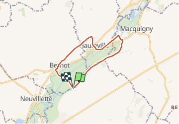
Trail Walking Mont-d'Origny - bernot hauteville  - Photo
© OpenStreetMap contributors
Length
Length
10 km
Max alt
Max alt
111 m
Uphill gradient
Uphill gradient
89 m
Km-Effort
Km-Effort  
11.2 km
Min alt
Min alt
70 m
Downhill gradient
Downhill gradient
88 m
Boucle
Boucle
Yes
Creation date :
2024-05-26 13:13:19.807
Updated on :
2024-05-26 16:08:47.164

(0 Reviews)

Walking
Walking
2h55
Difficulty : Very easy

Scan this QR Code to open this trail in the SityTrail application

FREE GPS app for hiking

Logo SityTrail SityTrail

IGN / Geographical institutes

Download SityTrail from the App Store Download SityTrail from Google Play

Logo SityTrail SityTrail World

The world is yours!

Download SityTrail from the App Store Download SityTrail from Google Play Download SityTrail on Huawei AppGallery

About

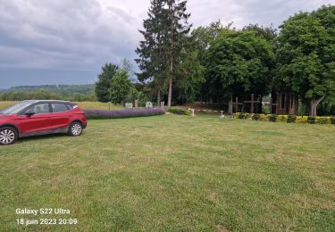
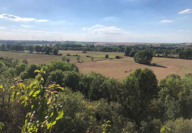
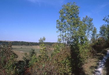
Trail Walking of 10 km to be discovered at Hauts-de-France, Aisne, Mont-d'Origny. This trail is proposed by alainwald.

Description

marche sur larges chemins

Elevation profile

Positioning

Country:
France
Region :
Hauts-de-France
Department/Province :
Aisne
Municipality :
Mont-d'Origny
Location:
Unknown
Start:(UTM)
536563 ; 5523101 (31U) N.

Trails nearby

Trail Walking Proix - la valette par le nouveau circuit - Photo
Walking
alainwald

Walking

Easy
Proix, Hauts-de-France, Aisne, France
15.8 km | 18.5 km-effort
3h 49min
Yes
Trail Walking Origny-Sainte-Benoite - Origny Sainte Benoite - Photo
Walking
mjh

Walking

Easy
Origny-Sainte-Benoite, Hauts-de-France, Aisne, France
16.6 km | 18.5 km-effort
4h 6min
Yes
Trail Walking Proix - tour 2 la valette - Photo
Walking
alainwald

Walking

Easy
Proix, Hauts-de-France, Aisne, France
15.3 km | 18.1 km-effort
4h 42min
Yes
Trail Walking Mont-d'Origny - Falaise bloucard - Photo
Walking
ggguerin

Walking

Medium
Mont-d'Origny, Hauts-de-France, Aisne, France
6.2 km | 7.2 km-effort
1h 27min
Yes
Trail Walking Origny-Sainte-Benoite - Les Rayères - Photo
Walking
tracegps

Walking

Very difficult
(1)
Origny-Sainte-Benoite, Hauts-de-France, Aisne, France
15.5 km | 17.5 km-effort
4h 0min
Yes
Trail Mountain bike Proix - la salette marly-gomont  - Photo
Mountain bike
alainwald

Mountain bike

Easy
Proix, Hauts-de-France, Aisne, France
45 km | 51 km-effort
3h 18min
Yes
Trail Walking Proix - parcours la salette (proix) - Photo
Walking
alainwald

Walking

Easy
Proix, Hauts-de-France, Aisne, France
14.5 km | 17 km-effort
3h 39min
Yes
Trail Walking Mont-d'Origny - bernot autre circuit  - Photo
Walking
alainwald

Walking

Very easy
Mont-d'Origny, Hauts-de-France, Aisne, France
13.1 km | 15 km-effort
3h 17min
Yes
Trail Walking Mont-d'Origny - bernot par les eoliennes  - Photo
Walking
alainwald

Walking

Easy
Mont-d'Origny, Hauts-de-France, Aisne, France
15.8 km | 18.5 km-effort
4h 17min
Yes


Close
My subscriptions