


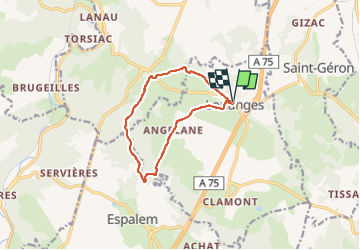


12.4 km | 18.4 km-effort


User


FREE GPS app for hiking
 SityTrail
IGN / Geographical institutes
SityTrail World
The world is yours!
Trail Walking of 10 km to be discovered at Auvergne-Rhône-Alpes, Haute-Loire, Lorlanges. This trail is proposed by christianvic.
Accès au départ randonnée
Parking devant l'école, en bordure de la rue principale de Lorlanges.
Description zone
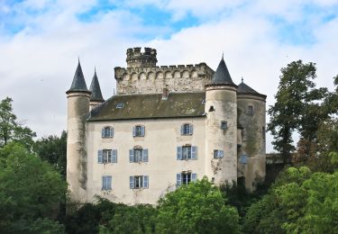
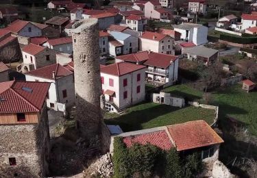
Ce circuit permet d'admirer de près les châteaux de Védrines et de Vernassal et, de loin, le château de Léotoing.
On foot

Walking
Walking
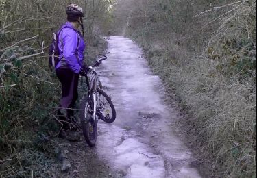
Mountain bike

Running

Other activity

Mountain bike

Walking
Walking