Trail Walking Terre-de-Haut - Les Saintes - J2 - Photo
 David25400
David25400

User GUIDE

© OpenStreetMap contributors
Length
Length
15.8 km
Max alt
Max alt
295 m
Uphill gradient
Uphill gradient
577 m
Km-Effort
Km-Effort  
24 km
Min alt
Min alt
-1 m
Downhill gradient
Downhill gradient
575 m
Boucle
Boucle
Yes
Creation date :
2024-05-21 13:22:17.274
Updated on :
2024-05-21 20:44:34.914

(0 Reviews)

Walking
Walking
7h20
Difficulty : Medium

Scan this QR Code to open this trail in the SityTrail application

FREE GPS app for hiking

Logo SityTrail SityTrail

IGN / Geographical institutes

Download SityTrail from the App Store Download SityTrail from Google Play

Logo SityTrail SityTrail World

The world is yours!

Download SityTrail from the App Store Download SityTrail from Google Play Download SityTrail on Huawei AppGallery

About

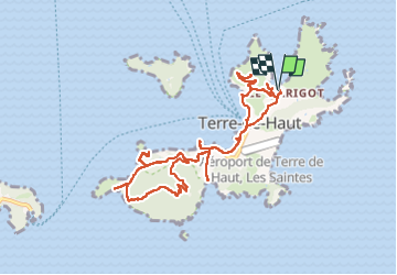
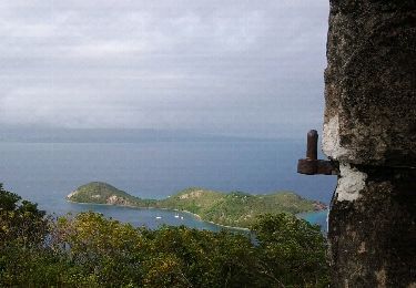
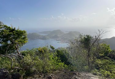
Trail Walking of 15.8 km to be discovered at Guadeloupe, Unknown, Terre-de-Haut. This trail is proposed by David25400.

Description

Anse Marigot - Fort Napoléon - Anse Figuier - Pain de Sucre - Anse Crawen - Chameau

Elevation profile

Photos

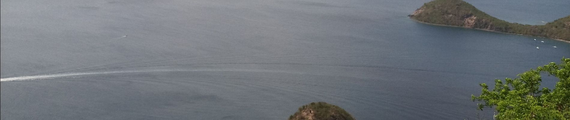
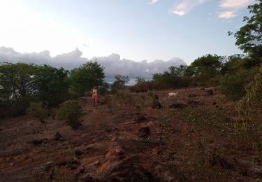
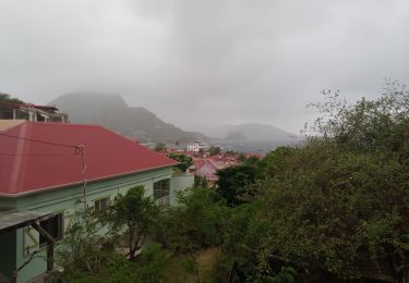
26 photos in total. Please click on a photo to see them all in the gallery.

Positioning

Country:
France
Region :
Guadeloupe
Department/Province :
Unknown
Municipality :
Terre-de-Haut
Location:
Unknown
Start:(UTM)
652281 ; 1755384 (20P) N.

Trails nearby

Trail Walking Terre-de-Haut - Les Saintes - J1 - Photo
Walking
GUIDE
David25400

Walking

Easy
Terre-de-Haut, Guadeloupe, Unknown, France
3.3 km | 5.5 km-effort
1h 49min
Yes
Trail Walking Terre-de-Haut - Les Saintes - J3 - Photo
Walking
GUIDE
David25400

Walking

Very easy
Terre-de-Haut, Guadeloupe, Unknown, France
5.7 km | 7 km-effort
2h 38min
Yes
Trail Walking Terre-de-Haut - Les Saintes - Photo
Walking
sphinkie

Walking

Medium
Terre-de-Haut, Guadeloupe, Unknown, France
16.3 km | 25 km-effort
5h 26min
Yes
Trail Walking Terre-de-Haut - cascade tambour  - Photo
Walking
Gerty Dhaussy

Walking

Very easy
Terre-de-Haut, Guadeloupe, Unknown, France
42 km | 68 km-effort
3h 47min
No
Trail Walking Terre-de-Haut - Morne du chameau - les saintes - Photo
Walking
jps13

Walking

Very difficult
Terre-de-Haut, Guadeloupe, Unknown, France
6.4 km | 11.5 km-effort
1h 27min
No
Trail Walking Terre-de-Haut - Le Chameau Terre de haut - Photo
Walking
Jean-Marc Golberg

Walking

Medium
Terre-de-Haut, Guadeloupe, Unknown, France
2.6 km | 6.2 km-effort
1h 46min
Yes
Trail Trail Terre-de-Haut - activity_10055340498 - Photo
Trail
loic09

Trail

Very easy
Terre-de-Haut, Guadeloupe, Unknown, France
9.5 km | 15 km-effort
Unknown
Yes
Trail Walking Terre-de-Haut - Station Morel  - Photo
Walking
Sébastien Duffes

Walking

Medium
Terre-de-Haut, Guadeloupe, Unknown, France
2.3 km | 3 km-effort
1h 25min
Yes
Trail On foot Terre-de-Haut - Découverte de la Terre-des-Hauts de l'archipel des Saintes  - Photo
On foot
Jo-Guide

On foot

Easy
Terre-de-Haut, Guadeloupe, Unknown, France
10.7 km | 17 km-effort
3h 52min
Yes


Close
My subscriptions