


14.1 km | 21 km-effort


User


FREE GPS app for hiking
 SityTrail
IGN / Geographical institutes
SityTrail World
The world is yours!
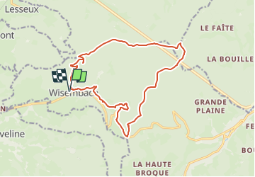
Trail Walking of 15.7 km to be discovered at Grand Est, Vosges, Wisembach. This trail is proposed by DanielROLLET.
2024 05 20 - Avec Marie - 9h35 à 15h35
Départ/Retour mairie de Wisembach > Col de Sainte-Marie > Haut des Yraux par la crête (ancienne frontière) > Stèle des Bavarois (par la crête des 767) > Croix le Prêtre.
Nombreux vestiges militaires (tranchées, blockhaus...)
Temps variable, un orage dans l’après-midi mais pas grave.

Walking

Equestrian

Walking
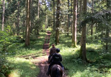
Horseback riding

Horseback riding

Horseback riding
Horseback riding

Walking

Walking