![](/images/other/stat-length.png)
![Trail Walking Lévis-Saint-Nom - rando du 09/04/2015 - Photo](https://media.geolcdn.com/t/1900/400/ext.pjpeg?maxdim=2&url=https%3A%2F%2Fservices.sitytrail.com%2FGeolivesWS%2FDownloadMedia.ashx%3FTrailID%3D405695%26Media%3Dfix__20150409114830.jpg)
rando du 09/04/2015
microb
User
![Length](/images/other/stat-length.png)
Length
9.4 km
![Max alt](https://static1.geolcdn.com/siteimages/upload/files/1508320355ic_sort_altitude_max_24dp.png)
Max alt
177 m
![Uphill gradient](https://static1.geolcdn.com/siteimages/upload/files/1508320355ic_sort_den_pos_24dp.png)
Uphill gradient
180 m
![Km-Effort](/images/other/stat-length.png)
Km-Effort
11.8 km
![Min alt](https://static1.geolcdn.com/siteimages/upload/files/1508320355ic_sort_altitude_min_24dp.png)
Min alt
92 m
![Downhill gradient](https://static1.geolcdn.com/siteimages/upload/files/1508320355ic_sort_den_neg_24dp.png)
Downhill gradient
179 m
![Boucle](https://static1.geolcdn.com/siteimages/upload/files/16400158638029165_repeat_loop_refresh_sync_direction_icon.png)
Boucle
Yes
Creation date :
2018-05-31 00:00:00.0
Updated on :
2018-05-31 00:00:00.0
![Walking](https://static1.geolcdn.com/sitytour/trail-icons/101.png)
2h42
Difficulty : Medium
![Scan this QR Code to open this trail in the SityTrail application](https://capi.geolives.com/qq0zvz2zws4bq2lad0pu/sitytour/trails/405695/qr.png?size=200)
FREE GPS app for hiking
About
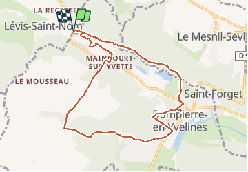
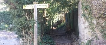
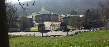
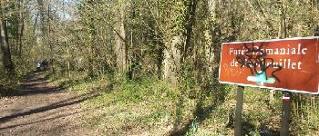
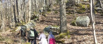
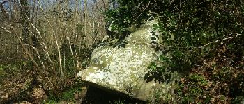
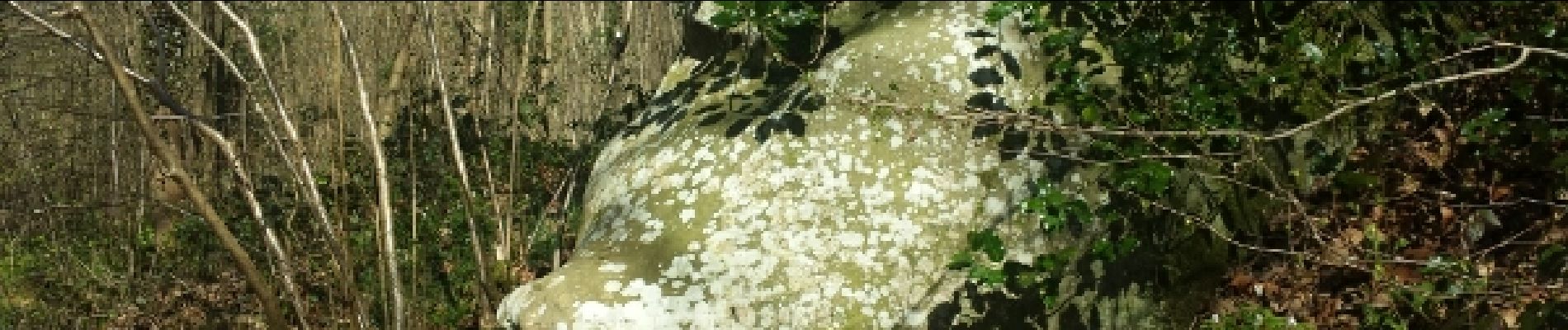
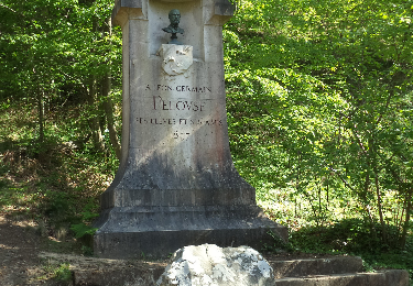
Trail Walking of 9.4 km to be discovered at Ile-de-France, Yvelines, Lévis-Saint-Nom. This trail is proposed by microb.
Description
Autour de Maincourt : Champ Romery Dammpierre le long de l'Yvette
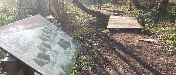
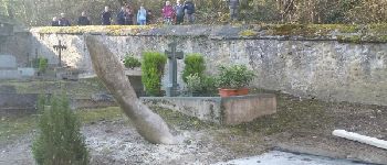
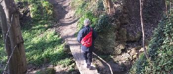
Points of interest
Positioning
Country:
France
Region :
Ile-de-France
Department/Province :
Yvelines
Municipality :
Lévis-Saint-Nom
Location:
Unknown
Start:(Dec)
Start:(UTM)
423443 ; 5396855 (31U) N.
Comments
Trails nearby
![Trail Walking Dampierre-en-Yvelines - _La Genèse - Photo](https://media.geolcdn.com/t/375/260/ext.jpg?maxdim=2&url=https%3A%2F%2Fservices.sitytrail.com%2FGeolivesWS%2FDownloadMedia.ashx%3FTrailID%3D746353%26Media%3D852eb799-755d-4473-ad2a-667c4a68a14c.jpg)
![Walking Walking](https://static1.geolcdn.com/sitytour/trail-icons/101.png)
_La Genèse
Walking
Easy
(12)
Dampierre-en-Yvelines,
Ile-de-France,
Yvelines,
France
![](/images/other/stat-length.png)
5.7 km | 7.1 km-effort
1h 30min
![](https://static1.geolcdn.com/siteimages/upload/files/16400158638029165_repeat_loop_refresh_sync_direction_icon.png)
Yes
![Trail Walking Dampierre-en-Yvelines - _Villages par mont et par vaux - Photo](https://media.geolcdn.com/t/375/260/ext.jpg?maxdim=2&url=https%3A%2F%2Fservices.sitytrail.com%2FGeolivesWS%2FDownloadMedia.ashx%3FTrailID%3D172084%26Media%3D1ba0ac7a-e5bc-4661-87da-e3aa68337b06.jpg)
![Walking Walking](https://static1.geolcdn.com/sitytour/trail-icons/101.png)
_Villages par mont et par vaux
Walking
Easy
(9)
Dampierre-en-Yvelines,
Ile-de-France,
Yvelines,
France
![](/images/other/stat-length.png)
5.3 km | 7 km-effort
1h 26min
![](https://static1.geolcdn.com/siteimages/upload/files/16400158638029165_repeat_loop_refresh_sync_direction_icon.png)
Yes
![Trail Walking Cernay-la-Ville - _Senlisse dans un écrin de verdure - Photo](https://media.geolcdn.com/t/375/260/ext.jpg?maxdim=2&url=https%3A%2F%2Fservices.sitytrail.com%2FGeolivesWS%2FDownloadMedia.ashx%3FTrailID%3D172082%26Media%3D58eba867-baea-4143-80e9-e47f03036c03.jpg)
![Walking Walking](https://static1.geolcdn.com/sitytour/trail-icons/101.png)
_Senlisse dans un écrin de verdure
Walking
Easy
(12)
Cernay-la-Ville,
Ile-de-France,
Yvelines,
France
![](/images/other/stat-length.png)
4.5 km | 5.7 km-effort
1h 30min
![](https://static1.geolcdn.com/siteimages/upload/files/16400158638029165_repeat_loop_refresh_sync_direction_icon.png)
Yes
![Trail Walking Saint-Forget - _Saint-Forget, fief de Cyrano de Bergerac - Photo](https://media.geolcdn.com/t/375/260/ext.jpg?maxdim=2&url=https%3A%2F%2Fservices.sitytrail.com%2FGeolivesWS%2FDownloadMedia.ashx%3FTrailID%3D172086%26Media%3D7b590dd2-7d00-4099-a55f-664d59f11356.jpg)
![Walking Walking](https://static1.geolcdn.com/sitytour/trail-icons/101.png)
_Saint-Forget, fief de Cyrano de Bergerac
Walking
Medium
(12)
Saint-Forget,
Ile-de-France,
Yvelines,
France
![](/images/other/stat-length.png)
8.5 km | 10.9 km-effort
2h 15min
![](https://static1.geolcdn.com/siteimages/upload/files/16400158638029165_repeat_loop_refresh_sync_direction_icon.png)
Yes
![Trail Walking Cernay-la-Ville - _Moulins des vaux de Cernay - Photo](https://media.geolcdn.com/t/375/260/ext.jpg?maxdim=2&url=https%3A%2F%2Fservices.sitytrail.com%2FGeolivesWS%2FDownloadMedia.ashx%3FTrailID%3D792341%26Media%3D9a8eb0df-2390-435a-866e-b0dd9677df49.JPG)
![Walking Walking](https://static1.geolcdn.com/sitytour/trail-icons/101.png)
_Moulins des vaux de Cernay
Walking
Easy
(9)
Cernay-la-Ville,
Ile-de-France,
Yvelines,
France
![](/images/other/stat-length.png)
6.3 km | 7.8 km-effort
2h 0min
![](https://static1.geolcdn.com/siteimages/upload/files/16400158638029165_repeat_loop_refresh_sync_direction_icon.png)
Yes
![Trail Walking Lévis-Saint-Nom - _Le Vallon du Pommeret - Photo](https://media.geolcdn.com/t/375/260/ext.jpg?maxdim=2&url=https%3A%2F%2Fservices.sitytrail.com%2FGeolivesWS%2FDownloadMedia.ashx%3FTrailID%3D172087%26Media%3D296168f6-bac5-406d-9015-aae13e393b5e.jpg)
![Walking Walking](https://static1.geolcdn.com/sitytour/trail-icons/101.png)
_Le Vallon du Pommeret
Walking
Easy
(11)
Lévis-Saint-Nom,
Ile-de-France,
Yvelines,
France
![](/images/other/stat-length.png)
6.3 km | 8 km-effort
1h 30min
![](https://static1.geolcdn.com/siteimages/upload/files/16400158638029165_repeat_loop_refresh_sync_direction_icon.png)
Yes
![Trail Walking Choisel - _Si Choisel m'était conté - Photo](https://media.geolcdn.com/t/375/260/ext.jpg?maxdim=2&url=https%3A%2F%2Fservices.sitytrail.com%2FGeolivesWS%2FDownloadMedia.ashx%3FTrailID%3D172083%26Media%3De60082f0-edf4-45f4-997a-35e9c7c799de.jpg)
![Walking Walking](https://static1.geolcdn.com/sitytour/trail-icons/101.png)
_Si Choisel m'était conté
Walking
Easy
(8)
Choisel,
Ile-de-France,
Yvelines,
France
![](/images/other/stat-length.png)
5.6 km | 6.6 km-effort
1h 27min
![](https://static1.geolcdn.com/siteimages/upload/files/16400158638029165_repeat_loop_refresh_sync_direction_icon.png)
Yes
![Trail Walking Senlisse - _Sentier découverte des maréchaux - Photo](https://media.geolcdn.com/t/375/260/ext.jpg?maxdim=2&url=https%3A%2F%2Fservices.sitytrail.com%2FGeolivesWS%2FDownloadMedia.ashx%3FTrailID%3D792820%26Media%3D3d8a65e5-a46f-42a3-8cf9-3bcb3c260e3a.png)
![Walking Walking](https://static1.geolcdn.com/sitytour/trail-icons/101.png)
_Sentier découverte des maréchaux
Walking
Easy
(4)
Senlisse,
Ile-de-France,
Yvelines,
France
![](/images/other/stat-length.png)
4.3 km | 5.4 km-effort
1h 12min
![](https://static1.geolcdn.com/siteimages/upload/files/16400158638029165_repeat_loop_refresh_sync_direction_icon.png)
Yes
![Trail Walking Le Mesnil-Saint-Denis - _Entre ancienne châtellenie et Ville nouvelle - Photo](https://media.geolcdn.com/t/375/260/ext.jpg?maxdim=2&url=https%3A%2F%2Fservices.sitytrail.com%2FGeolivesWS%2FDownloadMedia.ashx%3FTrailID%3D754427%26Media%3D98bcb1fa-3e08-461c-9cfd-0202e71bacca.png)
![Walking Walking](https://static1.geolcdn.com/sitytour/trail-icons/101.png)
_Entre ancienne châtellenie et Ville nouvelle
Walking
Easy
(1)
Le Mesnil-Saint-Denis,
Ile-de-France,
Yvelines,
France
![](/images/other/stat-length.png)
8.6 km | 9.5 km-effort
2h 30min
![](https://static1.geolcdn.com/siteimages/upload/files/16400158638029165_repeat_loop_refresh_sync_direction_icon.png)
Yes