Trail Walking Malbuisson - Malbuisson, Fort Saint Antoinr - Photo

Malbuisson, Fort Saint Antoinr

© OpenStreetMap contributors
Length
Length
8.8 km
Max alt
Max alt
1094 m
Uphill gradient
Uphill gradient
268 m
Km-Effort
Km-Effort  
12.4 km
Min alt
Min alt
884 m
Downhill gradient
Downhill gradient
268 m
Boucle
Boucle
Yes
Creation date :
2024-05-08 06:44:24.084
Updated on :
2024-05-08 09:53:00.68

(1 Reviews)

Walking
Walking
3h08
Difficulty : Difficult

Scan this QR Code to open this trail in the SityTrail application

FREE GPS app for hiking

Logo SityTrail SityTrail

IGN / Geographical institutes

Download SityTrail from the App Store Download SityTrail from Google Play

Logo SityTrail SityTrail World

The world is yours!

Download SityTrail from the App Store Download SityTrail from Google Play Download SityTrail on Huawei AppGallery

About

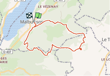
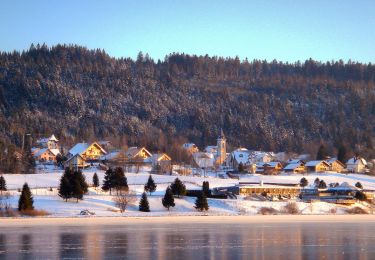
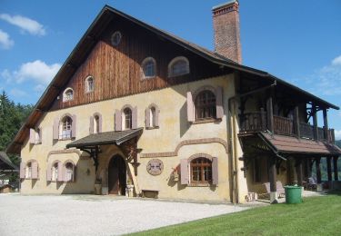
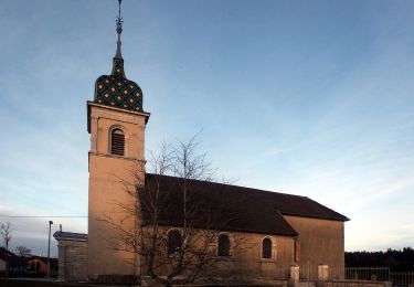
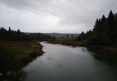
Trail Walking of 8.8 km to be discovered at Bourgogne-Franche-Comté, Doubs, Malbuisson. This trail is proposed by Marie-Claire-mcp.

Description

départ parking du grand Hôtel et rue des Tennis

Elevation profile

Positioning

Country:
France
Region :
Bourgogne-Franche-Comté
Department/Province :
Doubs
Municipality :
Malbuisson
Location:
Unknown
Start:(UTM)
294367 ; 5186331 (32T) N.

Comments

Please log in to post a review or rate the element


Trails nearby

Trail Walking Métabief - GTJ  Metabief - Pontarlier - Photo
Walking
svp59

Walking

Medium
(1)
Métabief, Bourgogne-Franche-Comté, Doubs, France
25 km | 35 km-effort
7h 17min
No
Trail Walking Saint-Antoine - Boucle du fort St Antoine  - Photo
Walking
mallovon

Walking

Medium
Saint-Antoine, Bourgogne-Franche-Comté, Doubs, France
4.8 km | 6.2 km-effort
1h 25min
Yes
Trail On foot Saint-Point-Lac - La Ronde des Deux Villages - Photo
On foot
PRO

On foot

Easy
Saint-Point-Lac, Bourgogne-Franche-Comté, Doubs, France
5.5 km | 7.3 km-effort
1h 40min
Yes
Trail On foot Les Grangettes - La Pierre qui Tourne - Photo
On foot
PRO

On foot

Easy
Les Grangettes, Bourgogne-Franche-Comté, Doubs, France
8.2 km | 10.7 km-effort
2h 25min
Yes
Trail On foot Malpas - Le Tour du Lac de Malpas - Photo
On foot
PRO

On foot

Easy
Malpas, Bourgogne-Franche-Comté, Doubs, France
4.9 km | 5.7 km-effort
1h 17min
Yes
Trail On foot Malbuisson - Sentier du Tour du Lac - Photo
On foot
PRO

On foot

Easy
Malbuisson, Bourgogne-Franche-Comté, Doubs, France
16 km | 19.9 km-effort
4h 30min
No
Trail Snowshoes Métabief - Les hauteurs de Metabief - Photo
Snowshoes
zefreefly

Snowshoes

Medium
Métabief, Bourgogne-Franche-Comté, Doubs, France
15.5 km | 23 km-effort
3h 51min
Yes
Trail Nordic walking Malbuisson - Fort St Antoine  - Photo
Nordic walking
mallovon

Nordic walking

Easy
Malbuisson, Bourgogne-Franche-Comté, Doubs, France
5.8 km | 7.3 km-effort
2h 21min
Yes
Trail Walking Montperreux - Chaon Saint Point - Lac - Photo
Walking
helmut68

Walking

Easy
(1)
Montperreux, Bourgogne-Franche-Comté, Doubs, France
15.1 km | 19.4 km-effort
3h 5min
Yes


Close
My subscriptions