Trail Walking Saint-Maurice-Navacelles - Cirque de Navacelles : La Baume Auriol - Navacelles - Foux de La Vis - Causse de Blandas - Photo

Cirque de Navacelles : La Baume Auriol - Navacelles - Foux de La Vis - Causse de Blandas

 vertygo
vertygo

User

© OpenStreetMap contributors
Length
Length
16.4 km
Max alt
Max alt
669 m
Uphill gradient
Uphill gradient
728 m
Km-Effort
Km-Effort  
26 km
Min alt
Min alt
334 m
Downhill gradient
Downhill gradient
726 m
Boucle
Boucle
Yes
Creation date :
2015-04-05 00:00:00.0
Updated on :
2015-04-05 00:00:00.0

(1 Reviews)

Walking
Walking
5h33
Difficulty : Medium

Scan this QR Code to open this trail in the SityTrail application

FREE GPS app for hiking

Logo SityTrail SityTrail

IGN / Geographical institutes

Download SityTrail from the App Store Download SityTrail from Google Play

Logo SityTrail SityTrail World

The world is yours!

Download SityTrail from the App Store Download SityTrail from Google Play Download SityTrail on Huawei AppGallery

About

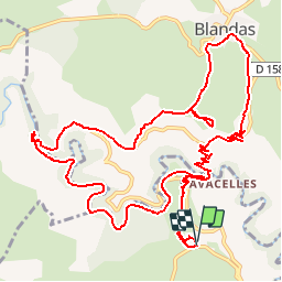
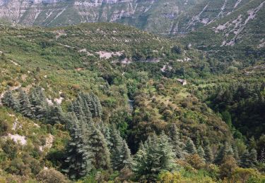
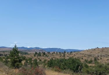
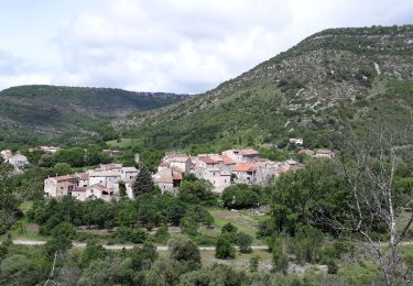
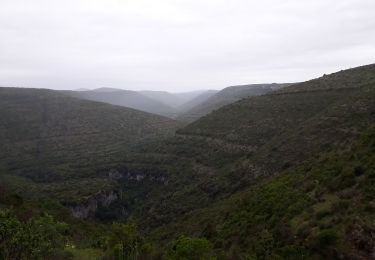
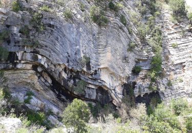
Trail Walking of 16.4 km to be discovered at Occitania, Hérault, Saint-Maurice-Navacelles. This trail is proposed by vertygo.

Description

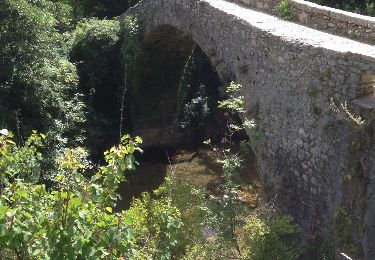
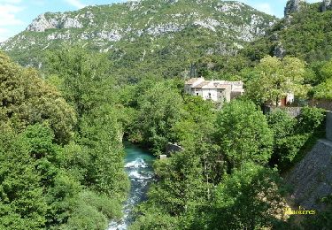
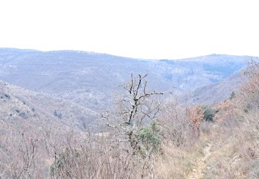
Départ du parking de la Baume Auriol - suivre un itinéraire balisé en jaune - descendre à Navacelles par le Chemin du facteur ; longer la rive droite de La Vis jusqu'à sa résurgence au moulin de la Foux ; remonter sur l'autre versant jusqu'au Causse de Blandas ; descendre sur Navacelles en passant par le Belvédère de Blandas

Elevation profile

Points of interest

Point of interest Saint-Maurice-Navacelles - P1000087 - Photo
vertygo
SAINT-MAURICE-NAVACELLES 
Point of interest Saint-Maurice-Navacelles - P1000089 - Photo
vertygo
SAINT-MAURICE-NAVACELLES 
Point of interest Blandas - P1000099 - Photo
vertygo
BLANDAS 
Point of interest Vissec - P1000110 - Photo
vertygo
VISSEC 
Point of interest Blandas - P1000113 - Photo
vertygo
BLANDAS 
Point of interest Blandas - P1000114 - Photo
vertygo
BLANDAS 
Point of interest Blandas - P1000115 - Photo
vertygo
BLANDAS 
Point of interest Blandas - P1000116 - Photo
vertygo
BLANDAS 
Point of interest Blandas - P1000120 - Photo
vertygo
BLANDAS 
Point of interest Blandas - P1000121 - Photo
vertygo
BLANDAS 
Point of interest Blandas - P1000124 - Photo
vertygo
BLANDAS 
Point of interest Saint-Maurice-Navacelles - P1000134 - Photo
vertygo
SAINT-MAURICE-NAVACELLES 

Positioning

Country:
France
Region :
Occitania
Department/Province :
Hérault
Municipality :
Saint-Maurice-Navacelles
Location:
Unknown
Start:(UTM)
540833 ; 4859521 (31T) N.

Comments

Please log in to post a review or rate the element


Trails nearby

Trail Walking Saint-Maurice-Navacelles - cirque de Navacelles - Photo
Walking
slm3005

Walking

Medium
(1)
Saint-Maurice-Navacelles, Occitania, Hérault, France
10.6 km | 14.5 km-effort
3h 17min
Yes
Trail Walking Rogues - Madières - La Sauvie - Photo
Walking
tracegps

Walking

Medium
(2)
Rogues, Occitania, Gard, France
14.3 km | 21 km-effort
3h 30min
Yes
Trail On foot Saint-Maurice-Navacelles - Navacelles Vissec par le chemin du facteur - Photo
On foot
GUIDE+

On foot

Medium
Saint-Maurice-Navacelles, Occitania, Hérault, France
17.7 km | 25 km-effort
5h 46min
Yes
Trail On foot Blandas - Randonnée Cirque de Navacelles - Causse de Blandas - Vissec - Moulin de la Foux - Photo
On foot
GUIDE+

On foot

Medium
Blandas, Occitania, Gard, France
19 km | 26 km-effort
6h 0min
Yes
Trail Walking Blandas - Causse de Blandas et Vallée de la Vis  - Photo
Walking
GUIDE
nadinebondoux

Walking

Difficult
Blandas, Occitania, Gard, France
19.1 km | 27 km-effort
6h 27min
Yes
Trail Walking Blandas - Vissec / Moulin de la Foux - Photo
Walking
GUIDE
nadinebondoux

Walking

Medium
Blandas, Occitania, Gard, France
12.9 km | 19.4 km-effort
3h 41min
Yes
Trail Walking Blandas - Bois de calot rouge - Photo
Walking
GUIDE
nadinebondoux

Walking

Medium
Blandas, Occitania, Gard, France
11 km | 15.5 km-effort
2h 58min
Yes
Trail Walking Saint-Maurice-Navacelles - Cirque de Navacelles Causses et Gorges de la Vis - Photo
Walking
GUIDE
nadinebondoux

Walking

Difficult
(1)
Saint-Maurice-Navacelles, Occitania, Hérault, France
21 km | 29 km-effort
5h 49min
Yes
Trail Walking Blandas - Sentier du Belvédère de Blandas 2 - Photo
Walking
BernardSalomon

Walking

Medium
(1)
Blandas, Occitania, Gard, France
11 km | 16.4 km-effort
3h 38min
Yes


Close
My subscriptions